Property Record
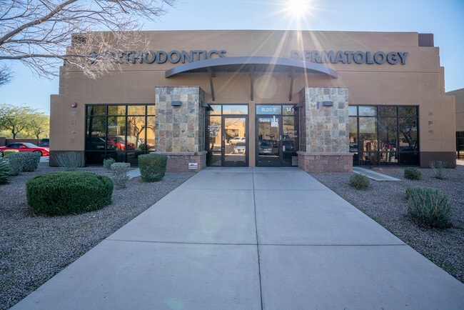
2525 W Carefree Hwy, Phoenix, AZ 85085


NEARBY LISTINGS FOR SALE OR LEASE
Property Detail
2525 W Carefree Hwy
Phoenix-Mesa-Scottsdale, AZ
Village At Sonoran Canyon Condominium
204-01-881
VILLAGE AT SONORAN CANYON CONDOMINIUM MCR 908-16
Medicalbuilding
Maricopa
X
Arizona
04013C0865L
140
2025
0.07 AC
2025
North I-17
611300
Phoenix
6,510 SF
DEMOGRAPHICS near 2525 W Carefree Hwy
1 Mile
3 Mile
5 Mile
2024 Total Population
9,062
23,744
66,086
2029 Population
9,838
25,693
71,907
Pop Growth 2024-2029
+ 8.56%
+ 8.21%
+ 8.81%
Average Age
37
39
40
2024 Total Households
3,256
8,843
23,837
HH Growth 2024-2029
+ 8.60%
+ 8.15%
+ 8.87%
Median Household Inc
$115,524
$119,293
$117,827
Avg Household Size
2.70
2.60
2.70
2024 Avg HH Vehicles
2.00
2.00
2.00
Median Home Value
$451,432
$471,359
$472,363
Median Year Built
2005
2006
2005
Nearby Places
Map Layers
Map Styles
 Street
 Aerial
- Restaurants
- Banks
- Shops
- Fitness
- Groceries
PUBLIC TRANSPORTATION
AIRPORT
Phoenix Sky Harbor International
DRIVE
WALK
Distance
Phoenix Sky Harbor International
47 min
33.5 mi
SALE & LEASE HISTORY
LISTING DATE
SALE/LEASE

Sep 25, 2016
For Lease
Oct 05, 2020
For Lease
Jan 22, 2020
For Sale
Jan 22, 2019
For Sale
Jan 15, 2020
For Sale
Jan 15, 2020
For Sale
Jan 15, 2020
For Sale
Nearby Properties
Address
Land Use
TOTAL SIZE
Lot Size
Zoning
Address
Land Use
TOTAL SIZE
Lot Size
Zoning
706,731 SF
40.21 AC
Address
Land Use
TOTAL SIZE
Lot Size
Zoning
155,462 SF
22.14 AC
Address
Land Use
TOTAL SIZE
Lot Size
Zoning
388,712 SF
23.13 AC
C2
Address
Land Use
TOTAL SIZE
Lot Size
Zoning
264,522 SF
40 AC
S1
Address
Land Use
TOTAL SIZE
Lot Size
Zoning
340,805 SF
12.34 AC
PCD
Address
Land Use
TOTAL SIZE
Lot Size
Zoning
315,209 SF
27.47 AC
R-8
Address
Land Use
TOTAL SIZE
Lot Size
Zoning
285,327 SF
13.67 AC
C-C
Address
Land Use
TOTAL SIZE
Lot Size
Zoning
21,906 SF
557.32 AC
R-43AG
Address
Land Use
TOTAL SIZE
Lot Size
Zoning
194,505 SF
27.48 AC
Address
Land Use
TOTAL SIZE
Lot Size
Zoning
113,123 SF
62.17 AC
R-43
Address
Land Use
TOTAL SIZE
Lot Size
Zoning
296,465 SF
14.54 AC
M-H
Address
Land Use
TOTAL SIZE
Lot Size
Zoning
123,638 SF
11.96 AC
PAD
Address
Land Use
TOTAL SIZE
Lot Size
Zoning
82,674 SF
14.61 AC
PAD
Address
Land Use
TOTAL SIZE
Lot Size
Zoning
84,030 SF
12.08 AC
R-6
Address
Land Use
TOTAL SIZE
Lot Size
Zoning
165,043 SF
9.54 AC
PCD
Address
Land Use
TOTAL SIZE
Lot Size
Zoning
227,103 SF
13.75 AC
M-H
Address
Land Use
TOTAL SIZE
Lot Size
Zoning
220,053 SF
15.34 AC
R-3A
Address
Land Use
TOTAL SIZE
Lot Size
Zoning
Address
Land Use
TOTAL SIZE
Lot Size
Zoning
67,261 SF
22.86 AC
RU43
Address
Land Use
TOTAL SIZE
Lot Size
Zoning
104,886 SF
13.15 AC
C-C
Address
Land Use
TOTAL SIZE
Lot Size
Zoning
254 SF
527.88 AC
R-35
Address
Land Use
TOTAL SIZE
Lot Size
Zoning
104,000 SF
3.52 AC
C2
Address
Land Use
TOTAL SIZE
Lot Size
Zoning
45,642 SF
7 AC
R-3A
Address
Land Use
TOTAL SIZE
Lot Size
Zoning
69,514 SF
5.82 AC
C-C
Address
Land Use
TOTAL SIZE
Lot Size
Zoning
39,600 SF
21.39 AC
PAD
Address
Land Use
TOTAL SIZE
Lot Size
Zoning
57,560 SF
5.87 AC
C-C
Address
Land Use
TOTAL SIZE
Lot Size
Zoning
69,996 SF
9.72 AC
PCD
Address
Land Use
TOTAL SIZE
Lot Size
Zoning
59,325 SF
6.21 AC
C-C
Address
Land Use
TOTAL SIZE
Lot Size
Zoning
93.39 AC
R-43AG
The World's #1 Commercial Real Estate Marketplace
Connect with us
© 2026 CoStar Group
The information above has been obtained from sources believed reliable. While we do not doubt its accuracy we have not verified it and make no guarantee, warranty or representation about it. It is your responsibility to independently confirm its accuracy and completeness. Any projections, opinions, assumptions, or estimates used are for example only and do not represent the current or future performance of the property. The value of this transaction to you depends on tax and other factors which should be evaluated by your tax, financial, and legal advisors. You and your advisors should conduct a careful, independent investigation of the property to determine to your satisfaction the suitability of the property for your needs.