Property Record
25266 Highway 18 Hwy, Crestline, CA 92325
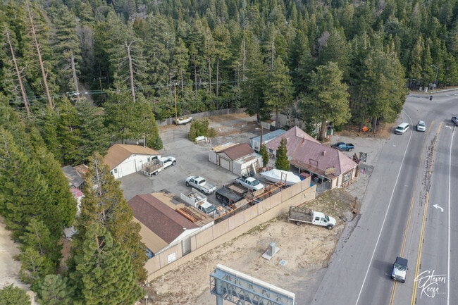
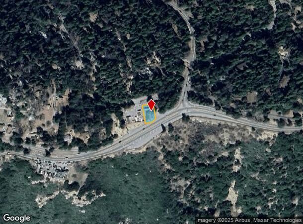

This Property Is For Sale
NEARBY LISTINGS FOR SALE OR LEASE
Property Detail
25266 Highway 18 Hwy
0340-245-04
PTN N 1/2 SW 1/4 SEC 25 TP 2N R 4W DESC AS FOL BEG INTERSECTION S LI RIM OF WORLD DR 60 FT WIDE AND N LI STATE HGWY 100 FT WIDE WHICH PT IS 39.75 FT S 79 DEG 01 MIN 00 SECONDS W AND 461.01 FT DUE S ALG 1/4 SEC LI FROM CEN SD SEC 25 TH S 79 DEG 01 MIN
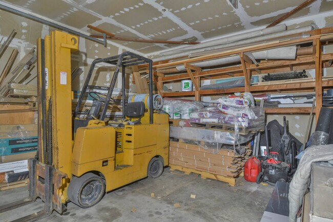
Storebuilding
San Bernardino
D
California
06071C7935H
0.18 AC
2024
San Bernardino
2025
Inland Empire (California)
010804
Riverside-San Bernardino-Ontario, CA
1,584 SF
DEMOGRAPHICS near 25266 Highway 18 Hwy
1 Mile
3 Mile
5 Mile
2024 Total Population
1,495
9,724
40,274
2029 Population
1,413
9,277
39,936
Pop Growth 2024-2029
(5.48%)
(4.60%)
(0.84%)
Average Age
43
43
39
2024 Total Households
605
4,007
13,981
HH Growth 2024-2029
(5.62%)
(4.74%)
(1.26%)
Median Household Inc
$67,151
$77,837
$84,476
Avg Household Size
2.40
2.30
2.70
2024 Avg HH Vehicles
2.00
2.00
2.00
Median Home Value
$366,298
$440,958
$435,587
Median Year Built
1967
1967
1968
Nearby Places
- Restaurants
- Banks
- Shops
- Fitness
- Groceries
PUBLIC TRANSPORTATION
AIRPORT
Ontario International
DRIVE
WALK
Distance
Ontario International
50 min
36.6 mi
Freight Ports
Port of Long Beach
DRIVE
WALK
Distance
Port of Long Beach
107 min
84.6 mi
Nearby Properties
Address
Land Use
TOTAL SIZE
Lot Size
Zoning
Address
Land Use
TOTAL SIZE
Lot Size
Zoning
73,307 SF
32.90 AC
CFSDRES
Address
Land Use
TOTAL SIZE
Lot Size
Zoning
25.95 AC
CFSDRES
Address
Land Use
TOTAL SIZE
Lot Size
Zoning
79,205 SF
17.72 AC
Address
Land Use
TOTAL SIZE
Lot Size
Zoning
78,044 SF
3.18 AC
LACS
Address
Land Use
TOTAL SIZE
Lot Size
Zoning
38,415 SF
33.85 AC
CFRS14M
Address
Land Use
TOTAL SIZE
Lot Size
Zoning
43,673 SF
2.63 AC
Address
Land Use
TOTAL SIZE
Lot Size
Zoning
32,675 SF
91.96 AC
LARC
Address
Land Use
TOTAL SIZE
Lot Size
Zoning
13,816 SF
28.10 AC
Address
Land Use
TOTAL SIZE
Lot Size
Zoning
32,648 SF
1.44 AC
LACGSCP
Address
Land Use
TOTAL SIZE
Lot Size
Zoning
Address
Land Use
TOTAL SIZE
Lot Size
Zoning
172.99 AC
Address
Land Use
TOTAL SIZE
Lot Size
Zoning
46,398 SF
1.88 AC
CFCGSCP
Address
Land Use
TOTAL SIZE
Lot Size
Zoning
Address
Land Use
TOTAL SIZE
Lot Size
Zoning
22,887 SF
19.30 AC
LARS14M
Address
Land Use
TOTAL SIZE
Lot Size
Zoning
25,759 SF
0.98 AC
LACGSCP
Address
Land Use
TOTAL SIZE
Lot Size
Zoning
3,570 SF
0.86 AC
LACS
Address
Land Use
TOTAL SIZE
Lot Size
Zoning
31,164 SF
0.82 AC
LACGSCP
Address
Land Use
TOTAL SIZE
Lot Size
Zoning
15,462 SF
0.52 AC
LACGSCP
Address
Land Use
TOTAL SIZE
Lot Size
Zoning
Address
Land Use
TOTAL SIZE
Lot Size
Zoning
3.45 AC
LACGSCP
Address
Land Use
TOTAL SIZE
Lot Size
Zoning
9,523 SF
0.67 AC
C
Address
Land Use
TOTAL SIZE
Lot Size
Zoning
2,784 SF
0.70 AC
LACN
Address
Land Use
TOTAL SIZE
Lot Size
Zoning
1,922 SF
0.53 AC
CFCGSCP
Address
Land Use
TOTAL SIZE
Lot Size
Zoning
12,368 SF
1.42 AC
LARS14M
Address
Land Use
TOTAL SIZE
Lot Size
Zoning
11,905 SF
3.33 AC
LARS14M
Address
Land Use
TOTAL SIZE
Lot Size
Zoning
10.79 AC
CFRL5
Address
Land Use
TOTAL SIZE
Lot Size
Zoning
35.61 AC
LARS14M
Address
Land Use
TOTAL SIZE
Lot Size
Zoning
6,198 SF
0.60 AC
LACGSCP
Address
Land Use
TOTAL SIZE
Lot Size
Zoning
10,000 SF
0.14 AC
LACGSCP
The World's #1 Commercial Real Estate Marketplace
Connect with us
© 2025 CoStar Group
The information above has been obtained from sources believed reliable. While we do not doubt its accuracy we have not verified it and make no guarantee, warranty or representation about it. It is your responsibility to independently confirm its accuracy and completeness. Any projections, opinions, assumptions, or estimates used are for example only and do not represent the current or future performance of the property. The value of this transaction to you depends on tax and other factors which should be evaluated by your tax, financial, and legal advisors. You and your advisors should conduct a careful, independent investigation of the property to determine to your satisfaction the suitability of the property for your needs.