Property Record
253 17Th St, Seal Beach, CA 90740


Save to a Folder
{{folder.Name}}
{{folder.ListingIds.length}} Properties
{{folder.ListingIds.length}} Property
Create a New Folder
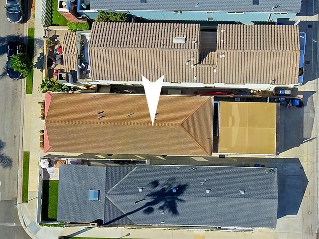
Property Detail
253 17Th St
Anaheim-Santa Ana-Irvine, CA
N TR 10 BLK 219 LOT 53
199-064-02
Orange
Multifamilydwelling
California
2024
53
2025
0.06 AC
099512
Seal Beach
2,090 SF
Orange County (California)
NEARBY LISTINGS FOR SALE OR LEASE
DEMOGRAPHICS near 253 17Th St
1 mile
3 mile
5 mile
2025 Total Population
9,888
58,180
264,066
2030 Population
9,947
58,234
262,562
Pop Growth 2025-2030
+ 0.60%
+ 0.09%
(0.57%)
Average Age
46
52
43
2025 Total Households
4,686
29,957
110,507
HH Growth 2025-2030
+ 0.53%
0.00%
(0.69%)
Median Household Inc
$126,972
$106,306
$104,839
Avg Household Size
2.10
1.90
2.30
2025 Avg HH Vehicles
2.00
2.00
2.00
Median Home Value
$1,137,818
$1,001,492
$968,286
Median Year Built
1967
1966
1964
Nearby Places
Map Layers
Map Styles
 Street
 Aerial
Layers
 Traffic
 Biking
Places
Listings with unknown addresses are not visible on the map
- Restaurants
- Banks
- Shops
- Fitness
- Groceries
PUBLIC TRANSPORTATION
AIRPORT
Long Beach (Daugherty Field)
Drive
Walk
Distance
Long Beach (Daugherty Field)
15 min
10.6 mi
John Wayne/Orange County
Drive
Walk
Distance
John Wayne/Orange County
22 min
16.0 mi
Los Angeles International
Drive
Walk
Distance
Los Angeles International
39 min
29.4 mi
Freight Ports
Port of Long Beach
Drive
Walk
Distance
Port of Long Beach
16 min
6.2 mi
SALE & LEASE HISTORY
LISTING DATE
SALE/LEASE

Sep 24, 2019
For Sale
Aug 26, 2019
For Sale
Nearby Properties
Address
Land Use
TOTAL SIZE
Lot Size
Zoning
Address
Land Use
TOTAL SIZE
Lot Size
Zoning
225,557 SF
10.81 AC
LBPD1
Address
Land Use
TOTAL SIZE
Lot Size
Zoning
454,844 SF
11.37 AC
Address
Land Use
TOTAL SIZE
Lot Size
Zoning
735.20 AC
Address
Land Use
TOTAL SIZE
Lot Size
Zoning
650.36 AC
Address
Land Use
TOTAL SIZE
Lot Size
Zoning
74,318 SF
NEW SHOP C
Address
Land Use
TOTAL SIZE
Lot Size
Zoning
74,318 SF
18.19 AC
NEW SHOP C
Address
Land Use
TOTAL SIZE
Lot Size
Zoning
256,538 SF
6.17 AC
NEW SHOPIN
Address
Land Use
TOTAL SIZE
Lot Size
Zoning
11.07 AC
Address
Land Use
TOTAL SIZE
Lot Size
Zoning
335,101 SF
8.32 AC
Address
Land Use
TOTAL SIZE
Lot Size
Zoning
392.51 AC
Address
Land Use
TOTAL SIZE
Lot Size
Zoning
3.97 AC
Address
Land Use
TOTAL SIZE
Lot Size
Zoning
16.18 AC
Address
Land Use
TOTAL SIZE
Lot Size
Zoning
54,112 SF
15.43 AC
LBPD1
Address
Land Use
TOTAL SIZE
Lot Size
Zoning
73,076 SF
2.53 AC
LBPD1
Address
Land Use
TOTAL SIZE
Lot Size
Zoning
320.34 AC
Address
Land Use
TOTAL SIZE
Lot Size
Zoning
11.97 AC
Address
Land Use
TOTAL SIZE
Lot Size
Zoning
3.32 AC
Address
Land Use
TOTAL SIZE
Lot Size
Zoning
200,280 SF
13.17 AC
LBPD1
Address
Land Use
TOTAL SIZE
Lot Size
Zoning
11.93 AC
Address
Land Use
TOTAL SIZE
Lot Size
Zoning
9.24 AC
Address
Land Use
TOTAL SIZE
Lot Size
Zoning
3.17 AC
Address
Land Use
TOTAL SIZE
Lot Size
Zoning
Address
Land Use
TOTAL SIZE
Lot Size
Zoning
168.42 AC
Address
Land Use
TOTAL SIZE
Lot Size
Zoning
Address
Land Use
TOTAL SIZE
Lot Size
Zoning
5.50 AC
Address
Land Use
TOTAL SIZE
Lot Size
Zoning
3.22 AC
Address
Land Use
TOTAL SIZE
Lot Size
Zoning
Address
Land Use
TOTAL SIZE
Lot Size
Zoning
71,949 SF
5.65 AC
Address
Land Use
TOTAL SIZE
Lot Size
Zoning
5.41 AC
Address
Land Use
TOTAL SIZE
Lot Size
Zoning
The World's #1 Commercial Real Estate Marketplace
Connect with us
© 2026 CoStar Group
The information above has been obtained from sources believed reliable. While we do not doubt its accuracy we have not verified it and make no guarantee, warranty or representation about it. It is your responsibility to independently confirm its accuracy and completeness. Any projections, opinions, assumptions, or estimates used are for example only and do not represent the current or future performance of the property. The value of this transaction to you depends on tax and other factors which should be evaluated by your tax, financial, and legal advisors. You and your advisors should conduct a careful, independent investigation of the property to determine to your satisfaction the suitability of the property for your needs.