Property Record
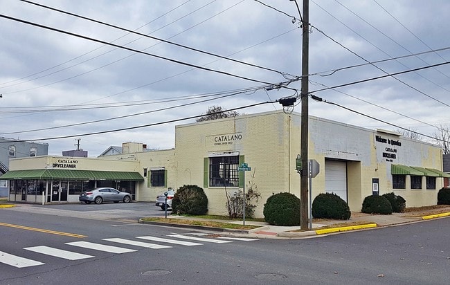
253 5Th Ave, Quantico, VA 22134


Property Detail
253 5Th Ave
8287-85-7805
L 47-BK 5
Commercialnec
PRINCE WILLIAM
B1
Virginia
B and X Area of moderate flood hazard, usually the area between the limits of the 100-year and 500-year floods.
47
2024
0.05 AC
2025
Quantico Marine Base
901101
Washington, DC
2,037 SF
Washington-Arlington-Alexandria, DC-VA-MD-WV
NEARBY LISTINGS FOR SALE OR LEASE
-
-
View all Quantico listings for sale on LoopNet.com
DEMOGRAPHICS near 253 5Th Ave
1 mile
3 mile
5 mile
2024 Total Population
6,054
19,137
59,409
2029 Population
6,956
20,772
62,590
Pop Growth 2024-2029
+ 14.90%
+ 8.54%
+ 5.35%
Average Age
28
32
34
2024 Total Households
2,047
6,336
19,230
HH Growth 2024-2029
+ 17.68%
+ 10.59%
+ 6.07%
Median Household Inc
$13,669
$78,168
$104,766
Avg Household Size
2.40
2.70
3.00
2024 Avg HH Vehicles
1.00
2.00
2.00
Median Home Value
$211,538
$602,778
$482,176
Median Year Built
2011
2007
2000
Nearby Places
Map Layers
Map Styles
 Street
 Aerial
Transit
 Traffic
 Biking
Places
Listings with unknown addresses are not visible on the map
- Restaurants
- Banks
- Shops
- Fitness
- Groceries
PUBLIC TRANSPORTATION
TRANSIT/SUBWAY
Quantico (Fredericksburg Line - Virginia Railway Express)
Drive
Walk
Distance
Quantico (Fredericksburg Line - Virginia Railway Express)
1 min
3 min
0.2 mi
COMMUTER RAIL
Drive
Walk
Distance
1 min
3 min
0.2 mi
AIRPORT
Ronald Reagan Washington Ntl
Drive
Walk
Distance
Ronald Reagan Washington Ntl
48 min
33.3 mi
Washington Dulles International
Drive
Walk
Distance
Washington Dulles International
71 min
41.6 mi
SALE & LEASE HISTORY
LISTING DATE
SALE/LEASE

Nov 04, 2020
For Sale
Dec 05, 2018
For Sale
Nearby Properties
Address
Land Use
TOTAL SIZE
Lot Size
Zoning
Address
Land Use
TOTAL SIZE
Lot Size
Zoning
13,253.84 AC
NZ
Address
Land Use
TOTAL SIZE
Lot Size
Zoning
207,924 SF
52.53 AC
PMR
Address
Land Use
TOTAL SIZE
Lot Size
Zoning
25,264 SF
0.12 AC
R4
Address
Land Use
TOTAL SIZE
Lot Size
Zoning
103,737 SF
18.62 AC
A1
Address
Land Use
TOTAL SIZE
Lot Size
Zoning
48,996 SF
8.01 AC
R16
Address
Land Use
TOTAL SIZE
Lot Size
Zoning
103,034 SF
21.89 AC
A1
Address
Land Use
TOTAL SIZE
Lot Size
Zoning
35,276 SF
5.50 AC
R16
Address
Land Use
TOTAL SIZE
Lot Size
Zoning
29,904 SF
5.29 AC
R16
Address
Land Use
TOTAL SIZE
Lot Size
Zoning
34,030 SF
19.86 AC
R4
Address
Land Use
TOTAL SIZE
Lot Size
Zoning
6,868 SF
552.42 AC
AC
Address
Land Use
TOTAL SIZE
Lot Size
Zoning
9,859 SF
0.25 AC
B1
Address
Land Use
TOTAL SIZE
Lot Size
Zoning
15,329 SF
0.19 AC
B1
Address
Land Use
TOTAL SIZE
Lot Size
Zoning
7,324 SF
0.06 AC
T1
Address
Land Use
TOTAL SIZE
Lot Size
Zoning
7,812 SF
0.05 AC
T1
Address
Land Use
TOTAL SIZE
Lot Size
Zoning
14,260 SF
0.70 AC
R4
Address
Land Use
TOTAL SIZE
Lot Size
Zoning
Address
Land Use
TOTAL SIZE
Lot Size
Zoning
4,716 SF
3,636.26 AC
AC
Address
Land Use
TOTAL SIZE
Lot Size
Zoning
1,440 SF
42.26 AC
R4
Address
Land Use
TOTAL SIZE
Lot Size
Zoning
10,664 SF
0.72 AC
R4
Address
Land Use
TOTAL SIZE
Lot Size
Zoning
4,871 SF
6.58 AC
AC
Address
Land Use
TOTAL SIZE
Lot Size
Zoning
7,632 SF
0.12 AC
B1
Address
Land Use
TOTAL SIZE
Lot Size
Zoning
9,895 SF
0.13 AC
B1
Address
Land Use
TOTAL SIZE
Lot Size
Zoning
5,342 SF
3.22 AC
R4
Address
Land Use
TOTAL SIZE
Lot Size
Zoning
8,726 SF
0.08 AC
B1
Address
Land Use
TOTAL SIZE
Lot Size
Zoning
4,788 SF
0.15 AC
PMR
Address
Land Use
TOTAL SIZE
Lot Size
Zoning
6,838 SF
0.22 AC
B1
Address
Land Use
TOTAL SIZE
Lot Size
Zoning
1,520 SF
0.90 AC
B1
Address
Land Use
TOTAL SIZE
Lot Size
Zoning
4,370 SF
0.04 AC
B1
Address
Land Use
TOTAL SIZE
Lot Size
Zoning
4,786 SF
0.06 AC
B1
Address
Land Use
TOTAL SIZE
Lot Size
Zoning
8,611 SF
0.17 AC
B1
The World's #1 Commercial Real Estate Marketplace
Connect with us
© 2026 CoStar Group
The information above has been obtained from sources believed reliable. While we do not doubt its accuracy we have not verified it and make no guarantee, warranty or representation about it. It is your responsibility to independently confirm its accuracy and completeness. Any projections, opinions, assumptions, or estimates used are for example only and do not represent the current or future performance of the property. The value of this transaction to you depends on tax and other factors which should be evaluated by your tax, financial, and legal advisors. You and your advisors should conduct a careful, independent investigation of the property to determine to your satisfaction the suitability of the property for your needs.