Property Record
253 Mantoloking Rd, Brick, NJ 08723
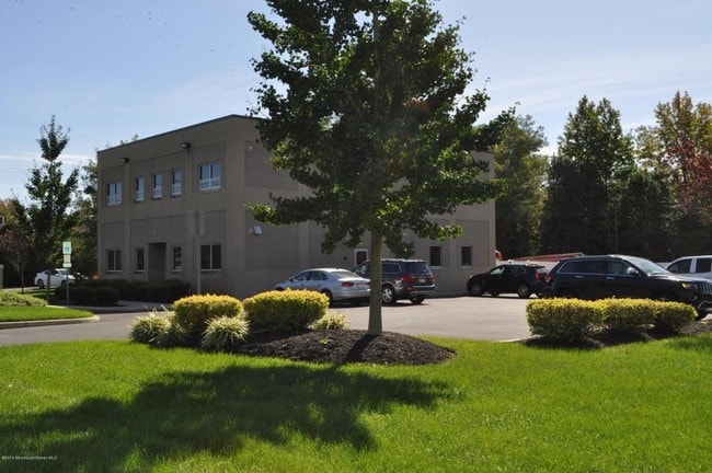

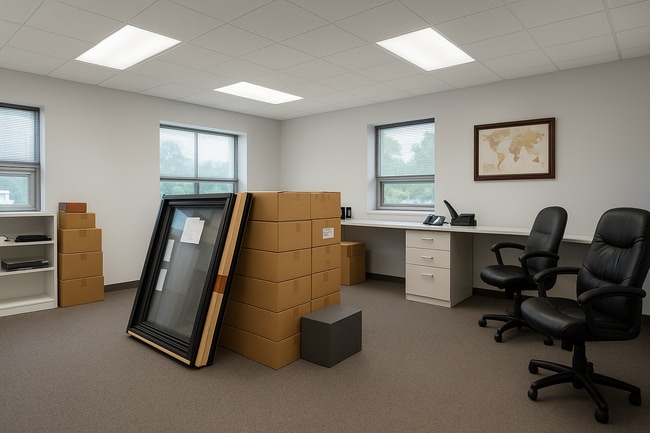
This Property Is For Sale
NEARBY LISTINGS FOR SALE OR LEASE
-
-
View all Brick listings for sale on LoopNet.com
Property Detail
253 Mantoloking Rd
New York-Jersey City-White Plains, NY-NJ
1.11AC
07-00109-11-00001
Ocean
Commercialnec
New Jersey
X
1
34029C0212F
1.11 AC
2024
Outer North Ocean County
2025
Northern New Jersey
713800
DEMOGRAPHICS near 253 Mantoloking Rd
1 Mile
3 Mile
5 Mile
2024 Total Population
2,534
53,255
126,063
2029 Population
2,738
57,594
135,851
Pop Growth 2024-2029
+ 8.05%
+ 8.15%
+ 7.76%
Average Age
43
43
45
2024 Total Households
1,005
21,161
52,498
HH Growth 2024-2029
+ 7.66%
+ 7.95%
+ 7.63%
Median Household Inc
$96,804
$104,845
$90,677
Avg Household Size
2.40
2.40
2.30
2024 Avg HH Vehicles
2.00
2.00
2.00
Median Home Value
$371,753
$414,496
$384,830
Median Year Built
1967
1970
1973
Nearby Places
- Restaurants
- Banks
- Shops
- Fitness
- Groceries
PUBLIC TRANSPORTATION
COMMUTER RAIL
Bay Head (North Jersey Coast Line - NJ Transit Commuter Rail (NJ Transit))
DRIVE
WALK
Distance
Bay Head (North Jersey Coast Line - NJ Transit Commuter Rail (NJ Transit))
9 min
4.2 mi
Point Pleasant Beach (North Jersey Coast Line - NJ Transit Commuter Rail (NJ Transit))
DRIVE
WALK
Distance
Point Pleasant Beach (North Jersey Coast Line - NJ Transit Commuter Rail (NJ Transit))
11 min
5.5 mi
Freight Ports
New York Container Terminal
DRIVE
WALK
Distance
New York Container Terminal
74 min
56.6 mi
Nearby Properties
Address
Land Use
TOTAL SIZE
Lot Size
Zoning
Address
Land Use
TOTAL SIZE
Lot Size
Zoning
50.10 AC
C
Address
Land Use
TOTAL SIZE
Lot Size
Zoning
7,936 SF
25.60 AC
EM18
Address
Land Use
TOTAL SIZE
Lot Size
Zoning
117 AC
RR1
Address
Land Use
TOTAL SIZE
Lot Size
Zoning
21,850 SF
30.98 AC
R-1A
Address
Land Use
TOTAL SIZE
Lot Size
Zoning
26.37 AC
R75
Address
Land Use
TOTAL SIZE
Lot Size
Zoning
26.43 AC
B3
Address
Land Use
TOTAL SIZE
Lot Size
Zoning
3,792 SF
7.64 AC
R-1A
Address
Land Use
TOTAL SIZE
Lot Size
Zoning
63,136 SF
10.31 AC
R-1A
Address
Land Use
TOTAL SIZE
Lot Size
Zoning
18,058 SF
6.09 AC
R-50
Address
Land Use
TOTAL SIZE
Lot Size
Zoning
32.50 AC
RM
Address
Land Use
TOTAL SIZE
Lot Size
Zoning
32.80 AC
RM
Address
Land Use
TOTAL SIZE
Lot Size
Zoning
2,408 SF
4.84 AC
B-2
Address
Land Use
TOTAL SIZE
Lot Size
Zoning
16.85 AC
B2
Address
Land Use
TOTAL SIZE
Lot Size
Zoning
17,450 SF
7.50 AC
HR
Address
Land Use
TOTAL SIZE
Lot Size
Zoning
1,140 SF
14 AC
GC
Address
Land Use
TOTAL SIZE
Lot Size
Zoning
1,976 SF
8.42 AC
R50
Address
Land Use
TOTAL SIZE
Lot Size
Zoning
1,702 SF
2.90 AC
C
Address
Land Use
TOTAL SIZE
Lot Size
Zoning
86,484 SF
7.25 AC
GC
Address
Land Use
TOTAL SIZE
Lot Size
Zoning
1,677 SF
3 AC
R-3A
Address
Land Use
TOTAL SIZE
Lot Size
Zoning
10.69 AC
B3
Address
Land Use
TOTAL SIZE
Lot Size
Zoning
10,003 SF
0.32 AC
PU
Address
Land Use
TOTAL SIZE
Lot Size
Zoning
19,248 SF
5.75 AC
W
Address
Land Use
TOTAL SIZE
Lot Size
Zoning
31,412 SF
2.29 AC
RM
Address
Land Use
TOTAL SIZE
Lot Size
Zoning
14 AC
R10
Address
Land Use
TOTAL SIZE
Lot Size
Zoning
0.34 AC
R5
Address
Land Use
TOTAL SIZE
Lot Size
Zoning
27,506 SF
7.74 AC
R-1A
Address
Land Use
TOTAL SIZE
Lot Size
Zoning
300 SF
5.14 AC
RMPS
Address
Land Use
TOTAL SIZE
Lot Size
Zoning
25.02 AC
R15
Address
Land Use
TOTAL SIZE
Lot Size
Zoning
6.35 AC
R75
Address
Land Use
TOTAL SIZE
Lot Size
Zoning
2,268 SF
6.91 AC
R75
The World's #1 Commercial Real Estate Marketplace
Connect with us
© 2025 CoStar Group
The information above has been obtained from sources believed reliable. While we do not doubt its accuracy we have not verified it and make no guarantee, warranty or representation about it. It is your responsibility to independently confirm its accuracy and completeness. Any projections, opinions, assumptions, or estimates used are for example only and do not represent the current or future performance of the property. The value of this transaction to you depends on tax and other factors which should be evaluated by your tax, financial, and legal advisors. You and your advisors should conduct a careful, independent investigation of the property to determine to your satisfaction the suitability of the property for your needs.