Property Record
2530 Knights Station Rd, Lakeland, FL 33810


NEARBY LISTINGS FOR SALE OR LEASE
Property Detail
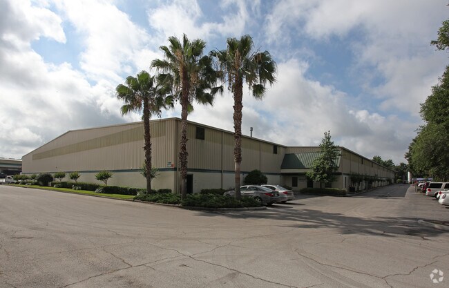
2530 Knights Station Rd
23-28-03-000000-014040
Alameda Heights
Lightindustrial
PARCEL B DESC AS: COMM SE COR OF SW1/4 OF NE1/4 RUN W 550.93 FT TO POB CONT W 544 FT N 665.25 FT E 264.01 FT N 34.50 FT E 156.32 FT S 343.99 FT S 30 DEG 26 MIN 29 SEC E 246.74 FT S 144.01 FT TO POB LESS THAT PART OF FOLL DESCRIBED RETENTION EASEMENT
X
Polk
12105C0303G
Florida
2024
5.48 AC
2025
Polk County
012001
Tampa/St Petersburg
136,852 SF
Lakeland-Winter Haven, FL
DEMOGRAPHICS near 2530 Knights Station Rd
1 Mile
3 Mile
5 Mile
2024 Total Population
6,015
54,392
127,579
2029 Population
7,261
65,137
152,242
Pop Growth 2024-2029
+ 20.71%
+ 19.75%
+ 19.33%
Average Age
38
40
40
2024 Total Households
2,161
21,262
49,924
HH Growth 2024-2029
+ 20.64%
+ 19.70%
+ 19.62%
Median Household Inc
$58,839
$48,135
$51,345
Avg Household Size
2.70
2.40
2.40
2024 Avg HH Vehicles
2.00
2.00
2.00
Median Home Value
$226,858
$173,722
$186,094
Median Year Built
2000
1985
1985
Nearby Places
Map Layers
Map Styles
 Street
 Aerial
- Restaurants
- Banks
- Shops
- Fitness
- Groceries
PUBLIC TRANSPORTATION
COMMUTER RAIL
Lakeland (Silver Star - Amtrak)
DRIVE
WALK
Distance
Lakeland (Silver Star - Amtrak)
9 min
4.4 mi
Freight Ports
Port of Tampa Bay
DRIVE
WALK
Distance
Port of Tampa Bay
44 min
33.5 mi
Nearby Properties
Address
Land Use
TOTAL SIZE
Lot Size
Zoning
Address
Land Use
TOTAL SIZE
Lot Size
Zoning
2,325,080 SF
27.05 AC
PUD
Address
Land Use
TOTAL SIZE
Lot Size
Zoning
1,091,160 SF
133.41 AC
PUD
Address
Land Use
TOTAL SIZE
Lot Size
Zoning
363,693 SF
22.54 AC
R2
Address
Land Use
TOTAL SIZE
Lot Size
Zoning
1,004,426 SF
93.42 AC
C4
Address
Land Use
TOTAL SIZE
Lot Size
Zoning
279,726 SF
19.09 AC
C3
Address
Land Use
TOTAL SIZE
Lot Size
Zoning
246,838 SF
24.57 AC
PUD
Address
Land Use
TOTAL SIZE
Lot Size
Zoning
568,801 SF
37.13 AC
C4
Address
Land Use
TOTAL SIZE
Lot Size
Zoning
762,259 SF
24.95 AC
PUD
Address
Land Use
TOTAL SIZE
Lot Size
Zoning
208,898 SF
17.62 AC
PUD
Address
Land Use
TOTAL SIZE
Lot Size
Zoning
297,600 SF
27.53 AC
XX
Address
Land Use
TOTAL SIZE
Lot Size
Zoning
309,334 SF
41.64 AC
Address
Land Use
TOTAL SIZE
Lot Size
Zoning
84,824 SF
163.73 AC
I2
Address
Land Use
TOTAL SIZE
Lot Size
Zoning
258,946 SF
11.73 AC
O3
Address
Land Use
TOTAL SIZE
Lot Size
Zoning
79,697 SF
6.37 AC
C2
Address
Land Use
TOTAL SIZE
Lot Size
Zoning
169,546 SF
14.40 AC
PUD
Address
Land Use
TOTAL SIZE
Lot Size
Zoning
226,953 SF
34.42 AC
Address
Land Use
TOTAL SIZE
Lot Size
Zoning
425,986 SF
45.72 AC
C5
Address
Land Use
TOTAL SIZE
Lot Size
Zoning
171,525 SF
40.58 AC
RC
Address
Land Use
TOTAL SIZE
Lot Size
Zoning
682,828 SF
36.01 AC
Address
Land Use
TOTAL SIZE
Lot Size
Zoning
115,608 SF
11.44 AC
RC
Address
Land Use
TOTAL SIZE
Lot Size
Zoning
156,987 SF
51.52 AC
Address
Land Use
TOTAL SIZE
Lot Size
Zoning
101,501 SF
16.54 AC
Address
Land Use
TOTAL SIZE
Lot Size
Zoning
180,802 SF
76.35 AC
Address
Land Use
TOTAL SIZE
Lot Size
Zoning
210,000 SF
12.91 AC
Address
Land Use
TOTAL SIZE
Lot Size
Zoning
292,124 SF
29.70 AC
PUD
Address
Land Use
TOTAL SIZE
Lot Size
Zoning
210,000 SF
13.28 AC
Address
Land Use
TOTAL SIZE
Lot Size
Zoning
87,975 SF
5.45 AC
O1
Address
Land Use
TOTAL SIZE
Lot Size
Zoning
183,800 SF
19.26 AC
Address
Land Use
TOTAL SIZE
Lot Size
Zoning
171,629 SF
14.91 AC
RA4
Address
Land Use
TOTAL SIZE
Lot Size
Zoning
174,000 SF
10.44 AC
The World's #1 Commercial Real Estate Marketplace
Connect with us
© 2026 CoStar Group
The information above has been obtained from sources believed reliable. While we do not doubt its accuracy we have not verified it and make no guarantee, warranty or representation about it. It is your responsibility to independently confirm its accuracy and completeness. Any projections, opinions, assumptions, or estimates used are for example only and do not represent the current or future performance of the property. The value of this transaction to you depends on tax and other factors which should be evaluated by your tax, financial, and legal advisors. You and your advisors should conduct a careful, independent investigation of the property to determine to your satisfaction the suitability of the property for your needs.