Property Record
2530 Quarry Rd Ne, Sauk Rapids, MN 56379
NEARBY LISTINGS FOR SALE OR LEASE
Property Detail
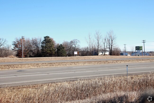
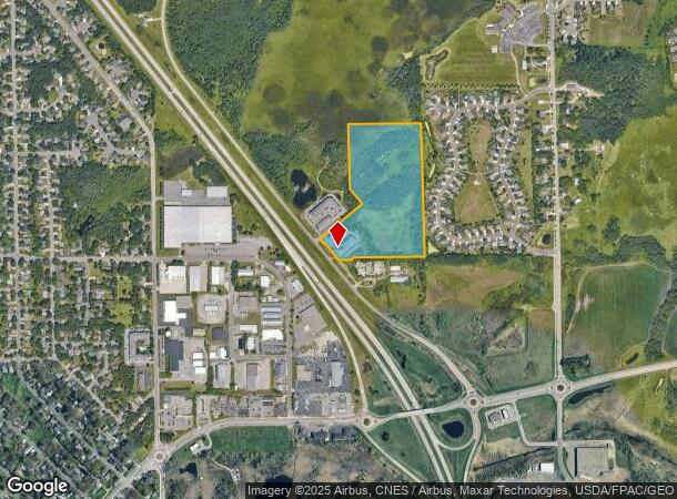
2530 Quarry Rd Ne
St. Cloud, MN
Quarry Village
19.04992.00
SECT-13 TWP-036 RANGE-031 QUARRY VILLAGE LOT-002 BLOCK-001 23.33 AC
Multifamilydwelling
Benton
X
Minnesota
27145C0635E
2
2025
23.33 AC
2025
Benton County
021104
Minneapolis/St Paul
1,205 SF
DEMOGRAPHICS near 2530 Quarry Rd Ne
1 Mile
3 Mile
5 Mile
2024 Total Population
4,276
33,364
94,471
2029 Population
4,277
33,732
97,279
Pop Growth 2024-2029
+ 0.02%
+ 1.10%
+ 2.97%
Average Age
36
38
37
2024 Total Households
1,636
14,271
37,208
HH Growth 2024-2029
0.00%
+ 1.16%
+ 3.02%
Median Household Inc
$64,849
$54,639
$56,673
Avg Household Size
2.50
2.20
2.40
2024 Avg HH Vehicles
2.00
2.00
2.00
Median Home Value
$221,062
$182,306
$195,253
Median Year Built
1993
1981
1982
Nearby Places
Map Layers
Map Styles
 Street
 Aerial
- Restaurants
- Banks
- Shops
- Fitness
- Groceries
PUBLIC TRANSPORTATION
COMMUTER RAIL
St. Cloud Amtrak Station (Empire Builder - Amtrak)
DRIVE
WALK
Distance
St. Cloud Amtrak Station (Empire Builder - Amtrak)
6 min
3.3 mi
Freight Ports
Port Milwaukee
DRIVE
WALK
Distance
Port Milwaukee
453 min
404.8 mi
Nearby Properties
Address
Land Use
TOTAL SIZE
Lot Size
Zoning
Address
Land Use
TOTAL SIZE
Lot Size
Zoning
16.60 AC
MD
Address
Land Use
TOTAL SIZE
Lot Size
Zoning
362,000 SF
86.20 AC
Address
Land Use
TOTAL SIZE
Lot Size
Zoning
157,266 SF
0.94 AC
R2
Address
Land Use
TOTAL SIZE
Lot Size
Zoning
10,800 SF
24.94 AC
Address
Land Use
TOTAL SIZE
Lot Size
Zoning
Address
Land Use
TOTAL SIZE
Lot Size
Zoning
365,299 SF
28.68 AC
R1
Address
Land Use
TOTAL SIZE
Lot Size
Zoning
252,469 SF
35 AC
Address
Land Use
TOTAL SIZE
Lot Size
Zoning
149,778 SF
7.86 AC
Address
Land Use
TOTAL SIZE
Lot Size
Zoning
Address
Land Use
TOTAL SIZE
Lot Size
Zoning
232,274 SF
2.94 AC
R3
Address
Land Use
TOTAL SIZE
Lot Size
Zoning
157,500 SF
1.25 AC
C3
Address
Land Use
TOTAL SIZE
Lot Size
Zoning
15.78 AC
Address
Land Use
TOTAL SIZE
Lot Size
Zoning
105,123 SF
36.87 AC
R1
Address
Land Use
TOTAL SIZE
Lot Size
Zoning
127,460 SF
5 AC
Address
Land Use
TOTAL SIZE
Lot Size
Zoning
6.61 AC
Address
Land Use
TOTAL SIZE
Lot Size
Zoning
25,608 SF
6.96 AC
R5
Address
Land Use
TOTAL SIZE
Lot Size
Zoning
36,393 SF
6.28 AC
Address
Land Use
TOTAL SIZE
Lot Size
Zoning
100,024 SF
0.47 AC
Address
Land Use
TOTAL SIZE
Lot Size
Zoning
Address
Land Use
TOTAL SIZE
Lot Size
Zoning
197,115 SF
18.23 AC
Address
Land Use
TOTAL SIZE
Lot Size
Zoning
29,349 SF
4.83 AC
Address
Land Use
TOTAL SIZE
Lot Size
Zoning
53,901 SF
1.92 AC
PUD22
Address
Land Use
TOTAL SIZE
Lot Size
Zoning
43,302 SF
5.67 AC
Address
Land Use
TOTAL SIZE
Lot Size
Zoning
71,940 SF
1.99 AC
Address
Land Use
TOTAL SIZE
Lot Size
Zoning
128,794 SF
2.32 AC
C3
Address
Land Use
TOTAL SIZE
Lot Size
Zoning
22,425 SF
5.54 AC
Address
Land Use
TOTAL SIZE
Lot Size
Zoning
81,500 SF
11.01 AC
Address
Land Use
TOTAL SIZE
Lot Size
Zoning
24,642 SF
5.40 AC
R5
Address
Land Use
TOTAL SIZE
Lot Size
Zoning
218,554 SF
13.63 AC
C5
Address
Land Use
TOTAL SIZE
Lot Size
Zoning
63,366 SF
2.61 AC
MD
The World's #1 Commercial Real Estate Marketplace
Connect with us
© 2026 CoStar Group
The information above has been obtained from sources believed reliable. While we do not doubt its accuracy we have not verified it and make no guarantee, warranty or representation about it. It is your responsibility to independently confirm its accuracy and completeness. Any projections, opinions, assumptions, or estimates used are for example only and do not represent the current or future performance of the property. The value of this transaction to you depends on tax and other factors which should be evaluated by your tax, financial, and legal advisors. You and your advisors should conduct a careful, independent investigation of the property to determine to your satisfaction the suitability of the property for your needs.