Property Record
25311 Us Highway 17, Hampstead, NC 28443


Save to a Folder
{{folder.Name}}
{{folder.ListingIds.length}} Properties
{{folder.ListingIds.length}} Property
Create a New Folder
This Property Is For Sale
Property Detail
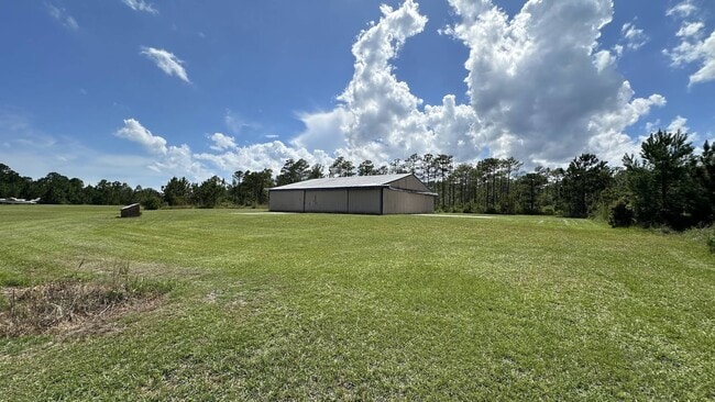
25311 Us Highway 17
4226-77-6380-0000
130.05 AC TR PB 52/108 RECOMB
Airport
PENDER
RA
North Carolina
A Areas with a 1% annual chance of flooding and a 26% chance of flooding over the life of a 30-year mortgage.
130.05 AC
2025
East Pender County
2025
Wilmington
920204
Wilmington, NC
6,120 SF
NEARBY LISTINGS FOR SALE OR LEASE
DEMOGRAPHICS near 25311 Us Highway 17
1 mile
3 mile
5 mile
2025 Total Population
1,243
9,306
18,566
2030 Population
1,377
10,578
21,238
Pop Growth 2025-2030
+ 10.78%
+ 13.67%
+ 14.39%
Average Age
37
39
41
2025 Total Households
469
3,613
7,509
HH Growth 2025-2030
+ 10.87%
+ 14.03%
+ 14.94%
Median Household Inc
$78,398
$77,204
$87,878
Avg Household Size
2.50
2.50
2.40
2025 Avg HH Vehicles
2.00
2.00
2.00
Median Home Value
$288,207
$326,428
$417,469
Median Year Built
2004
2003
2001
Nearby Places
Map Layers
Map Styles
 Street
 Aerial
Layers
 Traffic
 Biking
Places
Listings with unknown addresses are not visible on the map
- Restaurants
- Banks
- Shops
- Fitness
- Groceries
PUBLIC TRANSPORTATION
AIRPORT
Wilmington International
Drive
Walk
Distance
Wilmington International
45 min
29.3 mi
Albert J Ellis
Drive
Walk
Distance
Albert J Ellis
56 min
34.6 mi
Freight Ports
Port of Wilmington
Drive
Walk
Distance
Port of Wilmington
52 min
31.2 mi
Nearby Properties
Address
Land Use
TOTAL SIZE
Lot Size
Zoning
Address
Land Use
TOTAL SIZE
Lot Size
Zoning
333,789 SF
1 AC
RP
Address
Land Use
TOTAL SIZE
Lot Size
Zoning
151,776 SF
32.21 AC
SEEMAP
Address
Land Use
TOTAL SIZE
Lot Size
Zoning
104,760 SF
20 AC
Address
Land Use
TOTAL SIZE
Lot Size
Zoning
6,909 SF
36.97 AC
R-20
Address
Land Use
TOTAL SIZE
Lot Size
Zoning
60,562 SF
9.34 AC
SEEMAP
Address
Land Use
TOTAL SIZE
Lot Size
Zoning
138,492 SF
32.99 AC
SEEMAP
Address
Land Use
TOTAL SIZE
Lot Size
Zoning
42,232 SF
6.23 AC
SEEMAP
Address
Land Use
TOTAL SIZE
Lot Size
Zoning
46,080 SF
7.41 AC
Address
Land Use
TOTAL SIZE
Lot Size
Zoning
22,068 SF
3.13 AC
B2
Address
Land Use
TOTAL SIZE
Lot Size
Zoning
35,205 SF
5.86 AC
SEEMAP
Address
Land Use
TOTAL SIZE
Lot Size
Zoning
23,444 SF
5.17 AC
SEEMAP
Address
Land Use
TOTAL SIZE
Lot Size
Zoning
5,000 SF
24.13 AC
LI
Address
Land Use
TOTAL SIZE
Lot Size
Zoning
13,836 SF
1 AC
SEEMAP
Address
Land Use
TOTAL SIZE
Lot Size
Zoning
1,213.25 AC
R-15
Address
Land Use
TOTAL SIZE
Lot Size
Zoning
8,331 SF
2.17 AC
SEEMAP
Address
Land Use
TOTAL SIZE
Lot Size
Zoning
11,534 SF
1 AC
SEEMAP
Address
Land Use
TOTAL SIZE
Lot Size
Zoning
11,500 SF
1.59 AC
C1
Address
Land Use
TOTAL SIZE
Lot Size
Zoning
13,606 SF
1.52 AC
SEEMAP
Address
Land Use
TOTAL SIZE
Lot Size
Zoning
7,828 SF
2.89 AC
SEEMAP
Address
Land Use
TOTAL SIZE
Lot Size
Zoning
9,664 SF
3.10 AC
C1
Address
Land Use
TOTAL SIZE
Lot Size
Zoning
22,584 SF
3.35 AC
SEEMAP
Address
Land Use
TOTAL SIZE
Lot Size
Zoning
9,021 SF
2.65 AC
SEEMAP
Address
Land Use
TOTAL SIZE
Lot Size
Zoning
6,500 SF
34.41 AC
SEEMAP
Address
Land Use
TOTAL SIZE
Lot Size
Zoning
3,088 SF
31.91 AC
R-10A
Address
Land Use
TOTAL SIZE
Lot Size
Zoning
49,760 SF
7.42 AC
LI
Address
Land Use
TOTAL SIZE
Lot Size
Zoning
6,520 SF
8.82 AC
LI
Address
Land Use
TOTAL SIZE
Lot Size
Zoning
16,072 SF
3.18 AC
PD
Address
Land Use
TOTAL SIZE
Lot Size
Zoning
11,280 SF
0.95 AC
B2
Address
Land Use
TOTAL SIZE
Lot Size
Zoning
18,000 SF
4.64 AC
B2RA
Address
Land Use
TOTAL SIZE
Lot Size
Zoning
5,400 SF
3.01 AC
INCORP
The World's #1 Commercial Real Estate Marketplace
Connect with us
© 2026 CoStar Group
The information above has been obtained from sources believed reliable. While we do not doubt its accuracy we have not verified it and make no guarantee, warranty or representation about it. It is your responsibility to independently confirm its accuracy and completeness. Any projections, opinions, assumptions, or estimates used are for example only and do not represent the current or future performance of the property. The value of this transaction to you depends on tax and other factors which should be evaluated by your tax, financial, and legal advisors. You and your advisors should conduct a careful, independent investigation of the property to determine to your satisfaction the suitability of the property for your needs.