Property Record
25331 Us Highway 58, Barstow, CA 92311


NEARBY LISTINGS FOR SALE OR LEASE
Property Detail
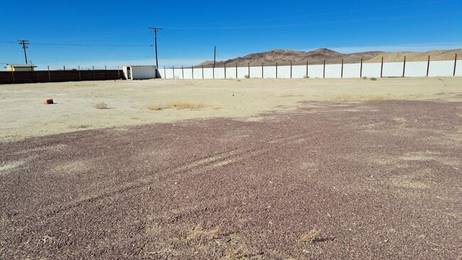
25331 Us Highway 58
0497-231-09
N 408 FT W 400 FT NW 1/4 NE 1/4 SEC 32 TP 10N R 2W 3.75 AC
Wellsiteagricultural
San Bernardino
D
California
06071C3915J
3.75 AC
2024
Mojave River Valley
2025
Inland Empire (California)
011900
Riverside-San Bernardino-Ontario, CA
DEMOGRAPHICS near 25331 Us Highway 58
1 Mile
3 Mile
5 Mile
2024 Total Population
120
2,998
13,720
2029 Population
126
3,099
14,249
Pop Growth 2024-2029
+ 5.00%
+ 3.37%
+ 3.86%
Average Age
41
36
37
2024 Total Households
43
1,031
4,789
HH Growth 2024-2029
+ 4.65%
+ 3.39%
+ 3.88%
Median Household Inc
$34,499
$55,192
$51,807
Avg Household Size
2.60
2.80
2.80
2024 Avg HH Vehicles
2.00
2.00
2.00
Median Home Value
$133,333
$105,714
$140,144
Median Year Built
1970
1972
1969
Nearby Places
Map Layers
Map Styles
 Street
 Aerial
- Restaurants
- Banks
- Shops
- Fitness
- Groceries
PUBLIC TRANSPORTATION
COMMUTER RAIL
Barstow (Southwest Chief - Amtrak)
DRIVE
WALK
Distance
Barstow (Southwest Chief - Amtrak)
11 min
6.2 mi
Freight Ports
Port of Long Beach
DRIVE
WALK
Distance
Port of Long Beach
151 min
130.5 mi
SALE & LEASE HISTORY
LISTING DATE
SALE/LEASE

Jan 18, 2024
For Lease
Nearby Properties
Address
Land Use
TOTAL SIZE
Lot Size
Zoning
Address
Land Use
TOTAL SIZE
Lot Size
Zoning
87,534 SF
19.40 AC
Address
Land Use
TOTAL SIZE
Lot Size
Zoning
7,808 SF
117.11 AC
RL10AP
Address
Land Use
TOTAL SIZE
Lot Size
Zoning
804 SF
55.30 AC
RL5
Address
Land Use
TOTAL SIZE
Lot Size
Zoning
9,100 SF
1.25 AC
CR
Address
Land Use
TOTAL SIZE
Lot Size
Zoning
77.51 AC
Address
Land Use
TOTAL SIZE
Lot Size
Zoning
3,162 SF
113 AC
RL5
Address
Land Use
TOTAL SIZE
Lot Size
Zoning
27,466 SF
2.07 AC
CR
Address
Land Use
TOTAL SIZE
Lot Size
Zoning
6,046 SF
65.84 AC
RL10AP
Address
Land Use
TOTAL SIZE
Lot Size
Zoning
30,994 SF
4.58 AC
Address
Land Use
TOTAL SIZE
Lot Size
Zoning
68.12 AC
RL
Address
Land Use
TOTAL SIZE
Lot Size
Zoning
114.36 AC
RL5
Address
Land Use
TOTAL SIZE
Lot Size
Zoning
3,379 SF
38.42 AC
RL5
Address
Land Use
TOTAL SIZE
Lot Size
Zoning
4,950 SF
3.64 AC
Address
Land Use
TOTAL SIZE
Lot Size
Zoning
2,037 SF
0.75 AC
CR
Address
Land Use
TOTAL SIZE
Lot Size
Zoning
4,820 SF
36.67 AC
IR
Address
Land Use
TOTAL SIZE
Lot Size
Zoning
40 AC
RL5
Address
Land Use
TOTAL SIZE
Lot Size
Zoning
2,400 SF
34.24 AC
IR
Address
Land Use
TOTAL SIZE
Lot Size
Zoning
19.70 AC
AG
Address
Land Use
TOTAL SIZE
Lot Size
Zoning
319.60 AC
RL
Address
Land Use
TOTAL SIZE
Lot Size
Zoning
39.09 AC
RL
Address
Land Use
TOTAL SIZE
Lot Size
Zoning
37.91 AC
RL
Address
Land Use
TOTAL SIZE
Lot Size
Zoning
408 SF
6.72 AC
IR
Address
Land Use
TOTAL SIZE
Lot Size
Zoning
1,441 SF
39.40 AC
RL5
Address
Land Use
TOTAL SIZE
Lot Size
Zoning
155.67 AC
RL40
Address
Land Use
TOTAL SIZE
Lot Size
Zoning
42.59 AC
RL5
Address
Land Use
TOTAL SIZE
Lot Size
Zoning
36.34 AC
RL5
Address
Land Use
TOTAL SIZE
Lot Size
Zoning
1,632 SF
5 AC
IR
The World's #1 Commercial Real Estate Marketplace
Connect with us
© 2025 CoStar Group
The information above has been obtained from sources believed reliable. While we do not doubt its accuracy we have not verified it and make no guarantee, warranty or representation about it. It is your responsibility to independently confirm its accuracy and completeness. Any projections, opinions, assumptions, or estimates used are for example only and do not represent the current or future performance of the property. The value of this transaction to you depends on tax and other factors which should be evaluated by your tax, financial, and legal advisors. You and your advisors should conduct a careful, independent investigation of the property to determine to your satisfaction the suitability of the property for your needs.