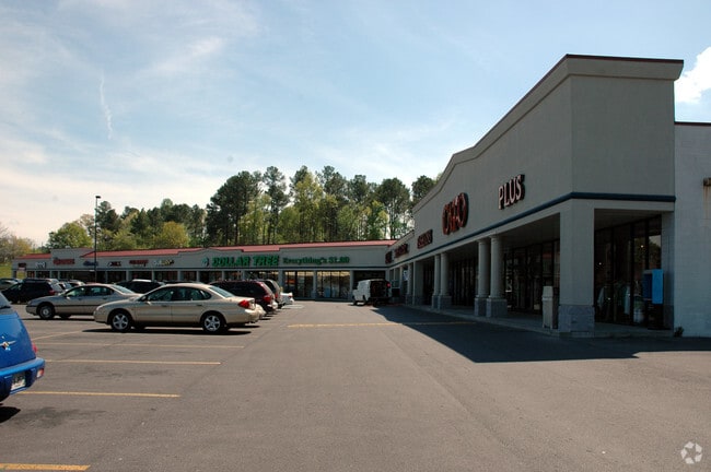
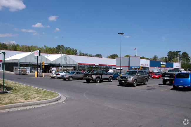
Property Record
2535 E Walnut Ave, Dalton, GA 30721

Property Detail
2535 E Walnut Ave
12-242-01-043
PT LTS 176T183ETAL( WALMART )
Stripcommercialcenter
Whitfield
C2
Georgia
B and X Area of moderate flood hazard, usually the area between the limits of the 100-year and 500-year floods.
176t18
2025
5.01 AC
2025
Georgia Northwest
001000
Other Market Areas
28,556 SF
Dalton, GA
NEARBY LISTINGS FOR SALE OR LEASE
DEMOGRAPHICS near 2535 E Walnut Ave
1 mile
3 mile
5 mile
2024 Total Population
5,711
32,722
64,924
2029 Population
5,873
33,587
66,515
Pop Growth 2024-2029
+ 2.84%
+ 2.64%
+ 2.45%
Average Age
35
36
38
2024 Total Households
1,780
10,835
22,391
HH Growth 2024-2029
+ 2.87%
+ 2.71%
+ 2.52%
Median Household Inc
$48,987
$49,438
$56,111
Avg Household Size
3.10
2.90
2.80
2024 Avg HH Vehicles
2.00
2.00
2.00
Median Home Value
$165,565
$190,223
$225,487
Median Year Built
1981
1983
1983
Nearby Places
Map Layers
Map Styles
 Street
 Aerial
Transit
 Traffic
 Biking
Places
Listings with unknown addresses are not visible on the map
- Restaurants
- Banks
- Shops
- Fitness
- Groceries
PUBLIC TRANSPORTATION
AIRPORT
Lovell Field
Drive
Walk
Distance
Lovell Field
44 min
31.7 mi
Freight Ports
Georgia Ports - Savannah
Drive
Walk
Distance
Georgia Ports - Savannah
381 min
339.3 mi
SALE & LEASE HISTORY
LISTING DATE
SALE/LEASE

Sep 25, 2016
For Lease
Nearby Properties
Address
Land Use
TOTAL SIZE
Lot Size
Zoning
Address
Land Use
TOTAL SIZE
Lot Size
Zoning
199,398 SF
37.16 AC
Address
Land Use
TOTAL SIZE
Lot Size
Zoning
784,920 SF
56.60 AC
M-2
Address
Land Use
TOTAL SIZE
Lot Size
Zoning
346,476 SF
31.41 AC
Address
Land Use
TOTAL SIZE
Lot Size
Zoning
193,716 SF
29.23 AC
Address
Land Use
TOTAL SIZE
Lot Size
Zoning
195,990 SF
60.25 AC
Address
Land Use
TOTAL SIZE
Lot Size
Zoning
664,020 SF
28.75 AC
M-2
Address
Land Use
TOTAL SIZE
Lot Size
Zoning
100,084 SF
1.47 AC
Address
Land Use
TOTAL SIZE
Lot Size
Zoning
760,961 SF
24.63 AC
M2
Address
Land Use
TOTAL SIZE
Lot Size
Zoning
125,756 SF
7 AC
Address
Land Use
TOTAL SIZE
Lot Size
Zoning
29,434 SF
6.36 AC
Address
Land Use
TOTAL SIZE
Lot Size
Zoning
84,200 SF
22.70 AC
Address
Land Use
TOTAL SIZE
Lot Size
Zoning
391,865 SF
17.51 AC
Address
Land Use
TOTAL SIZE
Lot Size
Zoning
184,747 SF
87.57 AC
Address
Land Use
TOTAL SIZE
Lot Size
Zoning
18,016 SF
27.65 AC
M-2
Address
Land Use
TOTAL SIZE
Lot Size
Zoning
38,016 SF
18 AC
Address
Land Use
TOTAL SIZE
Lot Size
Zoning
1,125,548 SF
24.22 AC
M2
Address
Land Use
TOTAL SIZE
Lot Size
Zoning
127,376 SF
5.64 AC
Address
Land Use
TOTAL SIZE
Lot Size
Zoning
283,000 SF
29.32 AC
Address
Land Use
TOTAL SIZE
Lot Size
Zoning
211,512 SF
3.60 AC
M2
Address
Land Use
TOTAL SIZE
Lot Size
Zoning
3,638 SF
117.55 AC
Address
Land Use
TOTAL SIZE
Lot Size
Zoning
193,500 SF
10.95 AC
M-2
Address
Land Use
TOTAL SIZE
Lot Size
Zoning
55,584 SF
21.34 AC
Address
Land Use
TOTAL SIZE
Lot Size
Zoning
541,013 SF
21.88 AC
Address
Land Use
TOTAL SIZE
Lot Size
Zoning
151,722 SF
15.17 AC
C2
Address
Land Use
TOTAL SIZE
Lot Size
Zoning
243,100 SF
27.04 AC
M2
Address
Land Use
TOTAL SIZE
Lot Size
Zoning
95,840 SF
80.46 AC
Address
Land Use
TOTAL SIZE
Lot Size
Zoning
200,586 SF
18.37 AC
C2
Address
Land Use
TOTAL SIZE
Lot Size
Zoning
234,696 SF
41.91 AC
Address
Land Use
TOTAL SIZE
Lot Size
Zoning
45,896 SF
2.22 AC
Address
Land Use
TOTAL SIZE
Lot Size
Zoning
72,430 SF
7.88 AC
The World's #1 Commercial Real Estate Marketplace
Connect with us
© 2026 CoStar Group
The information above has been obtained from sources believed reliable. While we do not doubt its accuracy we have not verified it and make no guarantee, warranty or representation about it. It is your responsibility to independently confirm its accuracy and completeness. Any projections, opinions, assumptions, or estimates used are for example only and do not represent the current or future performance of the property. The value of this transaction to you depends on tax and other factors which should be evaluated by your tax, financial, and legal advisors. You and your advisors should conduct a careful, independent investigation of the property to determine to your satisfaction the suitability of the property for your needs.