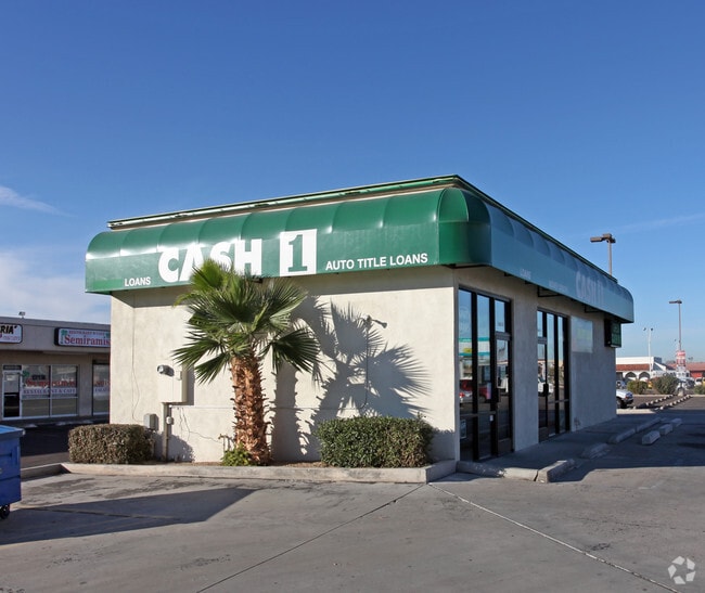
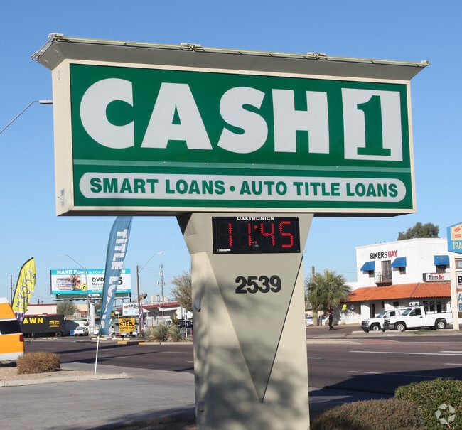
Property Record
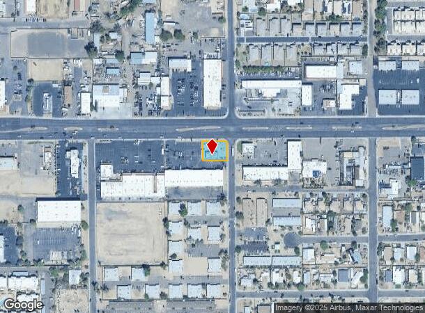
2539 E Bell Rd, Phoenix, AZ 85032
Current Lease Availabilities
NEARBY LISTINGS FOR SALE OR LEASE
Property Detail
2539 E Bell Rd
Phoenix-Mesa-Chandler, AZ
Kay Acres 2 Lots 1-14, 19-22 Blks A, B,
214-26-001B
KAY ACRES 2 LOTS 1-14, 19-22 BLKS A, B, C & D MCR 38/33
Storebuilding
Maricopa
X
Arizona
04013C1295M
1
2025
0.22 AC
2025
East Phoenix
103305
Phoenix
1,114 SF
DEMOGRAPHICS near 2539 E Bell Rd
1 Mile
3 Mile
5 Mile
2024 Total Population
25,602
140,246
292,581
2029 Population
27,547
150,969
316,226
Pop Growth 2024-2029
+ 7.60%
+ 7.65%
+ 8.08%
Average Age
36
39
40
2024 Total Households
9,570
57,670
120,303
HH Growth 2024-2029
+ 7.67%
+ 7.74%
+ 8.23%
Median Household Inc
$55,538
$71,766
$78,911
Avg Household Size
2.60
2.40
2.40
2024 Avg HH Vehicles
2.00
2.00
2.00
Median Home Value
$271,999
$370,285
$415,588
Median Year Built
1986
1986
1986
Nearby Places
Map Layers
Map Styles
 Street
 Aerial
- Restaurants
- Banks
- Shops
- Fitness
- Groceries
PUBLIC TRANSPORTATION
AIRPORT
Phoenix Sky Harbor International
DRIVE
WALK
Distance
Phoenix Sky Harbor International
28 min
18.8 mi
Phoenix-Mesa Gateway
DRIVE
WALK
Distance
Phoenix-Mesa Gateway
62 min
45.9 mi
Nearby Properties
Address
Land Use
TOTAL SIZE
Lot Size
Zoning
Address
Land Use
TOTAL SIZE
Lot Size
Zoning
281,880 SF
14.13 AC
Address
Land Use
TOTAL SIZE
Lot Size
Zoning
128,046 SF
9.97 AC
C2
Address
Land Use
TOTAL SIZE
Lot Size
Zoning
429,168 SF
9.52 AC
R-8
Address
Land Use
TOTAL SIZE
Lot Size
Zoning
342,574 SF
85.69 AC
R-18
Address
Land Use
TOTAL SIZE
Lot Size
Zoning
1,089,213 SF
53.03 AC
R-3
Address
Land Use
TOTAL SIZE
Lot Size
Zoning
336,494 SF
55.06 AC
R-43AG
Address
Land Use
TOTAL SIZE
Lot Size
Zoning
359,170 SF
37.47 AC
R-14
Address
Land Use
TOTAL SIZE
Lot Size
Zoning
24,200 SF
2.15 AC
R-18
Address
Land Use
TOTAL SIZE
Lot Size
Zoning
482,581 SF
20.45 AC
C-C
Address
Land Use
TOTAL SIZE
Lot Size
Zoning
3.27 AC
C-C
Address
Land Use
TOTAL SIZE
Lot Size
Zoning
338,640 SF
10.39 AC
R-4A
Address
Land Use
TOTAL SIZE
Lot Size
Zoning
336,529 SF
11.23 AC
R4A
Address
Land Use
TOTAL SIZE
Lot Size
Zoning
211,239 SF
12.33 AC
M-M
Address
Land Use
TOTAL SIZE
Lot Size
Zoning
105,406 SF
22.69 AC
R-18
Address
Land Use
TOTAL SIZE
Lot Size
Zoning
28,805 SF
2.67 AC
C-C
Address
Land Use
TOTAL SIZE
Lot Size
Zoning
345,339 SF
17.01 AC
M-H
Address
Land Use
TOTAL SIZE
Lot Size
Zoning
316,766 SF
13.32 AC
M-H
Address
Land Use
TOTAL SIZE
Lot Size
Zoning
358,670 SF
18.14 AC
M-H
Address
Land Use
TOTAL SIZE
Lot Size
Zoning
127,252 SF
0.89 AC
C-C
Address
Land Use
TOTAL SIZE
Lot Size
Zoning
305,811 SF
10.44 AC
M-H
Address
Land Use
TOTAL SIZE
Lot Size
Zoning
135,939 SF
19.35 AC
R1-8
Address
Land Use
TOTAL SIZE
Lot Size
Zoning
205,996 SF
20.50 AC
PAD-MD
Address
Land Use
TOTAL SIZE
Lot Size
Zoning
113,611 SF
1.43 AC
C-C
Address
Land Use
TOTAL SIZE
Lot Size
Zoning
120,494 SF
11.17 AC
C-C
Address
Land Use
TOTAL SIZE
Lot Size
Zoning
115,983 SF
4.85 AC
R-14
Address
Land Use
TOTAL SIZE
Lot Size
Zoning
286,650 SF
13.89 AC
M-L
Address
Land Use
TOTAL SIZE
Lot Size
Zoning
631 SF
83.59 AC
R-43AG
Address
Land Use
TOTAL SIZE
Lot Size
Zoning
149,760 SF
16.13 AC
C-C
Address
Land Use
TOTAL SIZE
Lot Size
Zoning
362,106 SF
15.60 AC
M-H
Address
Land Use
TOTAL SIZE
Lot Size
Zoning
229,447 SF
23.43 AC
The World's #1 Commercial Real Estate Marketplace
Connect with us
© 2026 CoStar Group
The information above has been obtained from sources believed reliable. While we do not doubt its accuracy we have not verified it and make no guarantee, warranty or representation about it. It is your responsibility to independently confirm its accuracy and completeness. Any projections, opinions, assumptions, or estimates used are for example only and do not represent the current or future performance of the property. The value of this transaction to you depends on tax and other factors which should be evaluated by your tax, financial, and legal advisors. You and your advisors should conduct a careful, independent investigation of the property to determine to your satisfaction the suitability of the property for your needs.