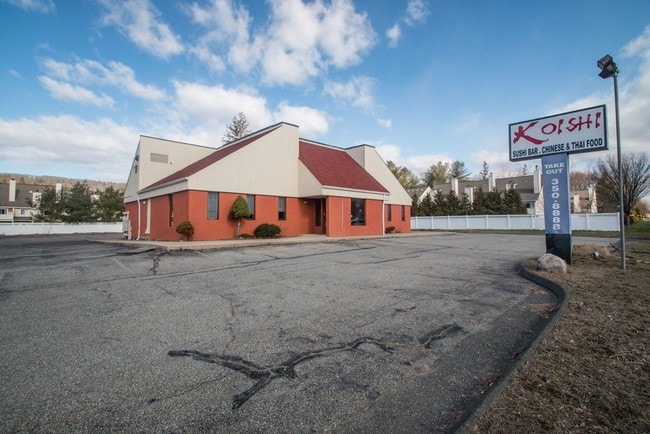
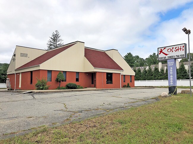
Property Record
254 Danbury Rd, New Milford, CT 06776
NEARBY LISTINGS FOR SALE OR LEASE
Property Detail
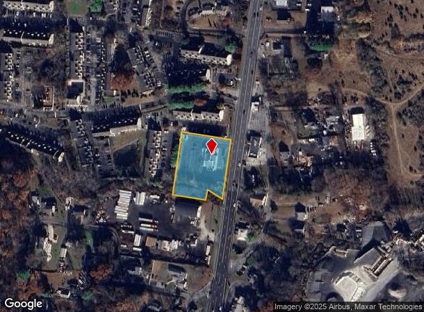
254 Danbury Rd
Torrington, CT
Litchfield
NMIL-000014-000003-000066
Connecticut
Commercialbuilding
66
2025
1.10 AC
2025
New Milford/SW Litchfield
425700
Hartford
4,460 SF
DEMOGRAPHICS near 254 Danbury Rd
1 Mile
3 Mile
5 Mile
2024 Total Population
3,277
15,785
37,750
2029 Population
3,316
15,884
38,082
Pop Growth 2024-2029
+ 1.19%
+ 0.63%
+ 0.88%
Average Age
42
42
43
2024 Total Households
1,281
6,414
14,934
HH Growth 2024-2029
+ 1.25%
+ 0.61%
+ 0.88%
Median Household Inc
$93,780
$91,330
$100,366
Avg Household Size
2.50
2.40
2.50
2024 Avg HH Vehicles
2.00
2.00
2.00
Median Home Value
$334,749
$350,519
$386,418
Median Year Built
1975
1972
1972
Nearby Places
Map Layers
Map Styles
 Street
 Aerial
- Restaurants
- Banks
- Shops
- Fitness
- Groceries
SALE & LEASE HISTORY
LISTING DATE
SALE/LEASE

Sep 20, 2018
For Lease
Sep 09, 2019
For Sale
May 30, 2018
For Sale
Nearby Properties
Address
Land Use
TOTAL SIZE
Lot Size
Zoning
Address
Land Use
TOTAL SIZE
Lot Size
Zoning
45.66 AC
IC/R40
Address
Land Use
TOTAL SIZE
Lot Size
Zoning
6.13 AC
R8
Address
Land Use
TOTAL SIZE
Lot Size
Zoning
42.62 AC
B1/RI
Address
Land Use
TOTAL SIZE
Lot Size
Zoning
24.95 AC
R40/MR
Address
Land Use
TOTAL SIZE
Lot Size
Zoning
227,659 SF
21.89 AC
I
Address
Land Use
TOTAL SIZE
Lot Size
Zoning
59.87 AC
RI
Address
Land Use
TOTAL SIZE
Lot Size
Zoning
10.30 AC
B2
Address
Land Use
TOTAL SIZE
Lot Size
Zoning
77,492 SF
30.25 AC
Address
Land Use
TOTAL SIZE
Lot Size
Zoning
110,200 SF
4.96 AC
I-1 HO
Address
Land Use
TOTAL SIZE
Lot Size
Zoning
75,257 SF
16.70 AC
R40
Address
Land Use
TOTAL SIZE
Lot Size
Zoning
7.61 AC
BI
Address
Land Use
TOTAL SIZE
Lot Size
Zoning
70,343 SF
37 AC
R20
Address
Land Use
TOTAL SIZE
Lot Size
Zoning
73,075 SF
8.79 AC
B1
Address
Land Use
TOTAL SIZE
Lot Size
Zoning
22,345 SF
0.76 AC
VC
Address
Land Use
TOTAL SIZE
Lot Size
Zoning
4.01 AC
I-C
Address
Land Use
TOTAL SIZE
Lot Size
Zoning
25,450 SF
9.16 AC
I
Address
Land Use
TOTAL SIZE
Lot Size
Zoning
4.46 AC
RM
Address
Land Use
TOTAL SIZE
Lot Size
Zoning
6.09 AC
I
Address
Land Use
TOTAL SIZE
Lot Size
Zoning
43,828 SF
1.29 AC
R8
Address
Land Use
TOTAL SIZE
Lot Size
Zoning
73,510 SF
16.94 AC
RI
Address
Land Use
TOTAL SIZE
Lot Size
Zoning
6.90 AC
B1
Address
Land Use
TOTAL SIZE
Lot Size
Zoning
2,811 SF
2 AC
MR
Address
Land Use
TOTAL SIZE
Lot Size
Zoning
20.20 AC
RR4
Address
Land Use
TOTAL SIZE
Lot Size
Zoning
12,916 SF
1.86 AC
B1
Address
Land Use
TOTAL SIZE
Lot Size
Zoning
5.46 AC
B1
Address
Land Use
TOTAL SIZE
Lot Size
Zoning
14 AC
B1
Address
Land Use
TOTAL SIZE
Lot Size
Zoning
45,942 SF
3.17 AC
B1
Address
Land Use
TOTAL SIZE
Lot Size
Zoning
72,592 SF
7.89 AC
IC
Address
Land Use
TOTAL SIZE
Lot Size
Zoning
3,062 SF
51.33 AC
I-C/R4
Address
Land Use
TOTAL SIZE
Lot Size
Zoning
4.06 AC
I
The World's #1 Commercial Real Estate Marketplace
Connect with us
© 2025 CoStar Group
The information above has been obtained from sources believed reliable. While we do not doubt its accuracy we have not verified it and make no guarantee, warranty or representation about it. It is your responsibility to independently confirm its accuracy and completeness. Any projections, opinions, assumptions, or estimates used are for example only and do not represent the current or future performance of the property. The value of this transaction to you depends on tax and other factors which should be evaluated by your tax, financial, and legal advisors. You and your advisors should conduct a careful, independent investigation of the property to determine to your satisfaction the suitability of the property for your needs.