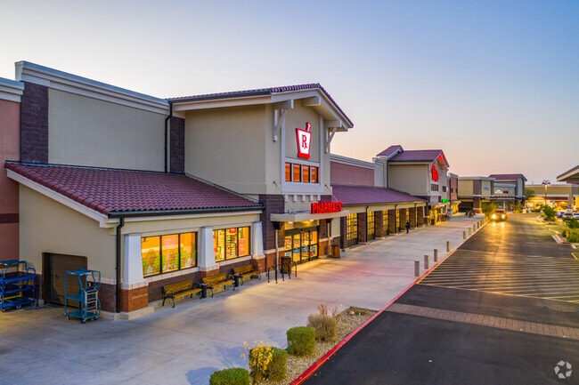
Property Record
25401 N Lake Pleasant Pky, Peoria, AZ 85383

NEARBY LISTINGS FOR SALE OR LEASE
Property Detail
25401 N Lake Pleasant Pky
Phoenix-Mesa-Chandler, AZ
Lake Pleasant Crossing Amd
201-08-395
LAKE PLEASANT CROSSING AMD MCR 1335-04
Regionalshoppingcenterormallwithanchorstore
Maricopa
X
Arizona
04013C1235L
1a
2025
18.75 AC
2025
Surprise/North Peoria
610901
Phoenix
122,780 SF
DEMOGRAPHICS near 25401 N Lake Pleasant Pky
1 Mile
3 Mile
5 Mile
2024 Total Population
4,866
50,884
155,079
2029 Population
5,311
55,240
168,532
Pop Growth 2024-2029
+ 9.15%
+ 8.56%
+ 8.67%
Average Age
38
38
43
2024 Total Households
1,588
16,129
58,038
HH Growth 2024-2029
+ 9.26%
+ 8.60%
+ 8.83%
Median Household Inc
$133,722
$128,870
$104,379
Avg Household Size
3.10
3.10
2.60
2024 Avg HH Vehicles
2.00
2.00
2.00
Median Home Value
$647,578
$482,266
$430,022
Median Year Built
2010
2006
2000
Nearby Places
Map Layers
Map Styles
 Street
 Aerial
- Restaurants
- Banks
- Shops
- Fitness
- Groceries
PUBLIC TRANSPORTATION
AIRPORT
Phoenix Sky Harbor International
DRIVE
WALK
Distance
Phoenix Sky Harbor International
52 min
34.9 mi
Freight Ports
Port of San Diego
DRIVE
WALK
Distance
Port of San Diego
401 min
358.4 mi
Nearby Properties
Address
Land Use
TOTAL SIZE
Lot Size
Zoning
Address
Land Use
TOTAL SIZE
Lot Size
Zoning
248,777 SF
51.46 AC
AG
Address
Land Use
TOTAL SIZE
Lot Size
Zoning
192,849 SF
19.09 AC
R3
Address
Land Use
TOTAL SIZE
Lot Size
Zoning
394,394 SF
15.24 AC
PAD
Address
Land Use
TOTAL SIZE
Lot Size
Zoning
103,384 SF
15.25 AC
PAD
Address
Land Use
TOTAL SIZE
Lot Size
Zoning
112,300 SF
13.72 AC
PAD
Address
Land Use
TOTAL SIZE
Lot Size
Zoning
96,045 SF
13.69 AC
PAD
Address
Land Use
TOTAL SIZE
Lot Size
Zoning
113,189 SF
15 AC
R-6
Address
Land Use
TOTAL SIZE
Lot Size
Zoning
217,564 SF
22.91 AC
PAD
Address
Land Use
TOTAL SIZE
Lot Size
Zoning
123,090 SF
11.22 AC
PAD
Address
Land Use
TOTAL SIZE
Lot Size
Zoning
139,095 SF
13.67 AC
PAD
Address
Land Use
TOTAL SIZE
Lot Size
Zoning
78,822 SF
8.14 AC
AG
Address
Land Use
TOTAL SIZE
Lot Size
Zoning
179,107 SF
15.29 AC
PAD
Address
Land Use
TOTAL SIZE
Lot Size
Zoning
61,914 SF
8.10 AC
PAD
Address
Land Use
TOTAL SIZE
Lot Size
Zoning
98,090 SF
7.26 AC
PAD
Address
Land Use
TOTAL SIZE
Lot Size
Zoning
43,185 SF
4.68 AC
PAD
Address
Land Use
TOTAL SIZE
Lot Size
Zoning
78,091 SF
8.46 AC
PAD
Address
Land Use
TOTAL SIZE
Lot Size
Zoning
21,920 SF
12.22 AC
PAD
Address
Land Use
TOTAL SIZE
Lot Size
Zoning
114,700 SF
11.91 AC
PAD
Address
Land Use
TOTAL SIZE
Lot Size
Zoning
118,893 SF
5.07 AC
C3
Address
Land Use
TOTAL SIZE
Lot Size
Zoning
51,962 SF
7.05 AC
R-43
Address
Land Use
TOTAL SIZE
Lot Size
Zoning
88,357 SF
7.99 AC
PAD
Address
Land Use
TOTAL SIZE
Lot Size
Zoning
80,483 SF
6.31 AC
PAD
Address
Land Use
TOTAL SIZE
Lot Size
Zoning
60,166 SF
7.27 AC
C-C
Address
Land Use
TOTAL SIZE
Lot Size
Zoning
59,760 SF
5.17 AC
PAD
Address
Land Use
TOTAL SIZE
Lot Size
Zoning
1,522 SF
20.43 AC
C2
Address
Land Use
TOTAL SIZE
Lot Size
Zoning
39,828 SF
4.09 AC
PAD
Address
Land Use
TOTAL SIZE
Lot Size
Zoning
5.12 AC
PAD
Address
Land Use
TOTAL SIZE
Lot Size
Zoning
33,539 SF
6.28 AC
PAD
The World's #1 Commercial Real Estate Marketplace
Connect with us
© 2026 CoStar Group
The information above has been obtained from sources believed reliable. While we do not doubt its accuracy we have not verified it and make no guarantee, warranty or representation about it. It is your responsibility to independently confirm its accuracy and completeness. Any projections, opinions, assumptions, or estimates used are for example only and do not represent the current or future performance of the property. The value of this transaction to you depends on tax and other factors which should be evaluated by your tax, financial, and legal advisors. You and your advisors should conduct a careful, independent investigation of the property to determine to your satisfaction the suitability of the property for your needs.