Property Record
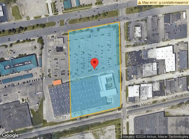
25451 Michigan Ave, Dearborn Heights, MI 48125


NEARBY LISTINGS FOR SALE OR LEASE
Property Detail
25451 Michigan Ave
Detroit-Warren-Dearborn, MI
Dearborn Grove
33-037-01-0134-309
134A1A2 134A1A3 134A1B PT OF LOT 134 DESC AS BEG AT THE NW COR OF SAID LOT 134; TH N 79D 44M 40S E 54.62 FT TH S 01D 32M 48S
Wholesaleoutletdiscountstore
Wayne
X
Michigan
26163C0241E
134
2025
1.78 AC
2025
Dearborn
572400
Detroit
149,828 SF
DEMOGRAPHICS near 25451 Michigan Ave
1 Mile
3 Mile
5 Mile
2024 Total Population
11,121
116,968
285,113
2029 Population
10,687
112,778
274,906
Pop Growth 2024-2029
(3.90%)
(3.58%)
(3.58%)
Average Age
39
39
39
2024 Total Households
4,457
44,723
111,002
HH Growth 2024-2029
(3.93%)
(3.60%)
(3.62%)
Median Household Inc
$61,135
$61,392
$59,765
Avg Household Size
2.50
2.60
2.50
2024 Avg HH Vehicles
2.00
2.00
2.00
Median Home Value
$169,887
$163,815
$152,252
Median Year Built
1955
1955
1956
Nearby Places
Map Layers
Map Styles
 Street
 Aerial
- Restaurants
- Banks
- Shops
- Fitness
- Groceries
PUBLIC TRANSPORTATION
COMMUTER RAIL
Dearborn (Wolverine - Amtrak)
DRIVE
WALK
Distance
Dearborn (Wolverine - Amtrak)
7 min
2.9 mi
AIRPORT
Detroit Metro Wayne County
DRIVE
WALK
Distance
Detroit Metro Wayne County
21 min
10.1 mi
Windsor International
DRIVE
WALK
Distance
Windsor International
47 min
24.1 mi
Freight Ports
Port of Toledo
DRIVE
WALK
Distance
Port of Toledo
73 min
54.6 mi
Nearby Properties
Address
Land Use
TOTAL SIZE
Lot Size
Zoning
Address
Land Use
TOTAL SIZE
Lot Size
Zoning
5,597,761 SF
73.85 AC
IB
Address
Land Use
TOTAL SIZE
Lot Size
Zoning
373,209 SF
349 AC
IC
Address
Land Use
TOTAL SIZE
Lot Size
Zoning
675,440 SF
66.32 AC
IB
Address
Land Use
TOTAL SIZE
Lot Size
Zoning
1,209,711 SF
69.44 AC
IB
Address
Land Use
TOTAL SIZE
Lot Size
Zoning
590,893 SF
51.81 AC
IB
Address
Land Use
TOTAL SIZE
Lot Size
Zoning
349,045 SF
40.28 AC
IB
Address
Land Use
TOTAL SIZE
Lot Size
Zoning
Address
Land Use
TOTAL SIZE
Lot Size
Zoning
126,712 SF
4.52 AC
BC
Address
Land Use
TOTAL SIZE
Lot Size
Zoning
463,642 SF
22.82 AC
Address
Land Use
TOTAL SIZE
Lot Size
Zoning
247,588 SF
4.12 AC
RE
Address
Land Use
TOTAL SIZE
Lot Size
Zoning
240,425 SF
6.39 AC
IB
Address
Land Use
TOTAL SIZE
Lot Size
Zoning
328,480 SF
11.54 AC
IA
Address
Land Use
TOTAL SIZE
Lot Size
Zoning
84,333 SF
1.15 AC
BC
Address
Land Use
TOTAL SIZE
Lot Size
Zoning
107,680 SF
7.46 AC
BC
Address
Land Use
TOTAL SIZE
Lot Size
Zoning
674,676 SF
17.30 AC
IB
Address
Land Use
TOTAL SIZE
Lot Size
Zoning
415,606 SF
18.75 AC
I-1
Address
Land Use
TOTAL SIZE
Lot Size
Zoning
63,706 SF
0.96 AC
BC
Address
Land Use
TOTAL SIZE
Lot Size
Zoning
240,819 SF
8.96 AC
I-1
Address
Land Use
TOTAL SIZE
Lot Size
Zoning
Address
Land Use
TOTAL SIZE
Lot Size
Zoning
58,958 SF
2.15 AC
BC
Address
Land Use
TOTAL SIZE
Lot Size
Zoning
127,017 SF
6.91 AC
Address
Land Use
TOTAL SIZE
Lot Size
Zoning
94,353 SF
8.70 AC
BC
Address
Land Use
TOTAL SIZE
Lot Size
Zoning
57,345 SF
0.73 AC
BC
Address
Land Use
TOTAL SIZE
Lot Size
Zoning
176,883 SF
10.83 AC
Address
Land Use
TOTAL SIZE
Lot Size
Zoning
110,117 SF
5.85 AC
RE
Address
Land Use
TOTAL SIZE
Lot Size
Zoning
93,425 SF
7.75 AC
Address
Land Use
TOTAL SIZE
Lot Size
Zoning
88,769 SF
0.91 AC
IB
Address
Land Use
TOTAL SIZE
Lot Size
Zoning
171,414 SF
23.57 AC
Address
Land Use
TOTAL SIZE
Lot Size
Zoning
240,100 SF
4.09 AC
OS
Address
Land Use
TOTAL SIZE
Lot Size
Zoning
53,263 SF
2.80 AC
The World's #1 Commercial Real Estate Marketplace
Connect with us
© 2026 CoStar Group
The information above has been obtained from sources believed reliable. While we do not doubt its accuracy we have not verified it and make no guarantee, warranty or representation about it. It is your responsibility to independently confirm its accuracy and completeness. Any projections, opinions, assumptions, or estimates used are for example only and do not represent the current or future performance of the property. The value of this transaction to you depends on tax and other factors which should be evaluated by your tax, financial, and legal advisors. You and your advisors should conduct a careful, independent investigation of the property to determine to your satisfaction the suitability of the property for your needs.