Property Record
25459 Howell Point Rd, Betterton, MD 21610

Property Detail
25459 Howell Point Rd
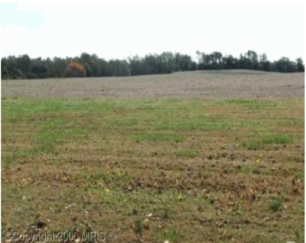
Agriculturalland
121 AC S/S HOWELL POINT RD BETTERTON
R 1
KENT
B and X Area of moderate flood hazard, usually the area between the limits of the 100-year and 500-year floods.
Maryland
2025
121 AC
2025
Kent County
950200
Baltimore
2,620 SF
03-022404
NEARBY LISTINGS FOR SALE OR LEASE
-
-
View all Betterton listings for sale on LoopNet.com
DEMOGRAPHICS near 25459 Howell Point Rd
1 mile
3 mile
5 mile
2025 Total Population
329
945
2,407
2030 Population
338
974
2,509
Pop Growth 2025-2030
+ 2.74%
+ 3.07%
+ 4.24%
Average Age
50
49
48
2025 Total Households
152
424
1,036
HH Growth 2025-2030
+ 2.63%
+ 3.07%
+ 4.25%
Median Household Inc
$65,735
$70,146
$83,152
Avg Household Size
2.10
2.20
2.20
2025 Avg HH Vehicles
2.00
2.00
2.00
Median Home Value
$363,749
$359,574
$353,846
Median Year Built
1979
1976
1979
Nearby Places
Map Layers
Map Styles
 Street
 Aerial
Layers
 Traffic
 Biking
Places
Listings with unknown addresses are not visible on the map
- Restaurants
- Banks
- Shops
- Fitness
- Groceries
Nearby Properties
Address
Land Use
TOTAL SIZE
Lot Size
Zoning
Address
Land Use
TOTAL SIZE
Lot Size
Zoning
2,860 SF
100 AC
RCD
Address
Land Use
TOTAL SIZE
Lot Size
Zoning
951 SF
4.79 AC
C-1
Address
Land Use
TOTAL SIZE
Lot Size
Zoning
672 SF
15.08 AC
RCDR2
Address
Land Use
TOTAL SIZE
Lot Size
Zoning
19,829 SF
2.06 AC
B-1
Address
Land Use
TOTAL SIZE
Lot Size
Zoning
5,800 SF
1.54 AC
Address
Land Use
TOTAL SIZE
Lot Size
Zoning
5.58 AC
RR
Address
Land Use
TOTAL SIZE
Lot Size
Zoning
5,384 SF
0.28 AC
R-3
Address
Land Use
TOTAL SIZE
Lot Size
Zoning
0.83 AC
RCD
Address
Land Use
TOTAL SIZE
Lot Size
Zoning
7,200 SF
0.34 AC
Address
Land Use
TOTAL SIZE
Lot Size
Zoning
330 SF
4 AC
Address
Land Use
TOTAL SIZE
Lot Size
Zoning
1,918 SF
0.51 AC
R-3
Address
Land Use
TOTAL SIZE
Lot Size
Zoning
6,826 SF
0.60 AC
R-3
Address
Land Use
TOTAL SIZE
Lot Size
Zoning
3,380 SF
0.68 AC
Address
Land Use
TOTAL SIZE
Lot Size
Zoning
1,288 SF
1.25 AC
V
Address
Land Use
TOTAL SIZE
Lot Size
Zoning
2.68 AC
RCD
Address
Land Use
TOTAL SIZE
Lot Size
Zoning
1,680 SF
0.37 AC
C-1
Address
Land Use
TOTAL SIZE
Lot Size
Zoning
0.82 AC
C-1
Address
Land Use
TOTAL SIZE
Lot Size
Zoning
780 SF
0.30 AC
Address
Land Use
TOTAL SIZE
Lot Size
Zoning
50 AC
RCD
Address
Land Use
TOTAL SIZE
Lot Size
Zoning
3,684 SF
0.25 AC
R-3
Address
Land Use
TOTAL SIZE
Lot Size
Zoning
2.37 AC
AZDRC
Address
Land Use
TOTAL SIZE
Lot Size
Zoning
2.33 AC
AZDRC
Address
Land Use
TOTAL SIZE
Lot Size
Zoning
2,603 SF
118.50 AC
AZD
Address
Land Use
TOTAL SIZE
Lot Size
Zoning
2 AC
RCD
Address
Land Use
TOTAL SIZE
Lot Size
Zoning
1,400 SF
1.85 AC
V
Address
Land Use
TOTAL SIZE
Lot Size
Zoning
1.52 AC
RR
Address
Land Use
TOTAL SIZE
Lot Size
Zoning
1.45 AC
R3
Address
Land Use
TOTAL SIZE
Lot Size
Zoning
2,880 SF
0.47 AC
R-3
Address
Land Use
TOTAL SIZE
Lot Size
Zoning
3,528 SF
1.85 AC
Address
Land Use
TOTAL SIZE
Lot Size
Zoning
The World's #1 Commercial Real Estate Marketplace
Connect with us
© 2026 CoStar Group
The information above has been obtained from sources believed reliable. While we do not doubt its accuracy we have not verified it and make no guarantee, warranty or representation about it. It is your responsibility to independently confirm its accuracy and completeness. Any projections, opinions, assumptions, or estimates used are for example only and do not represent the current or future performance of the property. The value of this transaction to you depends on tax and other factors which should be evaluated by your tax, financial, and legal advisors. You and your advisors should conduct a careful, independent investigation of the property to determine to your satisfaction the suitability of the property for your needs.