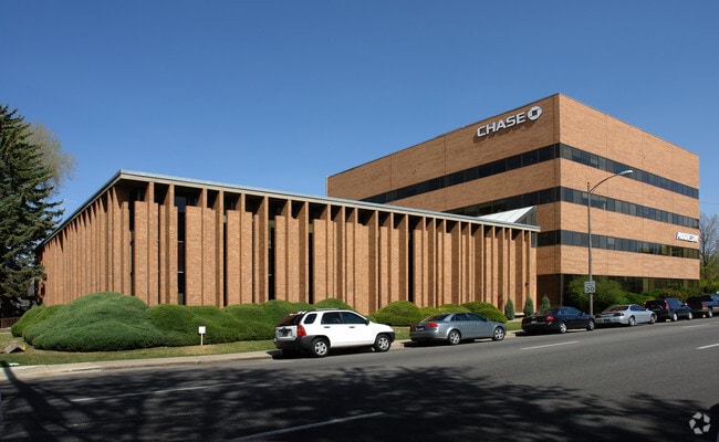
Property Record
255 E 6Th St, Loveland, CO 80537
Current Lease Availabilities
NEARBY LISTINGS FOR SALE OR LEASE
Property Detail
255 E 6Th St
Fort Collins-Loveland, CO
Lov Blk 7
95133-18-001
ALL OF BLK 7 EX LOTS 13 THRU 16, LOV; ALSO POR OF VACATED ALLEY PER BK 1712 PG 733
Officebuilding
Larimer
X
Colorado
08069C1189F
13-16
2024
1.72 AC
2025
Fort Collins/Loveland
002007
Denver
72,686 SF
DEMOGRAPHICS near 255 E 6Th St
1 mile
3 mile
5 mile
2024 Total Population
9,927
56,637
95,986
2029 Population
10,380
59,259
101,474
Pop Growth 2024-2029
+ 4.56%
+ 4.63%
+ 5.72%
Average Age
42
42
42
2024 Total Households
4,781
24,072
39,970
HH Growth 2024-2029
+ 4.79%
+ 4.89%
+ 5.97%
Median Household Inc
$64,310
$70,369
$78,168
Avg Household Size
2.00
2.30
2.40
2024 Avg HH Vehicles
2.00
2.00
2.00
Median Home Value
$359,830
$384,217
$434,692
Median Year Built
1957
1979
1992
Nearby Places
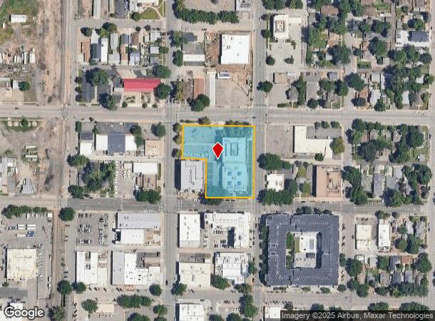
Map Layers
Map Styles
 Street
 Aerial
Transit
 Traffic
 Biking
Places
Listings with unknown addresses are not visible on the map
- Restaurants
- Banks
- Shops
- Fitness
- Groceries
Nearby Properties
Address
Land Use
TOTAL SIZE
Lot Size
Zoning
Address
Land Use
TOTAL SIZE
Lot Size
Zoning
218,000 SF
45.72 AC
R1
Address
Land Use
TOTAL SIZE
Lot Size
Zoning
366,684 SF
29.44 AC
R3
Address
Land Use
TOTAL SIZE
Lot Size
Zoning
201,500 SF
28.43 AC
R1E
Address
Land Use
TOTAL SIZE
Lot Size
Zoning
200,420 SF
41.52 AC
R1
Address
Land Use
TOTAL SIZE
Lot Size
Zoning
109,639 SF
8.49 AC
B
Address
Land Use
TOTAL SIZE
Lot Size
Zoning
147,663 SF
5.01 AC
R3E
Address
Land Use
TOTAL SIZE
Lot Size
Zoning
96,723 SF
9.16 AC
I
Address
Land Use
TOTAL SIZE
Lot Size
Zoning
115,599 SF
13.15 AC
P38
Address
Land Use
TOTAL SIZE
Lot Size
Zoning
125,566 SF
8.27 AC
R3E
Address
Land Use
TOTAL SIZE
Lot Size
Zoning
35,554 SF
7.69 AC
Address
Land Use
TOTAL SIZE
Lot Size
Zoning
137,225 SF
25.76 AC
R1
Address
Land Use
TOTAL SIZE
Lot Size
Zoning
205,804 SF
21.91 AC
P51
Address
Land Use
TOTAL SIZE
Lot Size
Zoning
82,749 SF
25.54 AC
R2
Address
Land Use
TOTAL SIZE
Lot Size
Zoning
64,309 SF
14.54 AC
Address
Land Use
TOTAL SIZE
Lot Size
Zoning
137,432 SF
12.89 AC
B
Address
Land Use
TOTAL SIZE
Lot Size
Zoning
196,188 SF
13.26 AC
C
Address
Land Use
TOTAL SIZE
Lot Size
Zoning
75,000 SF
2.96 AC
B
Address
Land Use
TOTAL SIZE
Lot Size
Zoning
296,360 SF
11.88 AC
B
Address
Land Use
TOTAL SIZE
Lot Size
Zoning
123,130 SF
4.17 AC
Address
Land Use
TOTAL SIZE
Lot Size
Zoning
165,709 SF
10.52 AC
Address
Land Use
TOTAL SIZE
Lot Size
Zoning
332,645 SF
14.16 AC
BUD
Address
Land Use
TOTAL SIZE
Lot Size
Zoning
83,954 SF
5.79 AC
FA
Address
Land Use
TOTAL SIZE
Lot Size
Zoning
269,696 SF
1.97 AC
Address
Land Use
TOTAL SIZE
Lot Size
Zoning
93,908 SF
28.86 AC
R1
Address
Land Use
TOTAL SIZE
Lot Size
Zoning
118,788 SF
14.01 AC
B
Address
Land Use
TOTAL SIZE
Lot Size
Zoning
137,950 SF
10.16 AC
Address
Land Use
TOTAL SIZE
Lot Size
Zoning
134,054 SF
14.45 AC
P59
Address
Land Use
TOTAL SIZE
Lot Size
Zoning
162,703 SF
14.92 AC
B
Address
Land Use
TOTAL SIZE
Lot Size
Zoning
90,060 SF
9.91 AC
P59
Address
Land Use
TOTAL SIZE
Lot Size
Zoning
48,952 SF
6.38 AC
FA
The World's #1 Commercial Real Estate Marketplace
Connect with us
© 2026 CoStar Group
The information above has been obtained from sources believed reliable. While we do not doubt its accuracy we have not verified it and make no guarantee, warranty or representation about it. It is your responsibility to independently confirm its accuracy and completeness. Any projections, opinions, assumptions, or estimates used are for example only and do not represent the current or future performance of the property. The value of this transaction to you depends on tax and other factors which should be evaluated by your tax, financial, and legal advisors. You and your advisors should conduct a careful, independent investigation of the property to determine to your satisfaction the suitability of the property for your needs.