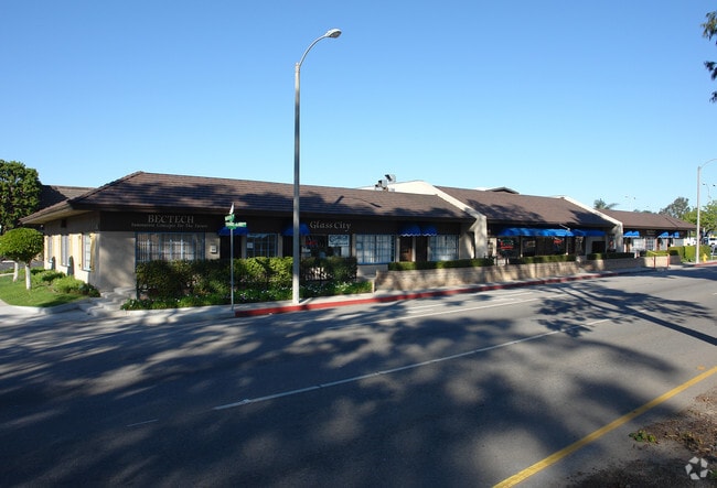
Property Record
255 E Channel Islands Blvd, Oxnard, CA 93033
Current Lease Availabilities
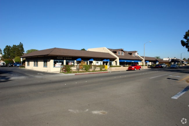
NEARBY LISTINGS FOR SALE OR LEASE
Property Detail
255 E Channel Islands Blvd
189-0-220-185
LOT: D REF: 011PM 099
Storebuilding
Ventura
X
California
06111C0912E
d
2024
0.71 AC
2025
Oxnard/Port Hueneme
004000
Los Angeles
9,618 SF
Oxnard-Thousand Oaks-Ventura, CA
DEMOGRAPHICS near 255 E Channel Islands Blvd
1 Mile
3 Mile
5 Mile
2024 Total Population
29,983
169,677
227,892
2029 Population
29,491
167,662
224,957
Pop Growth 2024-2029
(1.64%)
(1.19%)
(1.29%)
Average Age
37
37
37
2024 Total Households
7,364
46,193
62,925
HH Growth 2024-2029
(1.64%)
(0.89%)
(1.09%)
Median Household Inc
$78,808
$79,962
$83,115
Avg Household Size
3.70
3.50
3.40
2024 Avg HH Vehicles
2.00
2.00
2.00
Median Home Value
$488,189
$585,688
$603,722
Median Year Built
1967
1972
1975
Nearby Places
Map Layers
Map Styles
 Street
 Aerial
- Restaurants
- Banks
- Shops
- Fitness
- Groceries
PUBLIC TRANSPORTATION
COMMUTER RAIL
Oxnard (Ventura County Line - Southern California Regional Rail Authority (Metrolink))
DRIVE
WALK
Distance
Oxnard (Ventura County Line - Southern California Regional Rail Authority (Metrolink))
7 min
2.9 mi
DRIVE
WALK
Distance
13 min
7.4 mi
Freight Ports
The Port of Hueneme
DRIVE
WALK
Distance
The Port of Hueneme
5 min
2.1 mi
Nearby Properties
Address
Land Use
TOTAL SIZE
Lot Size
Zoning
Address
Land Use
TOTAL SIZE
Lot Size
Zoning
241,298 SF
8 AC
R3C
Address
Land Use
TOTAL SIZE
Lot Size
Zoning
90,086 SF
10.48 AC
CDI
Address
Land Use
TOTAL SIZE
Lot Size
Zoning
11.28 AC
CMPD
Address
Land Use
TOTAL SIZE
Lot Size
Zoning
166,920 SF
7.15 AC
R3PD
Address
Land Use
TOTAL SIZE
Lot Size
Zoning
158,736 SF
6.33 AC
Address
Land Use
TOTAL SIZE
Lot Size
Zoning
129,018 SF
5.09 AC
R3PD
Address
Land Use
TOTAL SIZE
Lot Size
Zoning
133,174 SF
5.94 AC
R3PD
Address
Land Use
TOTAL SIZE
Lot Size
Zoning
770 SF
9.80 AC
M1
Address
Land Use
TOTAL SIZE
Lot Size
Zoning
157,108 SF
21.40 AC
MULT
Address
Land Use
TOTAL SIZE
Lot Size
Zoning
20,349 SF
9.65 AC
C2
Address
Land Use
TOTAL SIZE
Lot Size
Zoning
7.95 AC
M2
Address
Land Use
TOTAL SIZE
Lot Size
Zoning
81,233 SF
3.29 AC
R3PD
Address
Land Use
TOTAL SIZE
Lot Size
Zoning
79,117 SF
3.25 AC
R3PD
Address
Land Use
TOTAL SIZE
Lot Size
Zoning
Address
Land Use
TOTAL SIZE
Lot Size
Zoning
94,375 SF
7.94 AC
Address
Land Use
TOTAL SIZE
Lot Size
Zoning
6,279 SF
5.53 AC
M2PD
Address
Land Use
TOTAL SIZE
Lot Size
Zoning
51,694 SF
2.75 AC
Address
Land Use
TOTAL SIZE
Lot Size
Zoning
1,800 SF
8.84 AC
M1
Address
Land Use
TOTAL SIZE
Lot Size
Zoning
14,931 SF
14.08 AC
Address
Land Use
TOTAL SIZE
Lot Size
Zoning
2,320 SF
12.02 AC
M1
Address
Land Use
TOTAL SIZE
Lot Size
Zoning
70,600 SF
3.75 AC
R3PD
Address
Land Use
TOTAL SIZE
Lot Size
Zoning
98,276 SF
14 AC
R3
Address
Land Use
TOTAL SIZE
Lot Size
Zoning
2,264 SF
13.03 AC
M1
Address
Land Use
TOTAL SIZE
Lot Size
Zoning
80,002 SF
3.16 AC
MLPD
Address
Land Use
TOTAL SIZE
Lot Size
Zoning
81,743 SF
3.38 AC
Address
Land Use
TOTAL SIZE
Lot Size
Zoning
79,556 SF
4.54 AC
Address
Land Use
TOTAL SIZE
Lot Size
Zoning
81,052 SF
11.23 AC
M1PD
Address
Land Use
TOTAL SIZE
Lot Size
Zoning
108,430 SF
5.90 AC
Address
Land Use
TOTAL SIZE
Lot Size
Zoning
48,720 SF
2.76 AC
R2PD
Address
Land Use
TOTAL SIZE
Lot Size
Zoning
56,230 SF
1.19 AC
The World's #1 Commercial Real Estate Marketplace
Connect with us
© 2026 CoStar Group
The information above has been obtained from sources believed reliable. While we do not doubt its accuracy we have not verified it and make no guarantee, warranty or representation about it. It is your responsibility to independently confirm its accuracy and completeness. Any projections, opinions, assumptions, or estimates used are for example only and do not represent the current or future performance of the property. The value of this transaction to you depends on tax and other factors which should be evaluated by your tax, financial, and legal advisors. You and your advisors should conduct a careful, independent investigation of the property to determine to your satisfaction the suitability of the property for your needs.