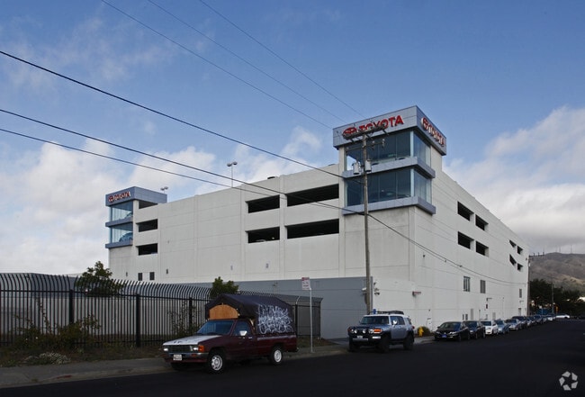
Property Record
255 San Pedro Rd, Daly City, CA 94014


NEARBY LISTINGS FOR SALE OR LEASE
Property Detail
255 San Pedro Rd
San Francisco-Redwood City-South San Francisco, CA
School House Hmstd Assn
006-363-100
3.61 AC MOL BEING LOT 4 & PTN OF LOTS 1 2 3 & 5 BLK 10 AND PTN OF HILL ST ABAND SCHOOL HOUSE HMSTD ASSN RSM 1/9 AND LOTS 4 5 6 9 10 & 11 AND PTN OF LOTS 3 & 8 BLK 1 CITY EXTENSION HMSTD PTN OF RSM D/44
Commercialnec
San Mateo
X
California
06081C0036F
4,1
2024
3.62 AC
2025
Brisbane/Daly City
601302
San Francisco
DEMOGRAPHICS near 255 San Pedro Rd
1 Mile
3 Mile
5 Mile
2024 Total Population
33,568
206,195
459,074
2029 Population
31,784
192,701
425,727
Pop Growth 2024-2029
(5.31%)
(6.54%)
(7.26%)
Average Age
42
43
43
2024 Total Households
10,026
65,115
152,094
HH Growth 2024-2029
(5.52%)
(6.66%)
(7.58%)
Median Household Inc
$97,576
$106,837
$119,603
Avg Household Size
3.20
3.00
2.90
2024 Avg HH Vehicles
2.00
2.00
2.00
Median Home Value
$991,670
$1,033,606
$1,074,322
Median Year Built
1968
1961
1956
Nearby Places
Map Layers
Map Styles
 Street
 Aerial
- Restaurants
- Banks
- Shops
- Fitness
- Groceries
PUBLIC TRANSPORTATION
TRANSIT/SUBWAY
Colma Station (Dublin/Pleasanton - Millbrae - Bay Area Rapid Transit (BART), Pittsburg/Bay Point - San Francisco International - Bay Area Rapid Transit (BART), Richmond - Millbrae - Bay Area Rapid Transit (BART))
DRIVE
WALK
Distance
Colma Station (Dublin/Pleasanton - Millbrae - Bay Area Rapid Transit (BART), Pittsburg/Bay Point - San Francisco International - Bay Area Rapid Transit (BART), Richmond - Millbrae - Bay Area Rapid Transit (BART))
1 min
6 min
0.3 mi
COMMUTER RAIL
South San Francisco (Caltrain - Caltrain (Caltrain), Express - Caltrain (Caltrain), Limited - Caltrain (Caltrain), Local Weekday - Caltrain (Caltrain), Local Weekend - Caltrain (Caltrain))
DRIVE
WALK
Distance
South San Francisco (Caltrain - Caltrain (Caltrain), Express - Caltrain (Caltrain), Limited - Caltrain (Caltrain), Local Weekday - Caltrain (Caltrain), Local Weekend - Caltrain (Caltrain))
10 min
5.6 mi
Bayshore Caltrain Station (Local - Caltrain (Caltrain), Local Weekday - Caltrain (Caltrain), Local Weekend - Caltrain (Caltrain))
DRIVE
WALK
Distance
Bayshore Caltrain Station (Local - Caltrain (Caltrain), Local Weekday - Caltrain (Caltrain), Local Weekend - Caltrain (Caltrain))
11 min
7.8 mi
AIRPORT
San Francisco International
DRIVE
WALK
Distance
San Francisco International
15 min
8.8 mi
Metro Oakland International
DRIVE
WALK
Distance
Metro Oakland International
40 min
28.4 mi
Freight Ports
Port of San Francisco
DRIVE
WALK
Distance
Port of San Francisco
16 min
11.0 mi
Nearby Properties
Address
Land Use
TOTAL SIZE
Lot Size
Zoning
Address
Land Use
TOTAL SIZE
Lot Size
Zoning
53.85 AC
Address
Land Use
TOTAL SIZE
Lot Size
Zoning
312,191 SF
2.74 AC
Address
Land Use
TOTAL SIZE
Lot Size
Zoning
167,105 SF
2.07 AC
C10000
Address
Land Use
TOTAL SIZE
Lot Size
Zoning
42.95 AC
Address
Land Use
TOTAL SIZE
Lot Size
Zoning
447,674 SF
21.51 AC
Address
Land Use
TOTAL SIZE
Lot Size
Zoning
178,110 SF
1.67 AC
Address
Land Use
TOTAL SIZE
Lot Size
Zoning
2.03 AC
C2
Address
Land Use
TOTAL SIZE
Lot Size
Zoning
Address
Land Use
TOTAL SIZE
Lot Size
Zoning
11.31 AC
RM2
Address
Land Use
TOTAL SIZE
Lot Size
Zoning
160,983 SF
1.84 AC
NC2
Address
Land Use
TOTAL SIZE
Lot Size
Zoning
10.62 AC
Address
Land Use
TOTAL SIZE
Lot Size
Zoning
Address
Land Use
TOTAL SIZE
Lot Size
Zoning
187,865 SF
3.54 AC
Address
Land Use
TOTAL SIZE
Lot Size
Zoning
209,692 SF
8.20 AC
R30000
Address
Land Use
TOTAL SIZE
Lot Size
Zoning
2,011 SF
2.49 AC
Address
Land Use
TOTAL SIZE
Lot Size
Zoning
73,491 SF
4.48 AC
C2
Address
Land Use
TOTAL SIZE
Lot Size
Zoning
175,618 SF
2.44 AC
Address
Land Use
TOTAL SIZE
Lot Size
Zoning
176,000 SF
1.64 AC
C2
Address
Land Use
TOTAL SIZE
Lot Size
Zoning
181,172 SF
2.11 AC
Address
Land Use
TOTAL SIZE
Lot Size
Zoning
108,917 SF
4.61 AC
PD0004
Address
Land Use
TOTAL SIZE
Lot Size
Zoning
153,054 SF
15.13 AC
Address
Land Use
TOTAL SIZE
Lot Size
Zoning
141,956 SF
1.74 AC
Address
Land Use
TOTAL SIZE
Lot Size
Zoning
73.91 AC
Address
Land Use
TOTAL SIZE
Lot Size
Zoning
128,506 SF
2.17 AC
Address
Land Use
TOTAL SIZE
Lot Size
Zoning
206.09 AC
Address
Land Use
TOTAL SIZE
Lot Size
Zoning
67,432 SF
4.55 AC
CL00C1
Address
Land Use
TOTAL SIZE
Lot Size
Zoning
113,136 SF
9.09 AC
G10000
Address
Land Use
TOTAL SIZE
Lot Size
Zoning
113,782 SF
2.90 AC
Address
Land Use
TOTAL SIZE
Lot Size
Zoning
6.80 AC
RM1
Address
Land Use
TOTAL SIZE
Lot Size
Zoning
257,754 SF
1.37 AC
The World's #1 Commercial Real Estate Marketplace
Connect with us
© 2025 CoStar Group
The information above has been obtained from sources believed reliable. While we do not doubt its accuracy we have not verified it and make no guarantee, warranty or representation about it. It is your responsibility to independently confirm its accuracy and completeness. Any projections, opinions, assumptions, or estimates used are for example only and do not represent the current or future performance of the property. The value of this transaction to you depends on tax and other factors which should be evaluated by your tax, financial, and legal advisors. You and your advisors should conduct a careful, independent investigation of the property to determine to your satisfaction the suitability of the property for your needs.