Property Record
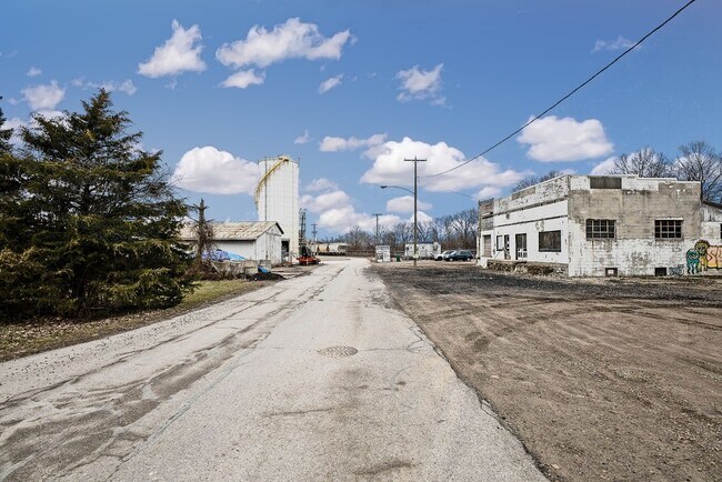
255 Walnut St, Blacklick, OH 43004


Property Detail
255 Walnut St
Columbus, OH
255 WALNUT ST TOWN OF SMITHVILLE LOT 11
170-000401
Franklin
Warehouse
Ohio
B and X Area of moderate flood hazard, usually the area between the limits of the 100-year and 500-year floods.
11
2024
0.18 AC
2025
East
007397
Columbus
4,224 SF
NEARBY LISTINGS FOR SALE OR LEASE
DEMOGRAPHICS near 255 Walnut St
1 mile
3 mile
5 mile
2025 Total Population
9,785
75,390
177,488
2030 Population
10,055
77,115
182,243
Pop Growth 2025-2030
+ 2.76%
+ 2.29%
+ 2.68%
Average Age
36
38
39
2025 Total Households
3,740
28,720
69,904
HH Growth 2025-2030
+ 2.99%
+ 2.41%
+ 2.78%
Median Household Inc
$94,033
$84,787
$75,032
Avg Household Size
2.60
2.60
2.50
2025 Avg HH Vehicles
2.00
2.00
2.00
Median Home Value
$330,924
$297,379
$291,134
Median Year Built
2001
1994
1987
Nearby Places
Map Layers
Map Styles
 Street
 Aerial
Layers
 Traffic
 Biking
Places
Listings with unknown addresses are not visible on the map
- Restaurants
- Banks
- Shops
- Fitness
- Groceries
PUBLIC TRANSPORTATION
AIRPORT
John Glenn Columbus International
Drive
Walk
Distance
John Glenn Columbus International
14 min
6.4 mi
Rickenbacker International
Drive
Walk
Distance
Rickenbacker International
28 min
17.0 mi
SALE & LEASE HISTORY
LISTING DATE
SALE/LEASE

Feb 19, 2020
For Sale
Nearby Properties
Address
Land Use
TOTAL SIZE
Lot Size
Zoning
Address
Land Use
TOTAL SIZE
Lot Size
Zoning
761,542 SF
21.30 AC
Address
Land Use
TOTAL SIZE
Lot Size
Zoning
208,472 SF
1.45 AC
Address
Land Use
TOTAL SIZE
Lot Size
Zoning
1,003,816 SF
75.60 AC
Address
Land Use
TOTAL SIZE
Lot Size
Zoning
978,491 SF
72.31 AC
Address
Land Use
TOTAL SIZE
Lot Size
Zoning
164,095 SF
33.71 AC
Address
Land Use
TOTAL SIZE
Lot Size
Zoning
147,649 SF
5.15 AC
Address
Land Use
TOTAL SIZE
Lot Size
Zoning
122,526 SF
27 AC
Address
Land Use
TOTAL SIZE
Lot Size
Zoning
514,341 SF
46.79 AC
Address
Land Use
TOTAL SIZE
Lot Size
Zoning
705,707 SF
107.11 AC
Address
Land Use
TOTAL SIZE
Lot Size
Zoning
48,912 SF
45.91 AC
Address
Land Use
TOTAL SIZE
Lot Size
Zoning
60,056 SF
0.22 AC
Address
Land Use
TOTAL SIZE
Lot Size
Zoning
137,136 SF
69.71 AC
Address
Land Use
TOTAL SIZE
Lot Size
Zoning
464,796 SF
7.33 AC
Address
Land Use
TOTAL SIZE
Lot Size
Zoning
166,628 SF
9.98 AC
Address
Land Use
TOTAL SIZE
Lot Size
Zoning
43,829 SF
27.86 AC
Address
Land Use
TOTAL SIZE
Lot Size
Zoning
171,366 SF
28.27 AC
Address
Land Use
TOTAL SIZE
Lot Size
Zoning
170,209 SF
15.03 AC
Address
Land Use
TOTAL SIZE
Lot Size
Zoning
15,850 SF
21.65 AC
Address
Land Use
TOTAL SIZE
Lot Size
Zoning
51,968 SF
22.80 AC
Address
Land Use
TOTAL SIZE
Lot Size
Zoning
82,450 SF
28.27 AC
Address
Land Use
TOTAL SIZE
Lot Size
Zoning
264,250 SF
10.31 AC
Address
Land Use
TOTAL SIZE
Lot Size
Zoning
511,125 SF
24.90 AC
Address
Land Use
TOTAL SIZE
Lot Size
Zoning
25,512 SF
18.89 AC
Address
Land Use
TOTAL SIZE
Lot Size
Zoning
176,140 SF
9.24 AC
Address
Land Use
TOTAL SIZE
Lot Size
Zoning
209,585 SF
24.94 AC
Address
Land Use
TOTAL SIZE
Lot Size
Zoning
105,542 SF
13.90 AC
Address
Land Use
TOTAL SIZE
Lot Size
Zoning
88,963 SF
14 AC
Address
Land Use
TOTAL SIZE
Lot Size
Zoning
95,576 SF
16 AC
Address
Land Use
TOTAL SIZE
Lot Size
Zoning
29,720 SF
0.23 AC
Address
Land Use
TOTAL SIZE
Lot Size
Zoning
55,327 SF
13.59 AC
The World's #1 Commercial Real Estate Marketplace
Connect with us
© 2026 CoStar Group
The information above has been obtained from sources believed reliable. While we do not doubt its accuracy we have not verified it and make no guarantee, warranty or representation about it. It is your responsibility to independently confirm its accuracy and completeness. Any projections, opinions, assumptions, or estimates used are for example only and do not represent the current or future performance of the property. The value of this transaction to you depends on tax and other factors which should be evaluated by your tax, financial, and legal advisors. You and your advisors should conduct a careful, independent investigation of the property to determine to your satisfaction the suitability of the property for your needs.