Property Record
255 Woodford Ave, Elyria, OH 44035

Property Detail
255 Woodford Ave
Cleveland-Elyria, OH
W OF R
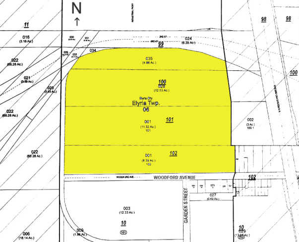
06-24-100-000-028
Lorain
Industrialgeneral
Ohio
B and X Area of moderate flood hazard, usually the area between the limits of the 100-year and 500-year floods.
102
2024
12.53 AC
2024
Lorain/Avon Lake
070600
Cleveland
60,140 SF
NEARBY LISTINGS FOR SALE OR LEASE
DEMOGRAPHICS near 255 Woodford Ave
1 mile
3 mile
5 mile
2025 Total Population
7,139
50,530
91,100
2030 Population
7,304
51,724
93,217
Pop Growth 2025-2030
+ 2.31%
+ 2.36%
+ 2.32%
Average Age
40
41
42
2025 Total Households
2,892
21,838
38,718
HH Growth 2025-2030
+ 2.39%
+ 2.42%
+ 2.39%
Median Household Inc
$37,808
$55,241
$63,624
Avg Household Size
2.20
2.20
2.30
2025 Avg HH Vehicles
1.00
2.00
2.00
Median Home Value
$114,919
$147,620
$179,608
Median Year Built
1948
1962
1967
Nearby Places
Map Layers
Map Styles
 Street
 Aerial
Transit
 Traffic
 Biking
Places
Listings with unknown addresses are not visible on the map
- Restaurants
- Banks
- Shops
- Fitness
- Groceries
PUBLIC TRANSPORTATION
COMMUTER RAIL
Drive
Walk
Distance
5 min
1.9 mi
AIRPORT
Cleveland-Hopkins International
Drive
Walk
Distance
Cleveland-Hopkins International
31 min
19.2 mi
Nearby Properties
Address
Land Use
TOTAL SIZE
Lot Size
Zoning
Address
Land Use
TOTAL SIZE
Lot Size
Zoning
427,871 SF
6.24 AC
Address
Land Use
TOTAL SIZE
Lot Size
Zoning
351,623 SF
3.13 AC
Address
Land Use
TOTAL SIZE
Lot Size
Zoning
199,200 SF
1.77 AC
Address
Land Use
TOTAL SIZE
Lot Size
Zoning
264,274 SF
15.03 AC
Address
Land Use
TOTAL SIZE
Lot Size
Zoning
129,277 SF
17.35 AC
Address
Land Use
TOTAL SIZE
Lot Size
Zoning
61,570 SF
0.20 AC
Address
Land Use
TOTAL SIZE
Lot Size
Zoning
150,180 SF
20.21 AC
Address
Land Use
TOTAL SIZE
Lot Size
Zoning
112,888 SF
8.92 AC
Address
Land Use
TOTAL SIZE
Lot Size
Zoning
79,556 SF
17.55 AC
Address
Land Use
TOTAL SIZE
Lot Size
Zoning
106,938 SF
1.12 AC
Address
Land Use
TOTAL SIZE
Lot Size
Zoning
32,784 SF
0.25 AC
Address
Land Use
TOTAL SIZE
Lot Size
Zoning
126,448 SF
22.54 AC
Address
Land Use
TOTAL SIZE
Lot Size
Zoning
115,898 SF
8.67 AC
Address
Land Use
TOTAL SIZE
Lot Size
Zoning
158,510 SF
6.01 AC
Address
Land Use
TOTAL SIZE
Lot Size
Zoning
169,280 SF
15.56 AC
Address
Land Use
TOTAL SIZE
Lot Size
Zoning
194,787 SF
19.04 AC
Address
Land Use
TOTAL SIZE
Lot Size
Zoning
61,278 SF
8.25 AC
Address
Land Use
TOTAL SIZE
Lot Size
Zoning
57,634 SF
4.73 AC
Address
Land Use
TOTAL SIZE
Lot Size
Zoning
971,475 SF
54.21 AC
Address
Land Use
TOTAL SIZE
Lot Size
Zoning
151,565 SF
0.11 AC
Address
Land Use
TOTAL SIZE
Lot Size
Zoning
39,249 SF
0.74 AC
Address
Land Use
TOTAL SIZE
Lot Size
Zoning
76,610 SF
2.49 AC
Address
Land Use
TOTAL SIZE
Lot Size
Zoning
141,945 SF
7.80 AC
Address
Land Use
TOTAL SIZE
Lot Size
Zoning
29,864 SF
3.96 AC
Address
Land Use
TOTAL SIZE
Lot Size
Zoning
80,160 SF
4.67 AC
Address
Land Use
TOTAL SIZE
Lot Size
Zoning
52,685 SF
13.19 AC
Address
Land Use
TOTAL SIZE
Lot Size
Zoning
106,325 SF
2.25 AC
Address
Land Use
TOTAL SIZE
Lot Size
Zoning
286,466 SF
19.67 AC
Address
Land Use
TOTAL SIZE
Lot Size
Zoning
21,693 SF
1.27 AC
Address
Land Use
TOTAL SIZE
Lot Size
Zoning
42,095 SF
2.34 AC
The World's #1 Commercial Real Estate Marketplace
Connect with us
© 2026 CoStar Group
The information above has been obtained from sources believed reliable. While we do not doubt its accuracy we have not verified it and make no guarantee, warranty or representation about it. It is your responsibility to independently confirm its accuracy and completeness. Any projections, opinions, assumptions, or estimates used are for example only and do not represent the current or future performance of the property. The value of this transaction to you depends on tax and other factors which should be evaluated by your tax, financial, and legal advisors. You and your advisors should conduct a careful, independent investigation of the property to determine to your satisfaction the suitability of the property for your needs.