Property Record
2550 Route 100, Macungie, PA 18062
Current Lease Availabilities
NEARBY LISTINGS FOR SALE OR LEASE
Property Detail
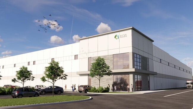
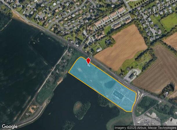
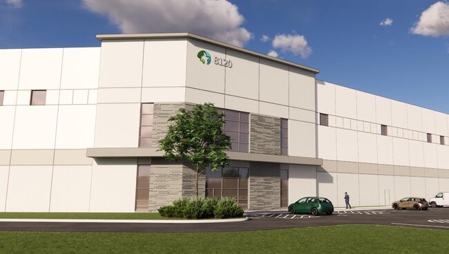
2550 Route 100
546481947467-1
Spring Creek Properties Settlement Subdi
Medicalbuilding
Lehigh
X
Pennsylvania
42011C0250G
14 AC
2025
Lehigh Valley
2025
Philadelphia
006302
Allentown-Bethlehem-Easton, PA-NJ
41,877 SF
DEMOGRAPHICS near 2550 Route 100
1 Mile
3 Mile
5 Mile
2024 Total Population
4,287
35,408
71,858
2029 Population
4,388
36,439
73,882
Pop Growth 2024-2029
+ 2.36%
+ 2.91%
+ 2.82%
Average Age
39
40
42
2024 Total Households
1,571
13,125
27,193
HH Growth 2024-2029
+ 2.42%
+ 2.99%
+ 2.89%
Median Household Inc
$113,888
$108,581
$109,768
Avg Household Size
2.70
2.60
2.60
2024 Avg HH Vehicles
2.00
2.00
2.00
Median Home Value
$336,908
$387,834
$406,595
Median Year Built
1991
1997
1991
Nearby Places
Map Layers
Map Styles
 Street
 Aerial
- Restaurants
- Banks
- Shops
- Fitness
- Groceries
PUBLIC TRANSPORTATION
AIRPORT
Lehigh Valley International
DRIVE
WALK
Distance
Lehigh Valley International
26 min
16.6 mi
Freight Ports
Port of Philadelphia
DRIVE
WALK
Distance
Port of Philadelphia
84 min
64.9 mi
Nearby Properties
Address
Land Use
TOTAL SIZE
Lot Size
Zoning
Address
Land Use
TOTAL SIZE
Lot Size
Zoning
474,892 SF
33.35 AC
L1-L
Address
Land Use
TOTAL SIZE
Lot Size
Zoning
1,155,164 SF
101.05 AC
L1
Address
Land Use
TOTAL SIZE
Lot Size
Zoning
600,000 SF
72.02 AC
L1
Address
Land Use
TOTAL SIZE
Lot Size
Zoning
1,200,000 SF
77.38 AC
HI-S
Address
Land Use
TOTAL SIZE
Lot Size
Zoning
1,099,800 SF
70 AC
HI-S
Address
Land Use
TOTAL SIZE
Lot Size
Zoning
1,088,000 SF
70.68 AC
HI-S
Address
Land Use
TOTAL SIZE
Lot Size
Zoning
927,980 SF
58.81 AC
HI-S
Address
Land Use
TOTAL SIZE
Lot Size
Zoning
199,343 SF
48.68 AC
O
Address
Land Use
TOTAL SIZE
Lot Size
Zoning
999,600 SF
67.99 AC
LI
Address
Land Use
TOTAL SIZE
Lot Size
Zoning
4,990 SF
39.62 AC
R5
Address
Land Use
TOTAL SIZE
Lot Size
Zoning
920,400 SF
65.34 AC
LI
Address
Land Use
TOTAL SIZE
Lot Size
Zoning
789,551 SF
52.39 AC
LI
Address
Land Use
TOTAL SIZE
Lot Size
Zoning
651,393 SF
71.96 AC
HI-S
Address
Land Use
TOTAL SIZE
Lot Size
Zoning
573,344 SF
38.61 AC
LI
Address
Land Use
TOTAL SIZE
Lot Size
Zoning
19,055 SF
194.07 AC
LI
Address
Land Use
TOTAL SIZE
Lot Size
Zoning
725,760 SF
50.25 AC
LI
Address
Land Use
TOTAL SIZE
Lot Size
Zoning
698,350 SF
42.82 AC
O
Address
Land Use
TOTAL SIZE
Lot Size
Zoning
4,037 SF
30.51 AC
R5
Address
Land Use
TOTAL SIZE
Lot Size
Zoning
7,132 SF
21.72 AC
C
Address
Land Use
TOTAL SIZE
Lot Size
Zoning
205,985 SF
28.37 AC
C
Address
Land Use
TOTAL SIZE
Lot Size
Zoning
535,000 SF
39.49 AC
O
Address
Land Use
TOTAL SIZE
Lot Size
Zoning
580,000 SF
38.42 AC
I
Address
Land Use
TOTAL SIZE
Lot Size
Zoning
2,310 SF
163.66 AC
R5
Address
Land Use
TOTAL SIZE
Lot Size
Zoning
81,261 SF
41.18 AC
L1
Address
Land Use
TOTAL SIZE
Lot Size
Zoning
5,762 SF
31.01 AC
U
Address
Land Use
TOTAL SIZE
Lot Size
Zoning
493,200 SF
41.29 AC
O
Address
Land Use
TOTAL SIZE
Lot Size
Zoning
77,506 SF
24.65 AC
C
Address
Land Use
TOTAL SIZE
Lot Size
Zoning
521,700 SF
35.81 AC
LI
Address
Land Use
TOTAL SIZE
Lot Size
Zoning
451,600 SF
46.71 AC
LI
Address
Land Use
TOTAL SIZE
Lot Size
Zoning
32,500 SF
147.04 AC
I
The World's #1 Commercial Real Estate Marketplace
Connect with us
© 2026 CoStar Group
The information above has been obtained from sources believed reliable. While we do not doubt its accuracy we have not verified it and make no guarantee, warranty or representation about it. It is your responsibility to independently confirm its accuracy and completeness. Any projections, opinions, assumptions, or estimates used are for example only and do not represent the current or future performance of the property. The value of this transaction to you depends on tax and other factors which should be evaluated by your tax, financial, and legal advisors. You and your advisors should conduct a careful, independent investigation of the property to determine to your satisfaction the suitability of the property for your needs.