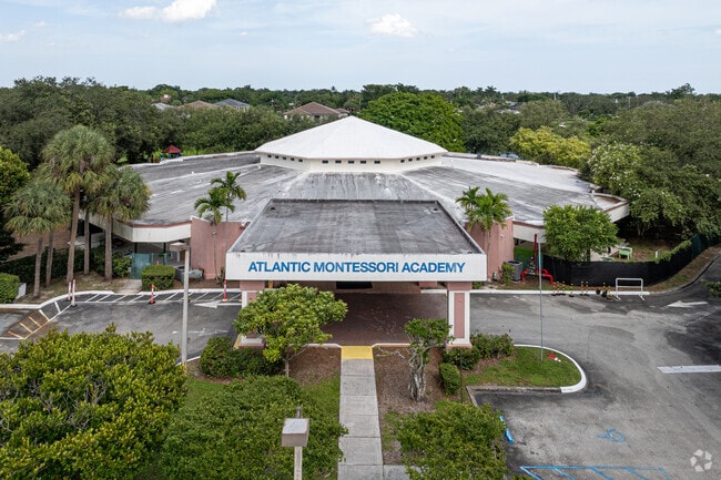
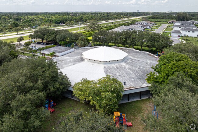
Property Record
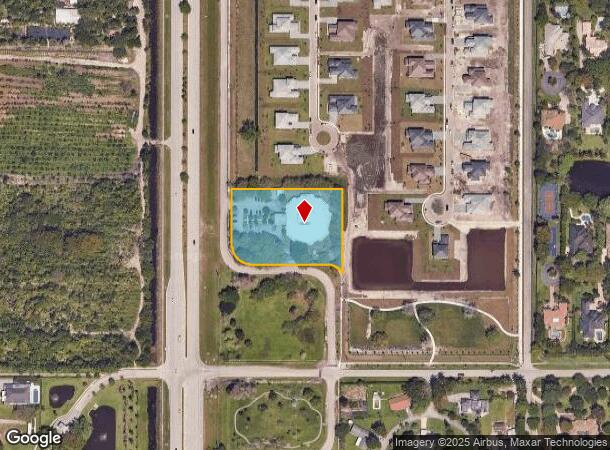
2550 S Flamingo Rd, Davie, FL 33325
NEARBY LISTINGS FOR SALE OR LEASE
Property Detail
2550 S Flamingo Rd
Fort Lauderdale-Pompano Beach-Deerfield Beach, FL
Dc Center 168-10 B
50-40-13-11-0010
DC CENTER 168-10 B PARCEL A
Daycare
Broward
AH
Florida
12011C0535J
a
0
2.37 AC
2025
Southwest Broward
070205
South Florida
21,550 SF
DEMOGRAPHICS near 2550 S Flamingo Rd
1 Mile
3 Mile
5 Mile
2024 Total Population
3,551
67,069
229,406
2029 Population
3,464
65,746
226,325
Pop Growth 2024-2029
(2.45%)
(1.97%)
(1.34%)
Average Age
40
40
40
2024 Total Households
1,080
23,101
82,522
HH Growth 2024-2029
(3.15%)
(2.48%)
(1.77%)
Median Household Inc
$127,876
$103,554
$96,780
Avg Household Size
3.00
2.80
2.70
2024 Avg HH Vehicles
2.00
2.00
2.00
Median Home Value
$746,924
$460,741
$438,846
Median Year Built
1987
1988
1987
Nearby Places
Map Layers
Map Styles
 Street
 Aerial
- Restaurants
- Banks
- Shops
- Fitness
- Groceries
PUBLIC TRANSPORTATION
AIRPORT
Fort Lauderdale/Hollywood International
DRIVE
WALK
Distance
Fort Lauderdale/Hollywood International
22 min
13.3 mi
Miami International
DRIVE
WALK
Distance
Miami International
40 min
27.1 mi
Nearby Properties
Address
Land Use
TOTAL SIZE
Lot Size
Zoning
Address
Land Use
TOTAL SIZE
Lot Size
Zoning
574,019 SF
44.58 AC
RM-10N
Address
Land Use
TOTAL SIZE
Lot Size
Zoning
337,553 SF
39.13 AC
RM-10
Address
Land Use
TOTAL SIZE
Lot Size
Zoning
365,027 SF
38.55 AC
CF
Address
Land Use
TOTAL SIZE
Lot Size
Zoning
390,022 SF
22.48 AC
I-1
Address
Land Use
TOTAL SIZE
Lot Size
Zoning
225,333 SF
26.30 AC
CF
Address
Land Use
TOTAL SIZE
Lot Size
Zoning
196,441 SF
22.10 AC
B-2
Address
Land Use
TOTAL SIZE
Lot Size
Zoning
151,764 SF
32.53 AC
CF (I-1)
Address
Land Use
TOTAL SIZE
Lot Size
Zoning
6,249 SF
232.79 AC
RS
Address
Land Use
TOTAL SIZE
Lot Size
Zoning
126,354 SF
14.98 AC
B-2
Address
Land Use
TOTAL SIZE
Lot Size
Zoning
461,984 SF
20.41 AC
B-3
Address
Land Use
TOTAL SIZE
Lot Size
Zoning
153,445 SF
2.43 AC
RM-16
Address
Land Use
TOTAL SIZE
Lot Size
Zoning
144,955 SF
25.64 AC
CF
Address
Land Use
TOTAL SIZE
Lot Size
Zoning
31,544 SF
242.68 AC
RS
Address
Land Use
TOTAL SIZE
Lot Size
Zoning
150,423 SF
20.57 AC
B-2
Address
Land Use
TOTAL SIZE
Lot Size
Zoning
161,613 SF
12.43 AC
I-1
Address
Land Use
TOTAL SIZE
Lot Size
Zoning
105,063 SF
13.31 AC
B-3
Address
Land Use
TOTAL SIZE
Lot Size
Zoning
260,210 SF
11.71 AC
CF-P
Address
Land Use
TOTAL SIZE
Lot Size
Zoning
6,711 SF
158.98 AC
AG
Address
Land Use
TOTAL SIZE
Lot Size
Zoning
165,252 SF
5.50 AC
CC
Address
Land Use
TOTAL SIZE
Lot Size
Zoning
141,025 SF
13.52 AC
B-3
Address
Land Use
TOTAL SIZE
Lot Size
Zoning
149,095 SF
3.32 AC
B-3
Address
Land Use
TOTAL SIZE
Lot Size
Zoning
115,306 SF
9.52 AC
B-2
Address
Land Use
TOTAL SIZE
Lot Size
Zoning
69,158 SF
53.73 AC
CF
Address
Land Use
TOTAL SIZE
Lot Size
Zoning
150,681 SF
14.96 AC
I-1
Address
Land Use
TOTAL SIZE
Lot Size
Zoning
63,878 SF
7.23 AC
B-3
Address
Land Use
TOTAL SIZE
Lot Size
Zoning
112,664 SF
11.32 AC
CF
Address
Land Use
TOTAL SIZE
Lot Size
Zoning
21,880 SF
116.63 AC
CR
Address
Land Use
TOTAL SIZE
Lot Size
Zoning
121,730 SF
2.10 AC
B-2
Address
Land Use
TOTAL SIZE
Lot Size
Zoning
257,443 SF
11.79 AC
PRD-16Q
Address
Land Use
TOTAL SIZE
Lot Size
Zoning
117,907 SF
8.72 AC
CC
The World's #1 Commercial Real Estate Marketplace
Connect with us
© 2025 CoStar Group
The information above has been obtained from sources believed reliable. While we do not doubt its accuracy we have not verified it and make no guarantee, warranty or representation about it. It is your responsibility to independently confirm its accuracy and completeness. Any projections, opinions, assumptions, or estimates used are for example only and do not represent the current or future performance of the property. The value of this transaction to you depends on tax and other factors which should be evaluated by your tax, financial, and legal advisors. You and your advisors should conduct a careful, independent investigation of the property to determine to your satisfaction the suitability of the property for your needs.