Property Record
25500 W 12 Mile Rd, Southfield, MI 48034

NEARBY LISTINGS FOR SALE OR LEASE
-
-
View all Southfield listings for sale on LoopNet.com
Property Detail
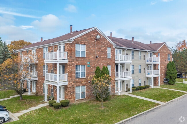
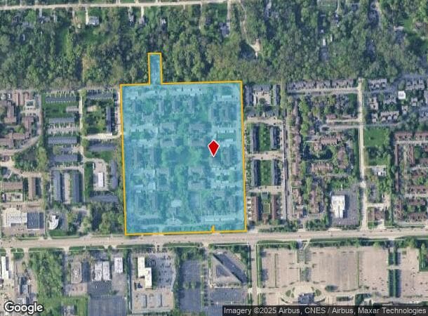
25500 W 12 Mile Rd
Detroit-Warren-Dearborn, MI
Supervisors Plat #22
24-08-351-010
T1N,R10E,SEC 08 SUPERVISOR'S PLAT NO 22 LOTS 1 TO 34 INCL, ALL OF VAC LESLIE ST & ALL OF VAC HOPE ST ADJ TO SAME, ALSO PART
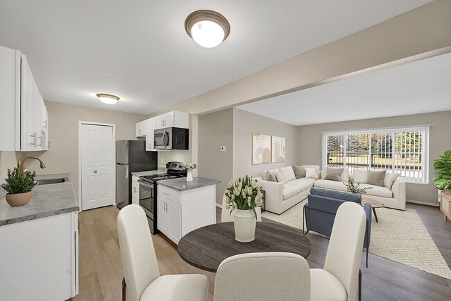
Multifamilydwelling
Oakland
X
Michigan
26125C0518F
1-34
2024
28.57 AC
2025
Southfield
160900
Detroit
439,171 SF
DEMOGRAPHICS near 25500 W 12 Mile Rd
1 Mile
3 Mile
5 Mile
2024 Total Population
11,087
59,732
193,742
2029 Population
11,011
59,096
191,244
Pop Growth 2024-2029
(0.69%)
(1.06%)
(1.29%)
Average Age
43
45
43
2024 Total Households
5,957
26,699
81,142
HH Growth 2024-2029
(0.76%)
(1.01%)
(1.26%)
Median Household Inc
$55,373
$74,753
$83,973
Avg Household Size
1.80
2.20
2.30
2024 Avg HH Vehicles
1.00
2.00
2.00
Median Home Value
$264,938
$299,885
$279,757
Median Year Built
1974
1971
1966
Nearby Places
Map Layers
Map Styles
 Street
 Aerial
- Restaurants
- Banks
- Shops
- Fitness
- Groceries
PUBLIC TRANSPORTATION
COMMUTER RAIL
Troy Amtrak Station (Wolverine - Amtrak)
DRIVE
WALK
Distance
Troy Amtrak Station (Wolverine - Amtrak)
19 min
9.3 mi
AIRPORT
Windsor International
DRIVE
WALK
Distance
Windsor International
49 min
28.8 mi
Detroit Metro Wayne County
DRIVE
WALK
Distance
Detroit Metro Wayne County
41 min
33.1 mi
Freight Ports
Port of Toledo
DRIVE
WALK
Distance
Port of Toledo
91 min
74.7 mi
Nearby Properties
Address
Land Use
TOTAL SIZE
Lot Size
Zoning
Address
Land Use
TOTAL SIZE
Lot Size
Zoning
588 SF
53.02 AC
RM
Address
Land Use
TOTAL SIZE
Lot Size
Zoning
558,088 SF
40.09 AC
AI
Address
Land Use
TOTAL SIZE
Lot Size
Zoning
544,945 SF
23.89 AC
BI
Address
Land Use
TOTAL SIZE
Lot Size
Zoning
592,350 SF
23.64 AC
RC
Address
Land Use
TOTAL SIZE
Lot Size
Zoning
32.44 AC
RC
Address
Land Use
TOTAL SIZE
Lot Size
Zoning
460,062 SF
10.01 AC
RC
Address
Land Use
TOTAL SIZE
Lot Size
Zoning
301,269 SF
25.47 AC
OS
Address
Land Use
TOTAL SIZE
Lot Size
Zoning
167,882 SF
16.18 AC
BI
Address
Land Use
TOTAL SIZE
Lot Size
Zoning
405,020 SF
18.74 AC
RMM
Address
Land Use
TOTAL SIZE
Lot Size
Zoning
271,650 SF
12.88 AC
BI
Address
Land Use
TOTAL SIZE
Lot Size
Zoning
233,598 SF
17.24 AC
RS
Address
Land Use
TOTAL SIZE
Lot Size
Zoning
261,633 SF
12.19 AC
RMM
Address
Land Use
TOTAL SIZE
Lot Size
Zoning
228,544 SF
35.02 AC
BI
Address
Land Use
TOTAL SIZE
Lot Size
Zoning
17.19 AC
RC
Address
Land Use
TOTAL SIZE
Lot Size
Zoning
367,101 SF
37.77 AC
R-E
Address
Land Use
TOTAL SIZE
Lot Size
Zoning
325,654 SF
7.45 AC
ERO
Address
Land Use
TOTAL SIZE
Lot Size
Zoning
344,960 SF
8.90 AC
RC
Address
Land Use
TOTAL SIZE
Lot Size
Zoning
246,695 SF
18.46 AC
BI
Address
Land Use
TOTAL SIZE
Lot Size
Zoning
181,954 SF
RC
Address
Land Use
TOTAL SIZE
Lot Size
Zoning
255,136 SF
21.19 AC
AI
Address
Land Use
TOTAL SIZE
Lot Size
Zoning
248,911 SF
4.55 AC
RC
Address
Land Use
TOTAL SIZE
Lot Size
Zoning
350,140 SF
27.11 AC
RC
Address
Land Use
TOTAL SIZE
Lot Size
Zoning
63,550 SF
4.18 AC
AI
Address
Land Use
TOTAL SIZE
Lot Size
Zoning
306,250 SF
14.60 AC
RC
Address
Land Use
TOTAL SIZE
Lot Size
Zoning
Address
Land Use
TOTAL SIZE
Lot Size
Zoning
280,984 SF
11.88 AC
ERO-M
Address
Land Use
TOTAL SIZE
Lot Size
Zoning
276,825 SF
19.05 AC
AI
Address
Land Use
TOTAL SIZE
Lot Size
Zoning
288,641 SF
13.56 AC
RMM
Address
Land Use
TOTAL SIZE
Lot Size
Zoning
142,043 SF
17.87 AC
AI
The World's #1 Commercial Real Estate Marketplace
Connect with us
© 2026 CoStar Group
The information above has been obtained from sources believed reliable. While we do not doubt its accuracy we have not verified it and make no guarantee, warranty or representation about it. It is your responsibility to independently confirm its accuracy and completeness. Any projections, opinions, assumptions, or estimates used are for example only and do not represent the current or future performance of the property. The value of this transaction to you depends on tax and other factors which should be evaluated by your tax, financial, and legal advisors. You and your advisors should conduct a careful, independent investigation of the property to determine to your satisfaction the suitability of the property for your needs.