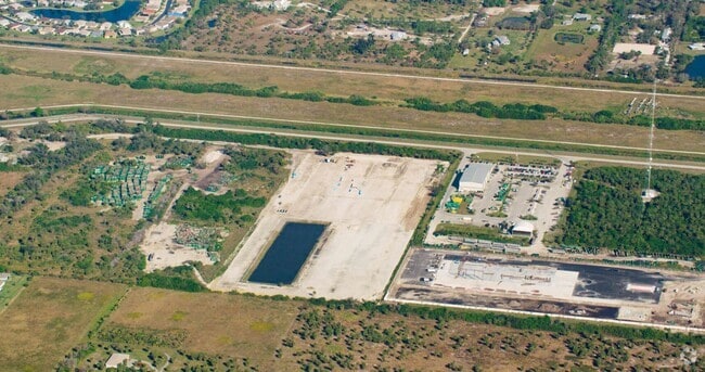
Property Record
25515 Old Landfill Rd, Punta Gorda, FL 33980

NEARBY LISTINGS FOR SALE OR LEASE
Property Detail
25515 Old Landfill Rd
Punta Gorda, FL
Ecogreen Subdivion
402319200001
ECOGREEN SUBDIVION LOT 1 13.35 AC M/L 464/471 501/536 E660/1545 742/361 838/449 E1064/1194 E1488/1352 1492/1732 E1611/1767 E1649/680 1972/600 3081/1446 3504/1888 PL3511/961 E4267/1720
Warehouse
Charlotte
X
Florida
12015C0231G
1,464
2024
13.35 AC
2025
Charlotte County
021002
Southwest Florida
24,189 SF
DEMOGRAPHICS near 25515 Old Landfill Rd
1 Mile
3 Mile
5 Mile
2024 Total Population
3,989
40,668
89,967
2029 Population
4,912
48,686
107,454
Pop Growth 2024-2029
+ 23.14%
+ 19.72%
+ 19.44%
Average Age
60
51
51
2024 Total Households
2,074
18,552
40,741
HH Growth 2024-2029
+ 23.53%
+ 20.16%
+ 19.80%
Median Household Inc
$52,078
$54,688
$53,917
Avg Household Size
1.80
2.10
2.10
2024 Avg HH Vehicles
1.00
2.00
2.00
Median Home Value
$153,400
$214,393
$229,772
Median Year Built
1990
1986
1985
Nearby Places
Map Layers
Map Styles
 Street
 Aerial
- Restaurants
- Banks
- Shops
- Fitness
- Groceries
PUBLIC TRANSPORTATION
AIRPORT
Punta Gorda
DRIVE
WALK
Distance
Punta Gorda
23 min
8.5 mi
Freight Ports
Port Manatee
DRIVE
WALK
Distance
Port Manatee
87 min
68.0 mi
Nearby Properties
Address
Land Use
TOTAL SIZE
Lot Size
Zoning
Address
Land Use
TOTAL SIZE
Lot Size
Zoning
333,027 SF
9.79 AC
CHRW
Address
Land Use
TOTAL SIZE
Lot Size
Zoning
202,009 SF
20.89 AC
PD
Address
Land Use
TOTAL SIZE
Lot Size
Zoning
204,731 SF
16.11 AC
PD
Address
Land Use
TOTAL SIZE
Lot Size
Zoning
229,973 SF
21.33 AC
PD
Address
Land Use
TOTAL SIZE
Lot Size
Zoning
121,585 SF
696.03 AC
RE1
Address
Land Use
TOTAL SIZE
Lot Size
Zoning
249,777 SF
48 AC
RMF10
Address
Land Use
TOTAL SIZE
Lot Size
Zoning
172,298 SF
37.42 AC
OMI
Address
Land Use
TOTAL SIZE
Lot Size
Zoning
789,392 SF
31.39 AC
RMF15
Address
Land Use
TOTAL SIZE
Lot Size
Zoning
254.31 AC
PD
Address
Land Use
TOTAL SIZE
Lot Size
Zoning
217,784 SF
38.63 AC
PD
Address
Land Use
TOTAL SIZE
Lot Size
Zoning
139,109 SF
23.44 AC
CG
Address
Land Use
TOTAL SIZE
Lot Size
Zoning
40,430 SF
5.63 AC
RMF12
Address
Land Use
TOTAL SIZE
Lot Size
Zoning
128,594 SF
25.54 AC
PD
Address
Land Use
TOTAL SIZE
Lot Size
Zoning
70,518 SF
2.08 AC
PD
Address
Land Use
TOTAL SIZE
Lot Size
Zoning
102,337 SF
10.43 AC
RSF3.5
Address
Land Use
TOTAL SIZE
Lot Size
Zoning
73,222 SF
5.14 AC
PD
Address
Land Use
TOTAL SIZE
Lot Size
Zoning
50,970 SF
9.74 AC
RSF3.5
Address
Land Use
TOTAL SIZE
Lot Size
Zoning
83,180 SF
9.31 AC
PD
Address
Land Use
TOTAL SIZE
Lot Size
Zoning
95,547 SF
14.06 AC
PD
Address
Land Use
TOTAL SIZE
Lot Size
Zoning
125.54 AC
PD
Address
Land Use
TOTAL SIZE
Lot Size
Zoning
35,951 SF
24.23 AC
PD
Address
Land Use
TOTAL SIZE
Lot Size
Zoning
1,296 SF
14.46 AC
CG
Address
Land Use
TOTAL SIZE
Lot Size
Zoning
27,082 SF
2.05 AC
PD
Address
Land Use
TOTAL SIZE
Lot Size
Zoning
84,500 SF
5.59 AC
CG
Address
Land Use
TOTAL SIZE
Lot Size
Zoning
81,167 SF
5.63 AC
CG
Address
Land Use
TOTAL SIZE
Lot Size
Zoning
448 SF
16.37 AC
PD
Address
Land Use
TOTAL SIZE
Lot Size
Zoning
86,773 SF
5.07 AC
IG
Address
Land Use
TOTAL SIZE
Lot Size
Zoning
82,865 SF
19.74 AC
RMF12
Address
Land Use
TOTAL SIZE
Lot Size
Zoning
116,186 SF
20.02 AC
RMF10
Address
Land Use
TOTAL SIZE
Lot Size
Zoning
11.50 AC
CHRW
The World's #1 Commercial Real Estate Marketplace
Connect with us
© 2026 CoStar Group
The information above has been obtained from sources believed reliable. While we do not doubt its accuracy we have not verified it and make no guarantee, warranty or representation about it. It is your responsibility to independently confirm its accuracy and completeness. Any projections, opinions, assumptions, or estimates used are for example only and do not represent the current or future performance of the property. The value of this transaction to you depends on tax and other factors which should be evaluated by your tax, financial, and legal advisors. You and your advisors should conduct a careful, independent investigation of the property to determine to your satisfaction the suitability of the property for your needs.