Property Record
2568 Hempstead Tpke, East Meadow, NY 11554
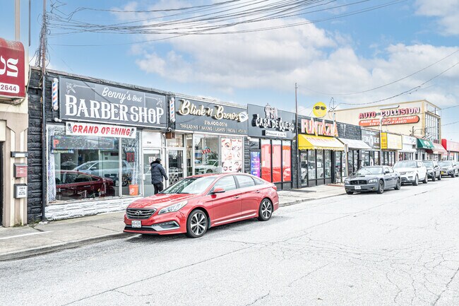

This Property Is For Sale
NEARBY LISTINGS FOR SALE OR LEASE
Property Detail
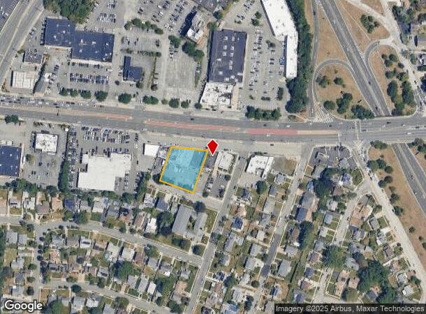
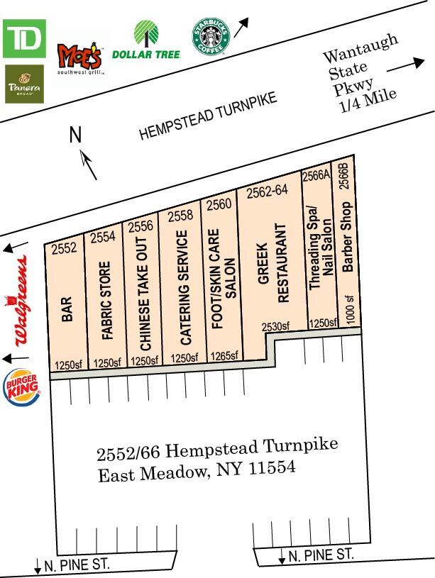
2568 Hempstead Tpke
Nassau County-Suffolk County, NY
Fay Manor
2089-51-004-00-0082-0
Nassau
Townhouserowhouse
New York
X
0.61 AC
36059C0235G
Central Nassau
24,432 SF
Long Island (New York)
DEMOGRAPHICS near 2568 Hempstead Tpke
1 Mile
3 Mile
5 Mile
2024 Total Population
23,148
183,737
508,324
2029 Population
22,765
180,366
498,845
Pop Growth 2024-2029
(1.65%)
(1.83%)
(1.86%)
Average Age
42
42
41
2024 Total Households
7,315
56,957
156,262
HH Growth 2024-2029
(1.82%)
(1.95%)
(1.95%)
Median Household Inc
$124,398
$130,369
$123,581
Avg Household Size
3.00
3.10
3.10
2024 Avg HH Vehicles
2.00
2.00
2.00
Median Home Value
$529,741
$584,791
$605,318
Median Year Built
1953
1954
1954
Nearby Places
Map Layers
Map Styles
 Street
 Aerial
- Restaurants
- Banks
- Shops
- Fitness
- Groceries
PUBLIC TRANSPORTATION
COMMUTER RAIL
Hicksville Station (Montauk Branch - Long Island Rail Road, Port Jefferson Branch - Long Island Rail Road, Ronkonkoma Branch - Long Island Rail Road)
DRIVE
WALK
Distance
Hicksville Station (Montauk Branch - Long Island Rail Road, Port Jefferson Branch - Long Island Rail Road, Ronkonkoma Branch - Long Island Rail Road)
6 min
3.5 mi
Westbury Station (Port Jefferson Branch - Long Island Rail Road)
DRIVE
WALK
Distance
Westbury Station (Port Jefferson Branch - Long Island Rail Road)
8 min
6.1 mi
AIRPORT
John F Kennedy International
DRIVE
WALK
Distance
John F Kennedy International
29 min
18.0 mi
LaGuardia
DRIVE
WALK
Distance
LaGuardia
36 min
24.5 mi
Long Island MacArthur
DRIVE
WALK
Distance
Long Island MacArthur
39 min
29.0 mi
Freight Ports
NY - Red Hook Container Terminal
DRIVE
WALK
Distance
NY - Red Hook Container Terminal
47 min
32.7 mi
Nearby Properties
Address
Land Use
TOTAL SIZE
Lot Size
Zoning
Address
Land Use
TOTAL SIZE
Lot Size
Zoning
1,027,545 SF
15.65 AC
Address
Land Use
TOTAL SIZE
Lot Size
Zoning
419,282 SF
57.46 AC
Address
Land Use
TOTAL SIZE
Lot Size
Zoning
187,225 SF
15.35 AC
Address
Land Use
TOTAL SIZE
Lot Size
Zoning
1,188,742 SF
11.93 AC
Address
Land Use
TOTAL SIZE
Lot Size
Zoning
181,472 SF
168.80 AC
Address
Land Use
TOTAL SIZE
Lot Size
Zoning
2,835 SF
239 AC
Address
Land Use
TOTAL SIZE
Lot Size
Zoning
170,920 SF
27.82 AC
Address
Land Use
TOTAL SIZE
Lot Size
Zoning
Address
Land Use
TOTAL SIZE
Lot Size
Zoning
6,120 SF
226.22 AC
Address
Land Use
TOTAL SIZE
Lot Size
Zoning
51,432 SF
32.03 AC
Address
Land Use
TOTAL SIZE
Lot Size
Zoning
822,113 SF
26 AC
Address
Land Use
TOTAL SIZE
Lot Size
Zoning
568,086 SF
21.99 AC
Address
Land Use
TOTAL SIZE
Lot Size
Zoning
493,535 SF
5.88 AC
Address
Land Use
TOTAL SIZE
Lot Size
Zoning
5,628 SF
31.86 AC
Address
Land Use
TOTAL SIZE
Lot Size
Zoning
249,762 SF
18.36 AC
Address
Land Use
TOTAL SIZE
Lot Size
Zoning
92,466 SF
8 AC
Address
Land Use
TOTAL SIZE
Lot Size
Zoning
254,845 SF
22.28 AC
Address
Land Use
TOTAL SIZE
Lot Size
Zoning
384,267 SF
29.25 AC
Address
Land Use
TOTAL SIZE
Lot Size
Zoning
10,072 SF
22.75 AC
Address
Land Use
TOTAL SIZE
Lot Size
Zoning
8,000 SF
17.75 AC
Address
Land Use
TOTAL SIZE
Lot Size
Zoning
120,000 SF
28.96 AC
Address
Land Use
TOTAL SIZE
Lot Size
Zoning
225,460 SF
14.70 AC
Address
Land Use
TOTAL SIZE
Lot Size
Zoning
35,718 SF
22.15 AC
Address
Land Use
TOTAL SIZE
Lot Size
Zoning
505,020 SF
58.54 AC
Address
Land Use
TOTAL SIZE
Lot Size
Zoning
432,954 SF
26.25 AC
Address
Land Use
TOTAL SIZE
Lot Size
Zoning
331,084 SF
26.95 AC
Address
Land Use
TOTAL SIZE
Lot Size
Zoning
144,358 SF
21.73 AC
Address
Land Use
TOTAL SIZE
Lot Size
Zoning
417,547 SF
19.25 AC
Address
Land Use
TOTAL SIZE
Lot Size
Zoning
115,825 SF
17.08 AC
Address
Land Use
TOTAL SIZE
Lot Size
Zoning
66,602 SF
19.93 AC
The World's #1 Commercial Real Estate Marketplace
Connect with us
© 2025 CoStar Group
The information above has been obtained from sources believed reliable. While we do not doubt its accuracy we have not verified it and make no guarantee, warranty or representation about it. It is your responsibility to independently confirm its accuracy and completeness. Any projections, opinions, assumptions, or estimates used are for example only and do not represent the current or future performance of the property. The value of this transaction to you depends on tax and other factors which should be evaluated by your tax, financial, and legal advisors. You and your advisors should conduct a careful, independent investigation of the property to determine to your satisfaction the suitability of the property for your needs.