Property Record
2555 74Th St, Lubbock, TX 79423
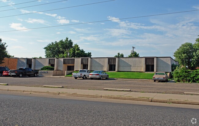


Property Detail
2555 74Th St
Lubbock, TX
TIMES SQUARE L 2-A
R77561
Lubbock
Officebuilding
Texas
B and X Area of moderate flood hazard, usually the area between the limits of the 100-year and 500-year floods.
10
2024
0.80 AC
2025
South Outer Lubbock
002102
Lubbock
9,550 SF
NEARBY LISTINGS FOR SALE OR LEASE
DEMOGRAPHICS near 2555 74Th St
1 mile
3 mile
5 mile
2024 Total Population
13,815
95,924
202,770
2029 Population
14,230
99,570
211,658
Pop Growth 2024-2029
+ 3.00%
+ 3.80%
+ 4.38%
Average Age
38
37
36
2024 Total Households
5,744
38,319
79,383
HH Growth 2024-2029
+ 3.22%
+ 4.03%
+ 4.77%
Median Household Inc
$56,605
$58,752
$57,762
Avg Household Size
2.40
2.40
2.40
2024 Avg HH Vehicles
2.00
2.00
2.00
Median Home Value
$184,319
$197,178
$222,851
Median Year Built
1976
1977
1982
Nearby Places
Map Layers
Map Styles
 Street
 Aerial
Transit
 Traffic
 Biking
Places
Listings with unknown addresses are not visible on the map
- Restaurants
- Banks
- Shops
- Fitness
- Groceries
PUBLIC TRANSPORTATION
AIRPORT
Lubbock Preston Smith International
Drive
Walk
Distance
Lubbock Preston Smith International
30 min
16.7 mi
Nearby Properties
Address
Land Use
TOTAL SIZE
Lot Size
Zoning
Address
Land Use
TOTAL SIZE
Lot Size
Zoning
391,942 SF
17.89 AC
Address
Land Use
TOTAL SIZE
Lot Size
Zoning
329,448 SF
13.27 AC
Address
Land Use
TOTAL SIZE
Lot Size
Zoning
176,165 SF
36.61 AC
Address
Land Use
TOTAL SIZE
Lot Size
Zoning
219,352 SF
21.90 AC
Address
Land Use
TOTAL SIZE
Lot Size
Zoning
138,202 SF
11.33 AC
Address
Land Use
TOTAL SIZE
Lot Size
Zoning
172,263 SF
11.01 AC
Address
Land Use
TOTAL SIZE
Lot Size
Zoning
167,208 SF
10.09 AC
Address
Land Use
TOTAL SIZE
Lot Size
Zoning
169,139 SF
12.07 AC
Address
Land Use
TOTAL SIZE
Lot Size
Zoning
157,644 SF
9.69 AC
Address
Land Use
TOTAL SIZE
Lot Size
Zoning
199,854 SF
19.21 AC
Address
Land Use
TOTAL SIZE
Lot Size
Zoning
49,538 SF
3.65 AC
Address
Land Use
TOTAL SIZE
Lot Size
Zoning
177,154 SF
8.79 AC
Address
Land Use
TOTAL SIZE
Lot Size
Zoning
83,300 SF
2.07 AC
Address
Land Use
TOTAL SIZE
Lot Size
Zoning
88,998 SF
7.56 AC
Address
Land Use
TOTAL SIZE
Lot Size
Zoning
61,322 SF
5.35 AC
Address
Land Use
TOTAL SIZE
Lot Size
Zoning
125,017 SF
6.95 AC
Address
Land Use
TOTAL SIZE
Lot Size
Zoning
65,798 SF
4.11 AC
Address
Land Use
TOTAL SIZE
Lot Size
Zoning
421,200 SF
43.22 AC
Address
Land Use
TOTAL SIZE
Lot Size
Zoning
38,414 SF
3.33 AC
Address
Land Use
TOTAL SIZE
Lot Size
Zoning
95,000 SF
12.33 AC
Address
Land Use
TOTAL SIZE
Lot Size
Zoning
80,832 SF
4.08 AC
Address
Land Use
TOTAL SIZE
Lot Size
Zoning
119,200 SF
8.44 AC
Address
Land Use
TOTAL SIZE
Lot Size
Zoning
122,118 SF
5.18 AC
Address
Land Use
TOTAL SIZE
Lot Size
Zoning
74,663 SF
7.28 AC
Address
Land Use
TOTAL SIZE
Lot Size
Zoning
88,417 SF
8.01 AC
Address
Land Use
TOTAL SIZE
Lot Size
Zoning
133,002 SF
7.25 AC
Address
Land Use
TOTAL SIZE
Lot Size
Zoning
202,036 SF
17.12 AC
Address
Land Use
TOTAL SIZE
Lot Size
Zoning
205,150 SF
23.43 AC
Address
Land Use
TOTAL SIZE
Lot Size
Zoning
133,795 SF
6.37 AC
Address
Land Use
TOTAL SIZE
Lot Size
Zoning
71,329 SF
14 AC
The World's #1 Commercial Real Estate Marketplace
Connect with us
© 2026 CoStar Group
The information above has been obtained from sources believed reliable. While we do not doubt its accuracy we have not verified it and make no guarantee, warranty or representation about it. It is your responsibility to independently confirm its accuracy and completeness. Any projections, opinions, assumptions, or estimates used are for example only and do not represent the current or future performance of the property. The value of this transaction to you depends on tax and other factors which should be evaluated by your tax, financial, and legal advisors. You and your advisors should conduct a careful, independent investigation of the property to determine to your satisfaction the suitability of the property for your needs.