Property Record
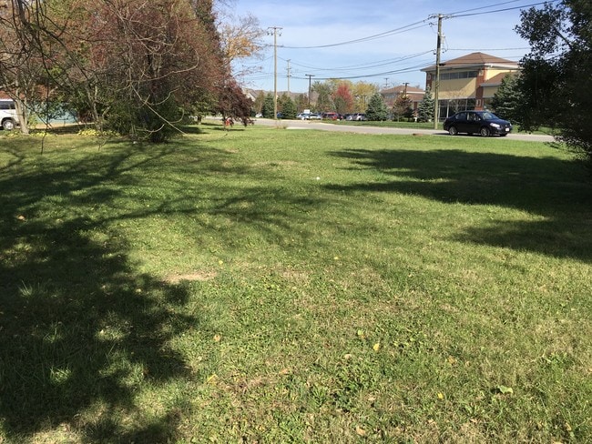
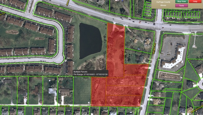
2555 E New York St, Aurora, IL 60502
This Property Is For Sale
NEARBY LISTINGS FOR SALE OR LEASE
Property Detail
2555 E New York St
Chicago-Naperville-Elgin, IL-IN
Vaughans Assmt Plat
07-19-401-003
DuPage
Sfr
Illinois
X
1.81 AC
17043C0119J
Western East/West Corr
1,024 SF
Chicago
DEMOGRAPHICS near 2555 E New York St
1 Mile
3 Mile
5 Mile
2024 Total Population
12,075
115,718
256,016
2029 Population
11,839
114,767
255,957
Pop Growth 2024-2029
(1.95%)
(0.82%)
(0.02%)
Average Age
37
36
37
2024 Total Households
4,398
39,039
88,412
HH Growth 2024-2029
(2.18%)
(0.85%)
0.00%
Median Household Inc
$110,902
$90,813
$91,535
Avg Household Size
2.70
2.90
2.80
2024 Avg HH Vehicles
2.00
2.00
2.00
Median Home Value
$343,932
$257,007
$272,552
Median Year Built
1996
1991
1990
Nearby Places
Map Layers
Map Styles
 Street
 Aerial
- Restaurants
- Banks
- Shops
- Fitness
- Groceries
PUBLIC TRANSPORTATION
COMMUTER RAIL
Aurora Station (Burlington Northern-Santa Fe Railway Line - Northeast Illinois Regional Commuter Railroad (Metra))
DRIVE
WALK
Distance
Aurora Station (Burlington Northern-Santa Fe Railway Line - Northeast Illinois Regional Commuter Railroad (Metra))
7 min
3.7 mi
Route 59 Station (Burlington Northern-Santa Fe Railway Line - Northeast Illinois Regional Commuter Railroad (Metra))
DRIVE
WALK
Distance
Route 59 Station (Burlington Northern-Santa Fe Railway Line - Northeast Illinois Regional Commuter Railroad (Metra))
8 min
3.9 mi
AIRPORT
Chicago Midway International
DRIVE
WALK
Distance
Chicago Midway International
48 min
29.4 mi
Chicago O'Hare International
DRIVE
WALK
Distance
Chicago O'Hare International
50 min
35.0 mi
Freight Ports
Port Milwaukee
DRIVE
WALK
Distance
Port Milwaukee
131 min
106.8 mi
Nearby Properties
Address
Land Use
TOTAL SIZE
Lot Size
Zoning
Address
Land Use
TOTAL SIZE
Lot Size
Zoning
916,143 SF
32.66 AC
Address
Land Use
TOTAL SIZE
Lot Size
Zoning
28.52 AC
R
Address
Land Use
TOTAL SIZE
Lot Size
Zoning
20.60 AC
Address
Land Use
TOTAL SIZE
Lot Size
Zoning
41.42 AC
Address
Land Use
TOTAL SIZE
Lot Size
Zoning
19.92 AC
C
Address
Land Use
TOTAL SIZE
Lot Size
Zoning
17.70 AC
Address
Land Use
TOTAL SIZE
Lot Size
Zoning
Address
Land Use
TOTAL SIZE
Lot Size
Zoning
829,087 SF
35.83 AC
C
Address
Land Use
TOTAL SIZE
Lot Size
Zoning
684,925 SF
25.63 AC
Address
Land Use
TOTAL SIZE
Lot Size
Zoning
283,844 SF
16.06 AC
M
Address
Land Use
TOTAL SIZE
Lot Size
Zoning
20.97 AC
R
Address
Land Use
TOTAL SIZE
Lot Size
Zoning
17.84 AC
M
Address
Land Use
TOTAL SIZE
Lot Size
Zoning
16.86 AC
C
Address
Land Use
TOTAL SIZE
Lot Size
Zoning
397,771 SF
22.12 AC
Address
Land Use
TOTAL SIZE
Lot Size
Zoning
11.02 AC
M
Address
Land Use
TOTAL SIZE
Lot Size
Zoning
9.83 AC
C
Address
Land Use
TOTAL SIZE
Lot Size
Zoning
293,121 SF
9.50 AC
Address
Land Use
TOTAL SIZE
Lot Size
Zoning
594,880 SF
29.15 AC
I
Address
Land Use
TOTAL SIZE
Lot Size
Zoning
173,303 SF
19.53 AC
Address
Land Use
TOTAL SIZE
Lot Size
Zoning
10 AC
C
Address
Land Use
TOTAL SIZE
Lot Size
Zoning
342,257 SF
31.05 AC
C
Address
Land Use
TOTAL SIZE
Lot Size
Zoning
521,922 SF
19.87 AC
Address
Land Use
TOTAL SIZE
Lot Size
Zoning
133,779 SF
9.77 AC
C
Address
Land Use
TOTAL SIZE
Lot Size
Zoning
363,500 SF
19.89 AC
Address
Land Use
TOTAL SIZE
Lot Size
Zoning
367,519 SF
15.98 AC
Address
Land Use
TOTAL SIZE
Lot Size
Zoning
244,494 SF
16.08 AC
Address
Land Use
TOTAL SIZE
Lot Size
Zoning
139,200 SF
11.17 AC
R
Address
Land Use
TOTAL SIZE
Lot Size
Zoning
315,100 SF
23.74 AC
Address
Land Use
TOTAL SIZE
Lot Size
Zoning
189,289 SF
18.56 AC
Address
Land Use
TOTAL SIZE
Lot Size
Zoning
331,425 SF
17.62 AC
The World's #1 Commercial Real Estate Marketplace
Connect with us
© 2026 CoStar Group
The information above has been obtained from sources believed reliable. While we do not doubt its accuracy we have not verified it and make no guarantee, warranty or representation about it. It is your responsibility to independently confirm its accuracy and completeness. Any projections, opinions, assumptions, or estimates used are for example only and do not represent the current or future performance of the property. The value of this transaction to you depends on tax and other factors which should be evaluated by your tax, financial, and legal advisors. You and your advisors should conduct a careful, independent investigation of the property to determine to your satisfaction the suitability of the property for your needs.