Property Record
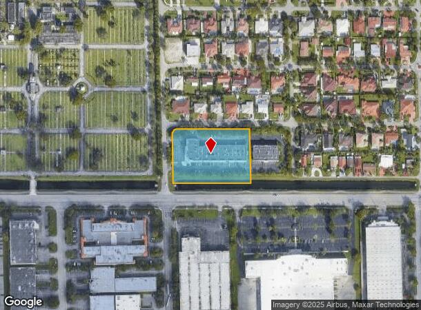
2555 Nw 102Nd Ave, Doral, FL 33172


NEARBY LISTINGS FOR SALE OR LEASE
Property Detail
2555 Nw 102Nd Ave
35-3029-115-0020
Point At Doral
Officebuilding
POINT AT DORAL PB 166-84 T-21097 TRACT A LESS PORT DESC AS FOLLOWS BEG SW COR OF TR A THENCE S89 DEG W 199.49FT N00 DEG W 242.89FT N89 DEG E 169.01FT SWLY AD 38.64FT S01 DEG E 218.55FT FOR POB LOT SIZE 97760 SQ FT FAU 35 3029 1116 0001 FKA THE POINT
AE
Miami/Dade
12086C0286L
Florida
2024
2.24 AC
2025
Miami Airport
009010
South Florida
45,455 SF
Miami-Miami Beach-Kendall, FL
DEMOGRAPHICS near 2555 Nw 102Nd Ave
1 Mile
3 Mile
5 Mile
2024 Total Population
4,536
146,856
329,950
2029 Population
4,363
145,011
322,371
Pop Growth 2024-2029
(3.81%)
(1.26%)
(2.30%)
Average Age
40
40
42
2024 Total Households
1,466
50,780
109,086
HH Growth 2024-2029
(4.77%)
(1.57%)
(2.69%)
Median Household Inc
$96,993
$61,532
$60,837
Avg Household Size
3.10
2.80
2.90
2024 Avg HH Vehicles
2.00
2.00
2.00
Median Home Value
$414,440
$330,746
$379,488
Median Year Built
1991
1990
1982
Nearby Places
Map Layers
Map Styles
 Street
 Aerial
- Restaurants
- Banks
- Shops
- Fitness
- Groceries
PUBLIC TRANSPORTATION
COMMUTER RAIL
Palmetto (Metrorail Green Line - Miami-Dade Transit (Metrorail/Metromover))
DRIVE
WALK
Distance
Palmetto (Metrorail Green Line - Miami-Dade Transit (Metrorail/Metromover))
12 min
5.8 mi
Okeechobee (Metrorail Green Line - Miami-Dade Transit (Metrorail/Metromover))
DRIVE
WALK
Distance
Okeechobee (Metrorail Green Line - Miami-Dade Transit (Metrorail/Metromover))
14 min
7.4 mi
AIRPORT
Miami International
DRIVE
WALK
Distance
Miami International
12 min
4.9 mi
Fort Lauderdale/Hollywood International
DRIVE
WALK
Distance
Fort Lauderdale/Hollywood International
43 min
32.1 mi
Freight Ports
Port of Miami
DRIVE
WALK
Distance
Port of Miami
26 min
14.4 mi
SALE & LEASE HISTORY
LISTING DATE
SALE/LEASE

Sep 25, 2016
For Lease
Sep 24, 2016
For Lease
May 13, 2019
For Lease
May 02, 2018
For Lease
Jun 21, 2017
For Lease
Jul 28, 2020
For Lease
Feb 08, 2017
For Lease
Nearby Properties
Address
Land Use
TOTAL SIZE
Lot Size
Zoning
Address
Land Use
TOTAL SIZE
Lot Size
Zoning
2,512,642 SF
100.78 AC
6400
Address
Land Use
TOTAL SIZE
Lot Size
Zoning
4,384,261 SF
343.66 AC
6400
Address
Land Use
TOTAL SIZE
Lot Size
Zoning
1,071,874 SF
6.73 AC
4802
Address
Land Use
TOTAL SIZE
Lot Size
Zoning
312,996 SF
157.16 AC
8900
Address
Land Use
TOTAL SIZE
Lot Size
Zoning
851,502 SF
11.73 AC
6119
Address
Land Use
TOTAL SIZE
Lot Size
Zoning
784,416 SF
1.72 AC
6480
Address
Land Use
TOTAL SIZE
Lot Size
Zoning
1,680,493 SF
23.71 AC
4100
Address
Land Use
TOTAL SIZE
Lot Size
Zoning
481,242 SF
13.61 AC
6400
Address
Land Use
TOTAL SIZE
Lot Size
Zoning
465,663 SF
11.29 AC
4100
Address
Land Use
TOTAL SIZE
Lot Size
Zoning
666,015 SF
4 AC
6119
Address
Land Use
TOTAL SIZE
Lot Size
Zoning
582,921 SF
4.51 AC
6119
Address
Land Use
TOTAL SIZE
Lot Size
Zoning
585,943 SF
22.41 AC
3800
Address
Land Use
TOTAL SIZE
Lot Size
Zoning
671,088 SF
19.84 AC
6400
Address
Land Use
TOTAL SIZE
Lot Size
Zoning
475,423 SF
14.56 AC
9450
Address
Land Use
TOTAL SIZE
Lot Size
Zoning
929,765 SF
453.69 AC
6119
Address
Land Use
TOTAL SIZE
Lot Size
Zoning
899,162 SF
9.89 AC
7700
Address
Land Use
TOTAL SIZE
Lot Size
Zoning
448,531 SF
37 AC
6400
Address
Land Use
TOTAL SIZE
Lot Size
Zoning
608,139 SF
5.80 AC
6119
Address
Land Use
TOTAL SIZE
Lot Size
Zoning
868,154 SF
1.71 AC
6480
Address
Land Use
TOTAL SIZE
Lot Size
Zoning
612,289 SF
3.38 AC
6119
Address
Land Use
TOTAL SIZE
Lot Size
Zoning
540,427 SF
26.86 AC
3700
Address
Land Use
TOTAL SIZE
Lot Size
Zoning
762,624 SF
1.70 AC
6480
Address
Land Use
TOTAL SIZE
Lot Size
Zoning
498,676 SF
25.96 AC
9450
Address
Land Use
TOTAL SIZE
Lot Size
Zoning
145.77 AC
7700
Address
Land Use
TOTAL SIZE
Lot Size
Zoning
755,156 SF
29.44 AC
7100
Address
Land Use
TOTAL SIZE
Lot Size
Zoning
352,663 SF
0.65 AC
6119
Address
Land Use
TOTAL SIZE
Lot Size
Zoning
438,387 SF
16.20 AC
3900
Address
Land Use
TOTAL SIZE
Lot Size
Zoning
359,107 SF
9.58 AC
9450
Address
Land Use
TOTAL SIZE
Lot Size
Zoning
428,212 SF
17.56 AC
3900
Address
Land Use
TOTAL SIZE
Lot Size
Zoning
468,218 SF
17.06 AC
7100
The World's #1 Commercial Real Estate Marketplace
Connect with us
© 2025 CoStar Group
The information above has been obtained from sources believed reliable. While we do not doubt its accuracy we have not verified it and make no guarantee, warranty or representation about it. It is your responsibility to independently confirm its accuracy and completeness. Any projections, opinions, assumptions, or estimates used are for example only and do not represent the current or future performance of the property. The value of this transaction to you depends on tax and other factors which should be evaluated by your tax, financial, and legal advisors. You and your advisors should conduct a careful, independent investigation of the property to determine to your satisfaction the suitability of the property for your needs.