Property Record
25560 The Old Rd, Stevenson Ranch, CA 91381

Property Detail
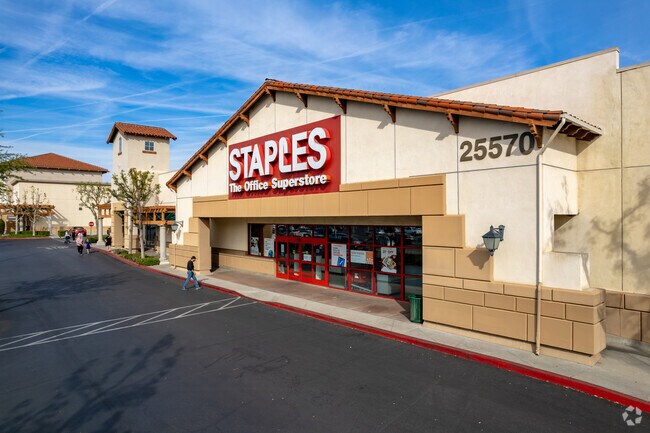
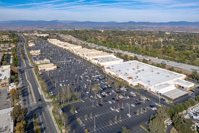
25560 The Old Rd
2826-096-008
P.M 280-41-59 LOT 15
Regionalshoppingcenterormallwithanchorstore
LOS ANGELES
LCA2
California
AE The base floodplain where base flood elevations are provided. AE Zones are now used on new format FIRMs instead of A1-A30 Zones.
15
2024
4.74 AC
2025
Santa Clarita Valley
920326
Los Angeles
66,737 SF
Los Angeles-Long Beach-Glendale, CA
NEARBY LISTINGS FOR SALE OR LEASE
DEMOGRAPHICS near 25560 The Old Rd
1 mile
3 mile
5 mile
2025 Total Population
15,769
69,584
115,537
2030 Population
15,643
69,128
114,876
Pop Growth 2025-2030
(0.80%)
(0.66%)
(0.57%)
Average Age
41
41
41
2025 Total Households
5,661
24,481
39,975
HH Growth 2025-2030
(0.90%)
(0.84%)
(0.78%)
Median Household Inc
$119,935
$118,730
$121,355
Avg Household Size
2.70
2.70
2.80
2025 Avg HH Vehicles
2.00
2.00
2.00
Median Home Value
$821,061
$837,092
$803,474
Median Year Built
1990
1987
1990
Nearby Places
Map Layers
Map Styles
 Street
 Aerial
Transit
 Traffic
 Biking
Places
Listings with unknown addresses are not visible on the map
- Restaurants
- Banks
- Shops
- Fitness
- Groceries
PUBLIC TRANSPORTATION
COMMUTER RAIL
Newhall (Antelope Valley Line - Southern California Regional Rail Authority (Metrolink))
Drive
Walk
Distance
Newhall (Antelope Valley Line - Southern California Regional Rail Authority (Metrolink))
9 min
3.3 mi
Santa Clarita (Antelope Valley Line - Southern California Regional Rail Authority (Metrolink))
Drive
Walk
Distance
Santa Clarita (Antelope Valley Line - Southern California Regional Rail Authority (Metrolink))
11 min
5.7 mi
AIRPORT
Bob Hope
Drive
Walk
Distance
Bob Hope
26 min
18.9 mi
Freight Ports
The Port of Hueneme
Drive
Walk
Distance
The Port of Hueneme
75 min
53.0 mi
SALE & LEASE HISTORY
LISTING DATE
SALE/LEASE

Sep 25, 2016
For Lease
Nearby Properties
Address
Land Use
TOTAL SIZE
Lot Size
Zoning
Address
Land Use
TOTAL SIZE
Lot Size
Zoning
491,654 SF
17.56 AC
SCPI
Address
Land Use
TOTAL SIZE
Lot Size
Zoning
479,178 SF
14.17 AC
SCCR
Address
Land Use
TOTAL SIZE
Lot Size
Zoning
173,298 SF
12.42 AC
LCA25*
Address
Land Use
TOTAL SIZE
Lot Size
Zoning
200,717 SF
7.62 AC
SCCR
Address
Land Use
TOTAL SIZE
Lot Size
Zoning
197,558 SF
3.08 AC
SCBP
Address
Land Use
TOTAL SIZE
Lot Size
Zoning
495,604 SF
38.40 AC
SCI
Address
Land Use
TOTAL SIZE
Lot Size
Zoning
291,344 SF
15.32 AC
LCA2
Address
Land Use
TOTAL SIZE
Lot Size
Zoning
1,014,267 SF
59.95 AC
SCPI
Address
Land Use
TOTAL SIZE
Lot Size
Zoning
225,723 SF
11.37 AC
Address
Land Use
TOTAL SIZE
Lot Size
Zoning
245,053 SF
19.81 AC
LCA25*
Address
Land Use
TOTAL SIZE
Lot Size
Zoning
258,260 SF
12.67 AC
SCSP
Address
Land Use
TOTAL SIZE
Lot Size
Zoning
139,196 SF
8.79 AC
SCUR5
Address
Land Use
TOTAL SIZE
Lot Size
Zoning
266,614 SF
7.47 AC
SCSP
Address
Land Use
TOTAL SIZE
Lot Size
Zoning
325,406 SF
4.11 AC
SCBP
Address
Land Use
TOTAL SIZE
Lot Size
Zoning
161,103 SF
4.68 AC
SCUR4
Address
Land Use
TOTAL SIZE
Lot Size
Zoning
180,450 SF
5.08 AC
SCCR
Address
Land Use
TOTAL SIZE
Lot Size
Zoning
402,480 SF
13.58 AC
SCCN
Address
Land Use
TOTAL SIZE
Lot Size
Zoning
118,380 SF
4.52 AC
LCA2
Address
Land Use
TOTAL SIZE
Lot Size
Zoning
83,698 SF
8.94 AC
SCPI
Address
Land Use
TOTAL SIZE
Lot Size
Zoning
174,562 SF
4.01 AC
SCCR
Address
Land Use
TOTAL SIZE
Lot Size
Zoning
212,783 SF
11.44 AC
SCBP
Address
Land Use
TOTAL SIZE
Lot Size
Zoning
132,668 SF
0.90 AC
SCCR
Address
Land Use
TOTAL SIZE
Lot Size
Zoning
271,399 SF
7.49 AC
LCA25*
Address
Land Use
TOTAL SIZE
Lot Size
Zoning
131,425 SF
0.82 AC
SCCR
Address
Land Use
TOTAL SIZE
Lot Size
Zoning
93,450 SF
4.83 AC
LCA2
Address
Land Use
TOTAL SIZE
Lot Size
Zoning
178,388 SF
6.37 AC
LCA2
Address
Land Use
TOTAL SIZE
Lot Size
Zoning
86,201 SF
3.68 AC
SCUR4
Address
Land Use
TOTAL SIZE
Lot Size
Zoning
320,405 SF
8.03 AC
SCCR
Address
Land Use
TOTAL SIZE
Lot Size
Zoning
125,275 SF
2.39 AC
SCCC
Address
Land Use
TOTAL SIZE
Lot Size
Zoning
138,025 SF
14.51 AC
LCA2
The World's #1 Commercial Real Estate Marketplace
Connect with us
© 2026 CoStar Group
The information above has been obtained from sources believed reliable. While we do not doubt its accuracy we have not verified it and make no guarantee, warranty or representation about it. It is your responsibility to independently confirm its accuracy and completeness. Any projections, opinions, assumptions, or estimates used are for example only and do not represent the current or future performance of the property. The value of this transaction to you depends on tax and other factors which should be evaluated by your tax, financial, and legal advisors. You and your advisors should conduct a careful, independent investigation of the property to determine to your satisfaction the suitability of the property for your needs.