Property Record
25575 Campbellton Rd, San Antonio, TX 78264

NEARBY LISTINGS FOR SALE OR LEASE
-
-
View all San Antonio listings for sale on LoopNet.com
Property Detail
25575 Campbellton Rd
San Antonio-New Braunfels, TX
Conv A/S Code
04146-000-0020
CB 4143 P-6A (1.74 AC), CB 4146 P-1 (.18 AC), P-2 ABS 1141; CB 4149 P-4 (35.0 AC), P-5B (19.04 AC)ABS 535 ; CB 4148 P-1 ABS 979 (47.5 AC); CB 4150 P-2B (28.15 AC), P-3 (42.83 AC); CB 4156 P-1 ABS 1064 (118.114 AC) 2023-REMAINS PER SPLIT/MERGE PER OWN
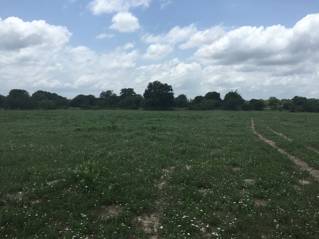
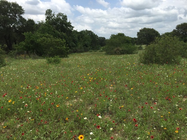
Privatepreserveopenspacevacantlandforestlandconservation
Bexar
A
Texas
48493C0250C
2
2024
298.91 AC
2025
South
152201
San Antonio
DEMOGRAPHICS near 25575 Campbellton Rd
1 Mile
3 Mile
5 Mile
2024 Total Population
457
8,194
19,446
2029 Population
486
8,783
20,864
Pop Growth 2024-2029
+ 6.35%
+ 7.19%
+ 7.29%
Average Age
38
37
36
2024 Total Households
144
2,485
5,878
HH Growth 2024-2029
+ 6.25%
+ 7.28%
+ 7.38%
Median Household Inc
$34,999
$35,652
$43,152
Avg Household Size
3.10
3.20
3.20
2024 Avg HH Vehicles
2.00
2.00
2.00
Median Home Value
$178,333
$146,559
$138,575
Median Year Built
1991
1994
1995
Nearby Places
Map Layers
Map Styles
 Street
 Aerial
- Restaurants
- Banks
- Shops
- Fitness
- Groceries
PUBLIC TRANSPORTATION
AIRPORT
San Antonio International
DRIVE
WALK
Distance
San Antonio International
40 min
32.3 mi
Freight Ports
Port of Corpus Christi
DRIVE
WALK
Distance
Port of Corpus Christi
130 min
123.6 mi
SALE & LEASE HISTORY
LISTING DATE
SALE/LEASE

Jun 14, 2017
For Sale
Nearby Properties
Address
Land Use
TOTAL SIZE
Lot Size
Zoning
Address
Land Use
TOTAL SIZE
Lot Size
Zoning
185.58 AC
Address
Land Use
TOTAL SIZE
Lot Size
Zoning
203.51 AC
Address
Land Use
TOTAL SIZE
Lot Size
Zoning
295.27 AC
Address
Land Use
TOTAL SIZE
Lot Size
Zoning
800 SF
450.79 AC
Address
Land Use
TOTAL SIZE
Lot Size
Zoning
240 SF
580.65 AC
Address
Land Use
TOTAL SIZE
Lot Size
Zoning
224.74 AC
Address
Land Use
TOTAL SIZE
Lot Size
Zoning
137.89 AC
Address
Land Use
TOTAL SIZE
Lot Size
Zoning
18,204 SF
20.44 AC
Address
Land Use
TOTAL SIZE
Lot Size
Zoning
10,452 SF
3.41 AC
Address
Land Use
TOTAL SIZE
Lot Size
Zoning
9,034 SF
1.23 AC
Address
Land Use
TOTAL SIZE
Lot Size
Zoning
9,173 SF
1.50 AC
Address
Land Use
TOTAL SIZE
Lot Size
Zoning
3,280 SF
186.35 AC
Address
Land Use
TOTAL SIZE
Lot Size
Zoning
34,626 SF
0.60 AC
Address
Land Use
TOTAL SIZE
Lot Size
Zoning
95.75 AC
Address
Land Use
TOTAL SIZE
Lot Size
Zoning
6,820 SF
147 AC
Address
Land Use
TOTAL SIZE
Lot Size
Zoning
112.73 AC
Address
Land Use
TOTAL SIZE
Lot Size
Zoning
3,200 SF
122.34 AC
Address
Land Use
TOTAL SIZE
Lot Size
Zoning
4,147 SF
179 AC
Address
Land Use
TOTAL SIZE
Lot Size
Zoning
31,683 SF
1.04 AC
Address
Land Use
TOTAL SIZE
Lot Size
Zoning
Address
Land Use
TOTAL SIZE
Lot Size
Zoning
90.94 AC
Address
Land Use
TOTAL SIZE
Lot Size
Zoning
6,350 SF
5.05 AC
Address
Land Use
TOTAL SIZE
Lot Size
Zoning
Address
Land Use
TOTAL SIZE
Lot Size
Zoning
224 SF
137.53 AC
Address
Land Use
TOTAL SIZE
Lot Size
Zoning
1,238 SF
3.29 AC
Address
Land Use
TOTAL SIZE
Lot Size
Zoning
137.50 AC
Address
Land Use
TOTAL SIZE
Lot Size
Zoning
8,640 SF
10 AC
Address
Land Use
TOTAL SIZE
Lot Size
Zoning
714 SF
66.54 AC
Address
Land Use
TOTAL SIZE
Lot Size
Zoning
280 SF
57.94 AC
The World's #1 Commercial Real Estate Marketplace
Connect with us
© 2025 CoStar Group
The information above has been obtained from sources believed reliable. While we do not doubt its accuracy we have not verified it and make no guarantee, warranty or representation about it. It is your responsibility to independently confirm its accuracy and completeness. Any projections, opinions, assumptions, or estimates used are for example only and do not represent the current or future performance of the property. The value of this transaction to you depends on tax and other factors which should be evaluated by your tax, financial, and legal advisors. You and your advisors should conduct a careful, independent investigation of the property to determine to your satisfaction the suitability of the property for your needs.