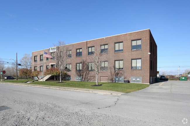
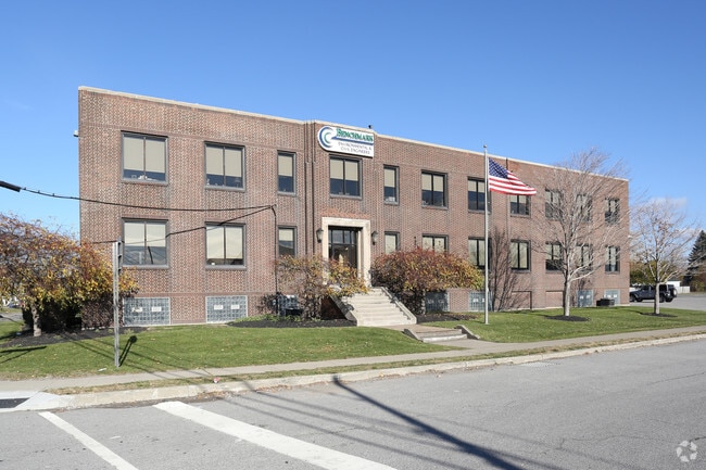
Property Record
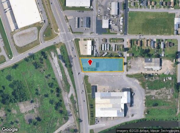
2558 Hamburg Tpke, Buffalo, NY 14218
NEARBY LISTINGS FOR SALE OR LEASE
Property Detail
2558 Hamburg Tpke
140900-141-200-0001-010-110
COURT ORDER CHG. 7-31-89 INDEX # H-80705 PT WILLMUTH ST
Officebuilding
Erie
X
New York
36029C0328J
10.110
2025
1.30 AC
2024
South
017400
Buffalo/Niagara Falls
9,930 SF
Buffalo-Cheektowaga-Niagara Falls, NY
DEMOGRAPHICS near 2558 Hamburg Tpke
1 Mile
3 Mile
5 Mile
2024 Total Population
7,548
49,772
130,773
2029 Population
7,395
48,704
129,016
Pop Growth 2024-2029
(2.03%)
(2.15%)
(1.34%)
Average Age
36
40
41
2024 Total Households
2,855
21,615
58,135
HH Growth 2024-2029
(2.14%)
(2.23%)
(1.35%)
Median Household Inc
$34,289
$56,490
$55,226
Avg Household Size
2.50
2.20
2.20
2024 Avg HH Vehicles
1.00
2.00
1.00
Median Home Value
$73,731
$145,395
$157,581
Median Year Built
1947
1949
1954
Nearby Places
Map Layers
Map Styles
 Street
 Aerial
- Restaurants
- Banks
- Shops
- Fitness
- Groceries
PUBLIC TRANSPORTATION
COMMUTER RAIL
DRIVE
WALK
Distance
10 min
5.9 mi
AIRPORT
Buffalo Niagara International
DRIVE
WALK
Distance
Buffalo Niagara International
28 min
17.0 mi
Niagara Falls International
DRIVE
WALK
Distance
Niagara Falls International
37 min
25.2 mi
SALE & LEASE HISTORY
LISTING DATE
SALE/LEASE

Nov 18, 2016
For Lease
Nearby Properties
Address
Land Use
TOTAL SIZE
Lot Size
Zoning
Address
Land Use
TOTAL SIZE
Lot Size
Zoning
42.90 AC
M1
Address
Land Use
TOTAL SIZE
Lot Size
Zoning
425,796 SF
7.10 AC
D-M
Address
Land Use
TOTAL SIZE
Lot Size
Zoning
5,340 SF
233.33 AC
D-ON
Address
Land Use
TOTAL SIZE
Lot Size
Zoning
337,198 SF
51.05 AC
M1
Address
Land Use
TOTAL SIZE
Lot Size
Zoning
80,440 SF
1.54 AC
N-1C
Address
Land Use
TOTAL SIZE
Lot Size
Zoning
702.40 AC
IND
Address
Land Use
TOTAL SIZE
Lot Size
Zoning
48.14 AC
OP
Address
Land Use
TOTAL SIZE
Lot Size
Zoning
6,514 SF
68.20 AC
D-OG
Address
Land Use
TOTAL SIZE
Lot Size
Zoning
18,840 SF
114.12 AC
M3
Address
Land Use
TOTAL SIZE
Lot Size
Zoning
151,200 SF
8.36 AC
BETH
Address
Land Use
TOTAL SIZE
Lot Size
Zoning
151,200 SF
8.29 AC
IND
Address
Land Use
TOTAL SIZE
Lot Size
Zoning
43,942 SF
14.34 AC
CBD
Address
Land Use
TOTAL SIZE
Lot Size
Zoning
110,150 SF
39.23 AC
IND
Address
Land Use
TOTAL SIZE
Lot Size
Zoning
9.91 AC
IND
Address
Land Use
TOTAL SIZE
Lot Size
Zoning
314,904 SF
30.05 AC
D-IL
Address
Land Use
TOTAL SIZE
Lot Size
Zoning
15.78 AC
IND
Address
Land Use
TOTAL SIZE
Lot Size
Zoning
7.50 AC
Address
Land Use
TOTAL SIZE
Lot Size
Zoning
107,760 SF
4.14 AC
D-E
Address
Land Use
TOTAL SIZE
Lot Size
Zoning
0.07 AC
Address
Land Use
TOTAL SIZE
Lot Size
Zoning
123 AC
OP
Address
Land Use
TOTAL SIZE
Lot Size
Zoning
Address
Land Use
TOTAL SIZE
Lot Size
Zoning
97,000 SF
133.30 AC
MC/I
Address
Land Use
TOTAL SIZE
Lot Size
Zoning
165,478 SF
9.79 AC
Address
Land Use
TOTAL SIZE
Lot Size
Zoning
198,558 SF
3.16 AC
N-3R
Address
Land Use
TOTAL SIZE
Lot Size
Zoning
279,026 SF
25.08 AC
D-IL
Address
Land Use
TOTAL SIZE
Lot Size
Zoning
72.11 AC
Address
Land Use
TOTAL SIZE
Lot Size
Zoning
28,578 SF
10.46 AC
C1
Address
Land Use
TOTAL SIZE
Lot Size
Zoning
5,600 SF
106.10 AC
PR
Address
Land Use
TOTAL SIZE
Lot Size
Zoning
33,345 SF
2.50 AC
OP
Address
Land Use
TOTAL SIZE
Lot Size
Zoning
149,858 SF
24.18 AC
The World's #1 Commercial Real Estate Marketplace
Connect with us
© 2025 CoStar Group
The information above has been obtained from sources believed reliable. While we do not doubt its accuracy we have not verified it and make no guarantee, warranty or representation about it. It is your responsibility to independently confirm its accuracy and completeness. Any projections, opinions, assumptions, or estimates used are for example only and do not represent the current or future performance of the property. The value of this transaction to you depends on tax and other factors which should be evaluated by your tax, financial, and legal advisors. You and your advisors should conduct a careful, independent investigation of the property to determine to your satisfaction the suitability of the property for your needs.