Property Record
25580 Blanco Rd, San Antonio, TX 78260


Property Detail
25580 Blanco Rd
San Antonio-New Braunfels, TX
CB 4847B (TIMBERWOOD C STORE), BLOCK 79 LOT 40 2022- NA PER PLAT 20002/801 FILED 6-11-2021. ASGIS08-27-2021.
04847-279-0400
BEXAR
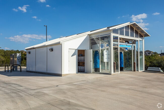
Servicestation
Texas
B and X Area of moderate flood hazard, usually the area between the limits of the 100-year and 500-year floods.
40
2025
2.14 AC
2025
Far North Central
980001
San Antonio
46,891 SF
NEARBY LISTINGS FOR SALE OR LEASE
-
-
View all San Antonio listings for sale on LoopNet.com
DEMOGRAPHICS near 25580 Blanco Rd
1 mile
3 mile
5 mile
2025 Total Population
2,595
34,512
93,350
2030 Population
2,742
36,513
98,625
Pop Growth 2025-2030
+ 5.66%
+ 5.80%
+ 5.65%
Average Age
42
39
39
2025 Total Households
873
11,311
32,271
HH Growth 2025-2030
+ 5.84%
+ 5.89%
+ 5.79%
Median Household Inc
$185,691
$148,975
$128,129
Avg Household Size
2.90
3.00
2.80
2025 Avg HH Vehicles
3.00
2.00
2.00
Median Home Value
$604,596
$471,136
$473,302
Median Year Built
2004
2005
2005
Nearby Places
Map Layers
Map Styles
 Street
 Aerial
Layers
 Traffic
 Biking
Places
Listings with unknown addresses are not visible on the map
- Restaurants
- Banks
- Shops
- Fitness
- Groceries
PUBLIC TRANSPORTATION
AIRPORT
San Antonio International
Drive
Walk
Distance
San Antonio International
20 min
14.3 mi
Freight Ports
Calhoun Port
Drive
Walk
Distance
Calhoun Port
195 min
163.2 mi
Nearby Properties
Address
Land Use
TOTAL SIZE
Lot Size
Zoning
Address
Land Use
TOTAL SIZE
Lot Size
Zoning
225,204 SF
32.21 AC
Address
Land Use
TOTAL SIZE
Lot Size
Zoning
330,888 SF
19.58 AC
Address
Land Use
TOTAL SIZE
Lot Size
Zoning
364,922 SF
23.73 AC
Address
Land Use
TOTAL SIZE
Lot Size
Zoning
203,966 SF
7.52 AC
Address
Land Use
TOTAL SIZE
Lot Size
Zoning
78,896 SF
8.49 AC
Address
Land Use
TOTAL SIZE
Lot Size
Zoning
85,910 SF
10.44 AC
Address
Land Use
TOTAL SIZE
Lot Size
Zoning
54,150 SF
3.47 AC
Address
Land Use
TOTAL SIZE
Lot Size
Zoning
99,291 SF
2.26 AC
Address
Land Use
TOTAL SIZE
Lot Size
Zoning
87,090 SF
2.77 AC
Address
Land Use
TOTAL SIZE
Lot Size
Zoning
34.92 AC
Address
Land Use
TOTAL SIZE
Lot Size
Zoning
Address
Land Use
TOTAL SIZE
Lot Size
Zoning
11,487 SF
1.54 AC
Address
Land Use
TOTAL SIZE
Lot Size
Zoning
8,740 SF
6.36 AC
Address
Land Use
TOTAL SIZE
Lot Size
Zoning
46,113 SF
2.69 AC
Address
Land Use
TOTAL SIZE
Lot Size
Zoning
63,467 SF
3.18 AC
Address
Land Use
TOTAL SIZE
Lot Size
Zoning
15,966 SF
1.72 AC
Address
Land Use
TOTAL SIZE
Lot Size
Zoning
18,969 SF
2.92 AC
Address
Land Use
TOTAL SIZE
Lot Size
Zoning
13,172 SF
9.97 AC
Address
Land Use
TOTAL SIZE
Lot Size
Zoning
12,871 SF
1.64 AC
Address
Land Use
TOTAL SIZE
Lot Size
Zoning
4,896 SF
3.06 AC
Address
Land Use
TOTAL SIZE
Lot Size
Zoning
39,433 SF
1.17 AC
Address
Land Use
TOTAL SIZE
Lot Size
Zoning
7.47 AC
Address
Land Use
TOTAL SIZE
Lot Size
Zoning
12,180 SF
0.75 AC
Address
Land Use
TOTAL SIZE
Lot Size
Zoning
13,904 SF
2.36 AC
Address
Land Use
TOTAL SIZE
Lot Size
Zoning
9.73 AC
Address
Land Use
TOTAL SIZE
Lot Size
Zoning
19,523 SF
1.68 AC
Address
Land Use
TOTAL SIZE
Lot Size
Zoning
16,100 SF
1.62 AC
Address
Land Use
TOTAL SIZE
Lot Size
Zoning
Address
Land Use
TOTAL SIZE
Lot Size
Zoning
44,682 SF
2.31 AC
The World's #1 Commercial Real Estate Marketplace
Connect with us
© 2026 CoStar Group
The information above has been obtained from sources believed reliable. While we do not doubt its accuracy we have not verified it and make no guarantee, warranty or representation about it. It is your responsibility to independently confirm its accuracy and completeness. Any projections, opinions, assumptions, or estimates used are for example only and do not represent the current or future performance of the property. The value of this transaction to you depends on tax and other factors which should be evaluated by your tax, financial, and legal advisors. You and your advisors should conduct a careful, independent investigation of the property to determine to your satisfaction the suitability of the property for your needs.