Property Record
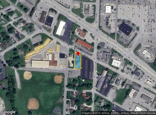
2559 Darlington Rd, Coraopolis, PA 15108

NEARBY LISTINGS FOR SALE OR LEASE
Property Detail
2559 Darlington Rd
57-022-0120.000
0.44 AC HSE GAR
Commercialnec
Beaver
X
Pennsylvania
42007C0045D
0.44 AC
2024
Beaver County
2025
Pittsburgh
451300
Pittsburgh, PA
1,416 SF
DEMOGRAPHICS near 2559 Darlington Rd
1 Mile
3 Mile
5 Mile
2024 Total Population
2,530
17,950
38,709
2029 Population
2,476
17,540
37,845
Pop Growth 2024-2029
(2.13%)
(2.28%)
(2.23%)
Average Age
45
42
43
2024 Total Households
1,019
7,207
15,794
HH Growth 2024-2029
(2.16%)
(2.39%)
(2.29%)
Median Household Inc
$105,921
$72,536
$62,143
Avg Household Size
2.40
2.30
2.30
2024 Avg HH Vehicles
2.00
2.00
2.00
Median Home Value
$240,000
$187,176
$171,232
Median Year Built
1968
1960
1956
Nearby Places
Map Layers
Map Styles
 Street
 Aerial
- Restaurants
- Banks
- Shops
- Fitness
- Groceries
PUBLIC TRANSPORTATION
AIRPORT
Pittsburgh International
DRIVE
WALK
Distance
Pittsburgh International
35 min
24.4 mi
Freight Ports
Port of Toledo
DRIVE
WALK
Distance
Port of Toledo
226 min
199.5 mi
Nearby Properties
Address
Land Use
TOTAL SIZE
Lot Size
Zoning
Address
Land Use
TOTAL SIZE
Lot Size
Zoning
24,364 SF
37.65 AC
Address
Land Use
TOTAL SIZE
Lot Size
Zoning
14.70 AC
Address
Land Use
TOTAL SIZE
Lot Size
Zoning
89,084 SF
58.57 AC
Address
Land Use
TOTAL SIZE
Lot Size
Zoning
78,562 SF
2.19 AC
Address
Land Use
TOTAL SIZE
Lot Size
Zoning
9,984 SF
261.69 AC
Address
Land Use
TOTAL SIZE
Lot Size
Zoning
74,951 SF
31.03 AC
Address
Land Use
TOTAL SIZE
Lot Size
Zoning
54,830 SF
26.44 AC
Address
Land Use
TOTAL SIZE
Lot Size
Zoning
38,204 SF
8.03 AC
Address
Land Use
TOTAL SIZE
Lot Size
Zoning
26,301 SF
11.17 AC
Address
Land Use
TOTAL SIZE
Lot Size
Zoning
12,982 SF
212.20 AC
Address
Land Use
TOTAL SIZE
Lot Size
Zoning
89,732 SF
8.20 AC
Address
Land Use
TOTAL SIZE
Lot Size
Zoning
99,072 SF
5.49 AC
Address
Land Use
TOTAL SIZE
Lot Size
Zoning
Address
Land Use
TOTAL SIZE
Lot Size
Zoning
66,640 SF
6.52 AC
Address
Land Use
TOTAL SIZE
Lot Size
Zoning
62,784 SF
11.98 AC
Address
Land Use
TOTAL SIZE
Lot Size
Zoning
27,460 SF
2.04 AC
Address
Land Use
TOTAL SIZE
Lot Size
Zoning
72,000 SF
10.36 AC
Address
Land Use
TOTAL SIZE
Lot Size
Zoning
56,705 SF
12.03 AC
Address
Land Use
TOTAL SIZE
Lot Size
Zoning
25,440 SF
2.35 AC
Address
Land Use
TOTAL SIZE
Lot Size
Zoning
13,040 SF
6.82 AC
Address
Land Use
TOTAL SIZE
Lot Size
Zoning
7,500 SF
3.85 AC
Address
Land Use
TOTAL SIZE
Lot Size
Zoning
14,480 SF
22.60 AC
Address
Land Use
TOTAL SIZE
Lot Size
Zoning
40,464 SF
4 AC
Address
Land Use
TOTAL SIZE
Lot Size
Zoning
54,249 SF
1.60 AC
Address
Land Use
TOTAL SIZE
Lot Size
Zoning
3.22 AC
Address
Land Use
TOTAL SIZE
Lot Size
Zoning
3,222 SF
34 AC
Address
Land Use
TOTAL SIZE
Lot Size
Zoning
7,658 SF
3.56 AC
Address
Land Use
TOTAL SIZE
Lot Size
Zoning
20,214 SF
1.06 AC
Address
Land Use
TOTAL SIZE
Lot Size
Zoning
12,145 SF
7.58 AC
Address
Land Use
TOTAL SIZE
Lot Size
Zoning
5,276 SF
9.90 AC
The World's #1 Commercial Real Estate Marketplace
Connect with us
© 2025 CoStar Group
The information above has been obtained from sources believed reliable. While we do not doubt its accuracy we have not verified it and make no guarantee, warranty or representation about it. It is your responsibility to independently confirm its accuracy and completeness. Any projections, opinions, assumptions, or estimates used are for example only and do not represent the current or future performance of the property. The value of this transaction to you depends on tax and other factors which should be evaluated by your tax, financial, and legal advisors. You and your advisors should conduct a careful, independent investigation of the property to determine to your satisfaction the suitability of the property for your needs.