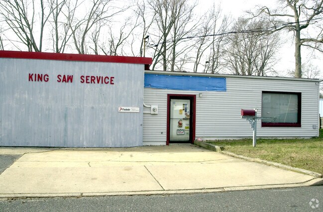
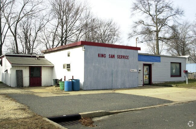
Property Record
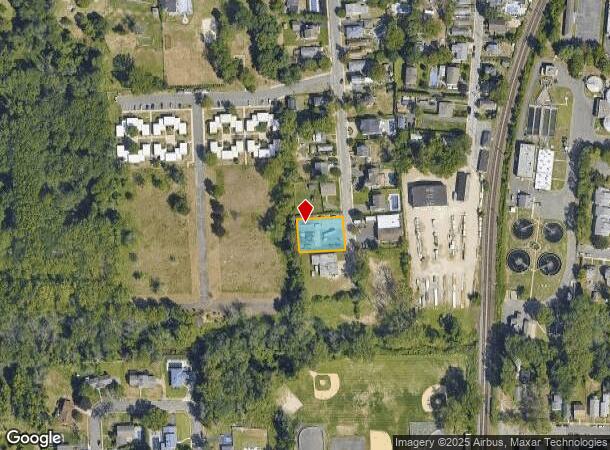
256 Overbrook Ave, Oakhurst, NJ 07755
NEARBY LISTINGS FOR SALE OR LEASE
Property Detail
256 Overbrook Ave
37-00022-0000-00039
Monmouth
Autorepair
New Jersey
AE
39
34025C0194F
0.31 AC
2024
Eastern Monmouth
2025
Northern New Jersey
806400
Lakewood-New Brunswick, NJ
2,300 SF
DEMOGRAPHICS near 256 Overbrook Ave
1 Mile
3 Mile
5 Mile
2024 Total Population
6,709
71,403
154,846
2029 Population
7,055
72,211
155,707
Pop Growth 2024-2029
+ 5.16%
+ 1.13%
+ 0.56%
Average Age
41
41
42
2024 Total Households
2,321
28,807
64,168
HH Growth 2024-2029
+ 5.17%
+ 1.15%
+ 0.53%
Median Household Inc
$106,127
$80,825
$82,390
Avg Household Size
2.80
2.30
2.30
2024 Avg HH Vehicles
2.00
2.00
2.00
Median Home Value
$755,856
$568,488
$491,711
Median Year Built
1956
1965
1969
Nearby Places
Map Layers
Map Styles
 Street
 Aerial
- Restaurants
- Banks
- Shops
- Fitness
- Groceries
PUBLIC TRANSPORTATION
COMMUTER RAIL
Elberon (North Jersey Coast Line - NJ Transit Commuter Rail (NJ Transit))
DRIVE
WALK
Distance
Elberon (North Jersey Coast Line - NJ Transit Commuter Rail (NJ Transit))
2 min
17 min
0.9 mi
Allenhurst (North Jersey Coast Line - NJ Transit Commuter Rail (NJ Transit))
DRIVE
WALK
Distance
Allenhurst (North Jersey Coast Line - NJ Transit Commuter Rail (NJ Transit))
5 min
2.2 mi
Freight Ports
New York Container Terminal
DRIVE
WALK
Distance
New York Container Terminal
57 min
41.4 mi
Nearby Properties
Address
Land Use
TOTAL SIZE
Lot Size
Zoning
Address
Land Use
TOTAL SIZE
Lot Size
Zoning
13.75 AC
M
Address
Land Use
TOTAL SIZE
Lot Size
Zoning
75.16 AC
R-7
Address
Land Use
TOTAL SIZE
Lot Size
Zoning
7,819 SF
28.41 AC
R-1
Address
Land Use
TOTAL SIZE
Lot Size
Zoning
89,939 SF
51.49 AC
I
Address
Land Use
TOTAL SIZE
Lot Size
Zoning
113.60 AC
WBA
Address
Land Use
TOTAL SIZE
Lot Size
Zoning
65,668 SF
111.60 AC
C50
Address
Land Use
TOTAL SIZE
Lot Size
Zoning
35.50 AC
R-7
Address
Land Use
TOTAL SIZE
Lot Size
Zoning
22,877 SF
10.35 AC
IC
Address
Land Use
TOTAL SIZE
Lot Size
Zoning
293,262 SF
28.40 AC
HC
Address
Land Use
TOTAL SIZE
Lot Size
Zoning
1,100 SF
37.83 AC
C-2
Address
Land Use
TOTAL SIZE
Lot Size
Zoning
314,569 SF
22.05 AC
R-4
Address
Land Use
TOTAL SIZE
Lot Size
Zoning
79,391 SF
9.17 AC
C-4
Address
Land Use
TOTAL SIZE
Lot Size
Zoning
32.19 AC
R-7
Address
Land Use
TOTAL SIZE
Lot Size
Zoning
194,812 SF
55.01 AC
R-4
Address
Land Use
TOTAL SIZE
Lot Size
Zoning
1.61 AC
R1
Address
Land Use
TOTAL SIZE
Lot Size
Zoning
16.49 AC
R-2
Address
Land Use
TOTAL SIZE
Lot Size
Zoning
705 SF
2.01 AC
WPRA
Address
Land Use
TOTAL SIZE
Lot Size
Zoning
137,672 SF
2.79 AC
BS
Address
Land Use
TOTAL SIZE
Lot Size
Zoning
20.62 AC
AR3P
Address
Land Use
TOTAL SIZE
Lot Size
Zoning
1,152 SF
87 SF
WPRA
Address
Land Use
TOTAL SIZE
Lot Size
Zoning
121,272 SF
3.93 AC
C-4
Address
Land Use
TOTAL SIZE
Lot Size
Zoning
14.23 AC
R-4
Address
Land Use
TOTAL SIZE
Lot Size
Zoning
5,407 SF
25.60 AC
C-3
Address
Land Use
TOTAL SIZE
Lot Size
Zoning
1,178 SF
21.78 AC
R-7
Address
Land Use
TOTAL SIZE
Lot Size
Zoning
157,580 SF
14.95 AC
R-4
Address
Land Use
TOTAL SIZE
Lot Size
Zoning
0.13 AC
BS
Address
Land Use
TOTAL SIZE
Lot Size
Zoning
40.82 AC
I
Address
Land Use
TOTAL SIZE
Lot Size
Zoning
108,629 SF
12.05 AC
HC
Address
Land Use
TOTAL SIZE
Lot Size
Zoning
Address
Land Use
TOTAL SIZE
Lot Size
Zoning
15 AC
R-7
The World's #1 Commercial Real Estate Marketplace
Connect with us
© 2026 CoStar Group
The information above has been obtained from sources believed reliable. While we do not doubt its accuracy we have not verified it and make no guarantee, warranty or representation about it. It is your responsibility to independently confirm its accuracy and completeness. Any projections, opinions, assumptions, or estimates used are for example only and do not represent the current or future performance of the property. The value of this transaction to you depends on tax and other factors which should be evaluated by your tax, financial, and legal advisors. You and your advisors should conduct a careful, independent investigation of the property to determine to your satisfaction the suitability of the property for your needs.