Property Record
256 Wallace Rd, Bedford, NH 03110


NEARBY LISTINGS FOR SALE OR LEASE
-
-
View all Bedford listings for lease on LoopNet.com
Property Detail
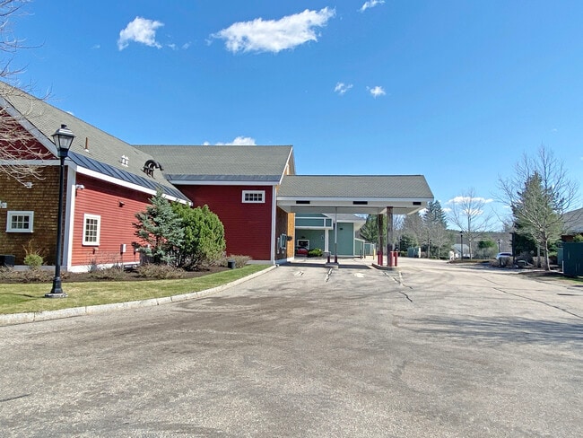
256 Wallace Rd
BEDD-000020-000038-000001
Hillsborough
Financialbuilding
New Hampshire
X
1
33011C0367D
1.74 AC
2024
Hillsborough
2024
Boston
002903
Manchester-Nashua, NH
3,744 SF
DEMOGRAPHICS near 256 Wallace Rd
1 Mile
3 Mile
5 Mile
2024 Total Population
1,817
20,783
91,249
2029 Population
1,859
21,344
92,860
Pop Growth 2024-2029
+ 2.31%
+ 2.70%
+ 1.77%
Average Age
40
42
40
2024 Total Households
579
6,993
34,930
HH Growth 2024-2029
+ 2.42%
+ 2.83%
+ 1.77%
Median Household Inc
$178,935
$150,039
$87,436
Avg Household Size
3.10
2.90
2.50
2024 Avg HH Vehicles
2.00
2.00
2.00
Median Home Value
$652,956
$547,256
$361,411
Median Year Built
1991
1987
1975
Nearby Places
Map Layers
Map Styles
 Street
 Aerial
- Restaurants
- Banks
- Shops
- Fitness
- Groceries
PUBLIC TRANSPORTATION
AIRPORT
Manchester Boston Regional
DRIVE
WALK
Distance
Manchester Boston Regional
17 min
7.7 mi
Freight Ports
Port of Boston
DRIVE
WALK
Distance
Port of Boston
89 min
63.2 mi
SALE & LEASE HISTORY
LISTING DATE
SALE/LEASE

Sep 09, 2019
For Lease
Mar 25, 2022
For Lease
Mar 04, 2020
For Lease
Jun 05, 2024
For Lease
Nearby Properties
Address
Land Use
TOTAL SIZE
Lot Size
Zoning
Address
Land Use
TOTAL SIZE
Lot Size
Zoning
347,230 SF
42.11 AC
RA
Address
Land Use
TOTAL SIZE
Lot Size
Zoning
Address
Land Use
TOTAL SIZE
Lot Size
Zoning
44,878 SF
12.89 AC
CO
Address
Land Use
TOTAL SIZE
Lot Size
Zoning
139,616 SF
18.47 AC
PZ
Address
Land Use
TOTAL SIZE
Lot Size
Zoning
95,643 SF
16 AC
RA
Address
Land Use
TOTAL SIZE
Lot Size
Zoning
122,900 SF
13.28 AC
PZ
Address
Land Use
TOTAL SIZE
Lot Size
Zoning
121,544 SF
12.22 AC
PZ
Address
Land Use
TOTAL SIZE
Lot Size
Zoning
66,911 SF
10.88 AC
PZ
Address
Land Use
TOTAL SIZE
Lot Size
Zoning
132,353 SF
15.52 AC
PZ
Address
Land Use
TOTAL SIZE
Lot Size
Zoning
37,253 SF
162.97 AC
CI
Address
Land Use
TOTAL SIZE
Lot Size
Zoning
76,720 SF
5 AC
CO
Address
Land Use
TOTAL SIZE
Lot Size
Zoning
76,174 SF
20.56 AC
CO
Address
Land Use
TOTAL SIZE
Lot Size
Zoning
75,394 SF
15.64 AC
RA
Address
Land Use
TOTAL SIZE
Lot Size
Zoning
97,267 SF
9.09 AC
OF
Address
Land Use
TOTAL SIZE
Lot Size
Zoning
114,808 SF
47.40 AC
RA
Address
Land Use
TOTAL SIZE
Lot Size
Zoning
53,578 SF
3.58 AC
CO
Address
Land Use
TOTAL SIZE
Lot Size
Zoning
87,306 SF
2.32 AC
PZ
Address
Land Use
TOTAL SIZE
Lot Size
Zoning
54,004 SF
14.90 AC
PZ
Address
Land Use
TOTAL SIZE
Lot Size
Zoning
79,480 SF
8.77 AC
CO
Address
Land Use
TOTAL SIZE
Lot Size
Zoning
49,133 SF
3.95 AC
CO
Address
Land Use
TOTAL SIZE
Lot Size
Zoning
85,263 SF
6.10 AC
PZ
Address
Land Use
TOTAL SIZE
Lot Size
Zoning
43,080 SF
2.71 AC
Address
Land Use
TOTAL SIZE
Lot Size
Zoning
57,016 SF
3.56 AC
PZ
Address
Land Use
TOTAL SIZE
Lot Size
Zoning
48,586 SF
6.86 AC
PZ
Address
Land Use
TOTAL SIZE
Lot Size
Zoning
41,196 SF
6.16 AC
PZ
Address
Land Use
TOTAL SIZE
Lot Size
Zoning
137,515 SF
IN
Address
Land Use
TOTAL SIZE
Lot Size
Zoning
58,820 SF
10 AC
RA
Address
Land Use
TOTAL SIZE
Lot Size
Zoning
33,388 SF
4.66 AC
PZ
Address
Land Use
TOTAL SIZE
Lot Size
Zoning
39,504 SF
2.52 AC
Address
Land Use
TOTAL SIZE
Lot Size
Zoning
60,908 SF
7.20 AC
CO
The World's #1 Commercial Real Estate Marketplace
Connect with us
© 2026 CoStar Group
The information above has been obtained from sources believed reliable. While we do not doubt its accuracy we have not verified it and make no guarantee, warranty or representation about it. It is your responsibility to independently confirm its accuracy and completeness. Any projections, opinions, assumptions, or estimates used are for example only and do not represent the current or future performance of the property. The value of this transaction to you depends on tax and other factors which should be evaluated by your tax, financial, and legal advisors. You and your advisors should conduct a careful, independent investigation of the property to determine to your satisfaction the suitability of the property for your needs.