Property Record
2560 E La Palma Ave, Anaheim, CA 92806


NEARBY LISTINGS FOR SALE OR LEASE
Property Detail
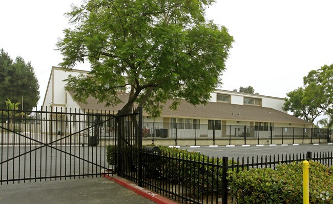
2560 E La Palma Ave
083-020-62
P BK 67 PG 6 PAR 1
Commercialnec
Orange
X
California
06059C0132J
1 AC
2024
North/East Anaheim
2025
Orange County (California)
086406
Anaheim-Santa Ana-Irvine, CA
11,408 SF
DEMOGRAPHICS near 2560 E La Palma Ave
1 mile
3 mile
5 mile
2024 Total Population
29,181
195,581
537,710
2029 Population
28,788
193,147
531,424
Pop Growth 2024-2029
(1.35%)
(1.24%)
(1.17%)
Average Age
36
37
38
2024 Total Households
7,859
59,337
169,140
HH Growth 2024-2029
(1.53%)
(1.39%)
(1.27%)
Median Household Inc
$76,468
$82,356
$89,699
Avg Household Size
3.50
3.10
3.00
2024 Avg HH Vehicles
2.00
2.00
2.00
Median Home Value
$690,992
$713,265
$756,928
Median Year Built
1968
1970
1970
Nearby Places
Map Layers
Map Styles
 Street
 Aerial
Transit
 Traffic
 Biking
Places
Listings with unknown addresses are not visible on the map
- Restaurants
- Banks
- Shops
- Fitness
- Groceries
PUBLIC TRANSPORTATION
COMMUTER RAIL
Anaheim Canyon (Inland Empire-Orange County Line - Southern California Regional Rail Authority (Metrolink))
Drive
Walk
Distance
Anaheim Canyon (Inland Empire-Orange County Line - Southern California Regional Rail Authority (Metrolink))
5 min
2.4 mi
Drive
Walk
Distance
7 min
3.6 mi
AIRPORT
John Wayne/Orange County
Drive
Walk
Distance
John Wayne/Orange County
19 min
14.3 mi
Long Beach (Daugherty Field)
Drive
Walk
Distance
Long Beach (Daugherty Field)
31 min
23.8 mi
Ontario International
Drive
Walk
Distance
Ontario International
39 min
29.3 mi
Freight Ports
Port of Long Beach
Drive
Walk
Distance
Port of Long Beach
35 min
23.3 mi
Nearby Properties
Address
Land Use
TOTAL SIZE
Lot Size
Zoning
Address
Land Use
TOTAL SIZE
Lot Size
Zoning
26.08 AC
Address
Land Use
TOTAL SIZE
Lot Size
Zoning
12.20 AC
Address
Land Use
TOTAL SIZE
Lot Size
Zoning
Address
Land Use
TOTAL SIZE
Lot Size
Zoning
Address
Land Use
TOTAL SIZE
Lot Size
Zoning
352,352 SF
12.98 AC
Address
Land Use
TOTAL SIZE
Lot Size
Zoning
4.29 AC
Address
Land Use
TOTAL SIZE
Lot Size
Zoning
29.16 AC
Address
Land Use
TOTAL SIZE
Lot Size
Zoning
Address
Land Use
TOTAL SIZE
Lot Size
Zoning
Address
Land Use
TOTAL SIZE
Lot Size
Zoning
Address
Land Use
TOTAL SIZE
Lot Size
Zoning
Address
Land Use
TOTAL SIZE
Lot Size
Zoning
4.25 AC
Address
Land Use
TOTAL SIZE
Lot Size
Zoning
4.79 AC
Address
Land Use
TOTAL SIZE
Lot Size
Zoning
Address
Land Use
TOTAL SIZE
Lot Size
Zoning
2.25 AC
Address
Land Use
TOTAL SIZE
Lot Size
Zoning
Address
Land Use
TOTAL SIZE
Lot Size
Zoning
10.83 AC
Address
Land Use
TOTAL SIZE
Lot Size
Zoning
3.35 AC
Address
Land Use
TOTAL SIZE
Lot Size
Zoning
Address
Land Use
TOTAL SIZE
Lot Size
Zoning
5.13 AC
Address
Land Use
TOTAL SIZE
Lot Size
Zoning
198,208 SF
11.62 AC
Address
Land Use
TOTAL SIZE
Lot Size
Zoning
1,404 SF
10.63 AC
Address
Land Use
TOTAL SIZE
Lot Size
Zoning
5.10 AC
Address
Land Use
TOTAL SIZE
Lot Size
Zoning
86,707 SF
9.07 AC
Address
Land Use
TOTAL SIZE
Lot Size
Zoning
12.72 AC
Address
Land Use
TOTAL SIZE
Lot Size
Zoning
Address
Land Use
TOTAL SIZE
Lot Size
Zoning
Address
Land Use
TOTAL SIZE
Lot Size
Zoning
10.43 AC
Address
Land Use
TOTAL SIZE
Lot Size
Zoning
Address
Land Use
TOTAL SIZE
Lot Size
Zoning
5.08 AC
The World's #1 Commercial Real Estate Marketplace
Connect with us
© 2026 CoStar Group
The information above has been obtained from sources believed reliable. While we do not doubt its accuracy we have not verified it and make no guarantee, warranty or representation about it. It is your responsibility to independently confirm its accuracy and completeness. Any projections, opinions, assumptions, or estimates used are for example only and do not represent the current or future performance of the property. The value of this transaction to you depends on tax and other factors which should be evaluated by your tax, financial, and legal advisors. You and your advisors should conduct a careful, independent investigation of the property to determine to your satisfaction the suitability of the property for your needs.