Property Record
2560 N Perris Blvd, Perris, CA 92571


NEARBY LISTINGS FOR SALE OR LEASE
Property Detail
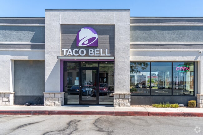
2560 N Perris Blvd
Riverside-San Bernardino-Ontario, CA
Parcel Map 26437
305-080-053
.69 ACRES IN PAR 20 PM 169/066 PM 26437
Restaurantbuilding
Riverside
X
California
06065C1430H
20
2024
0.69 AC
2025
Moreno Valley/Perris
042625
Inland Empire (California)
1,944 SF
DEMOGRAPHICS near 2560 N Perris Blvd
1 Mile
3 Mile
5 Mile
2024 Total Population
14,563
76,453
121,779
2029 Population
15,294
80,753
128,341
Pop Growth 2024-2029
+ 5.02%
+ 5.62%
+ 5.39%
Average Age
33
32
33
2024 Total Households
3,419
18,068
28,728
HH Growth 2024-2029
+ 4.53%
+ 5.29%
+ 5.01%
Median Household Inc
$71,426
$72,121
$74,146
Avg Household Size
4.10
4.00
4.00
2024 Avg HH Vehicles
3.00
3.00
3.00
Median Home Value
$325,379
$362,819
$376,664
Median Year Built
1991
1997
1993
Nearby Places
Map Layers
Map Styles
 Street
 Aerial
- Restaurants
- Banks
- Shops
- Fitness
- Groceries
PUBLIC TRANSPORTATION
AIRPORT
Ontario International
DRIVE
WALK
Distance
Ontario International
36 min
32.9 mi
Freight Ports
Port of Long Beach
DRIVE
WALK
Distance
Port of Long Beach
1 min
55.2 mi
Nearby Properties
Address
Land Use
TOTAL SIZE
Lot Size
Zoning
Address
Land Use
TOTAL SIZE
Lot Size
Zoning
1,189,664 SF
55.26 AC
Address
Land Use
TOTAL SIZE
Lot Size
Zoning
1,224,874 SF
59.05 AC
Address
Land Use
TOTAL SIZE
Lot Size
Zoning
1,009,869 SF
46.76 AC
Address
Land Use
TOTAL SIZE
Lot Size
Zoning
783,407 SF
36.72 AC
Address
Land Use
TOTAL SIZE
Lot Size
Zoning
656,695 SF
30.75 AC
RA5
Address
Land Use
TOTAL SIZE
Lot Size
Zoning
1,138,800 SF
43.93 AC
Address
Land Use
TOTAL SIZE
Lot Size
Zoning
1,309,754 SF
57.79 AC
IL
Address
Land Use
TOTAL SIZE
Lot Size
Zoning
579,708 SF
17.70 AC
LI
Address
Land Use
TOTAL SIZE
Lot Size
Zoning
343 SF
83.52 AC
LI
Address
Land Use
TOTAL SIZE
Lot Size
Zoning
678,087 SF
30.24 AC
Address
Land Use
TOTAL SIZE
Lot Size
Zoning
83.15 AC
Address
Land Use
TOTAL SIZE
Lot Size
Zoning
1,364,580 SF
80.02 AC
Address
Land Use
TOTAL SIZE
Lot Size
Zoning
325,560 SF
16.65 AC
Address
Land Use
TOTAL SIZE
Lot Size
Zoning
1,172,289 SF
41.82 AC
Address
Land Use
TOTAL SIZE
Lot Size
Zoning
1,582,985 SF
83.28 AC
LI
Address
Land Use
TOTAL SIZE
Lot Size
Zoning
285,482 SF
9.65 AC
Address
Land Use
TOTAL SIZE
Lot Size
Zoning
800,218 SF
37.43 AC
Address
Land Use
TOTAL SIZE
Lot Size
Zoning
355,031 SF
16.29 AC
LI
Address
Land Use
TOTAL SIZE
Lot Size
Zoning
406,650 SF
21.49 AC
Address
Land Use
TOTAL SIZE
Lot Size
Zoning
864,000 SF
43.64 AC
RA10
Address
Land Use
TOTAL SIZE
Lot Size
Zoning
426,546 SF
14.78 AC
LI
Address
Land Use
TOTAL SIZE
Lot Size
Zoning
428,730 SF
16.85 AC
Address
Land Use
TOTAL SIZE
Lot Size
Zoning
1,224,406 SF
74.17 AC
Address
Land Use
TOTAL SIZE
Lot Size
Zoning
302,333 SF
15.60 AC
LI
Address
Land Use
TOTAL SIZE
Lot Size
Zoning
423,665 SF
20.83 AC
Address
Land Use
TOTAL SIZE
Lot Size
Zoning
600,000 SF
26.69 AC
MSC
Address
Land Use
TOTAL SIZE
Lot Size
Zoning
202,538 SF
9.58 AC
Address
Land Use
TOTAL SIZE
Lot Size
Zoning
429,823 SF
20.07 AC
The World's #1 Commercial Real Estate Marketplace
Connect with us
© 2026 CoStar Group
The information above has been obtained from sources believed reliable. While we do not doubt its accuracy we have not verified it and make no guarantee, warranty or representation about it. It is your responsibility to independently confirm its accuracy and completeness. Any projections, opinions, assumptions, or estimates used are for example only and do not represent the current or future performance of the property. The value of this transaction to you depends on tax and other factors which should be evaluated by your tax, financial, and legal advisors. You and your advisors should conduct a careful, independent investigation of the property to determine to your satisfaction the suitability of the property for your needs.