Property Record
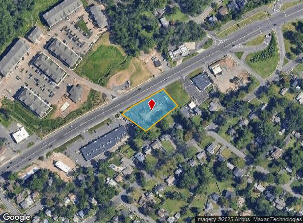
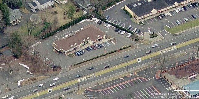
2560 Us Highway 22, Scotch Plains, NJ 07076

NEARBY LISTINGS FOR SALE OR LEASE
Property Detail
2560 Us Highway 22
16-04602-0000-00024
Union
Commercialnec
New Jersey
X
24
34035C0092E
0.92 AC
2024
Route 22 East
2025
Northern New Jersey
038500
Newark, NJ-PA
6,365 SF
DEMOGRAPHICS near 2560 Us Highway 22
1 Mile
3 Mile
5 Mile
2024 Total Population
8,916
95,759
277,738
2029 Population
8,854
95,246
275,756
Pop Growth 2024-2029
(0.70%)
(0.54%)
(0.71%)
Average Age
40
40
40
2024 Total Households
3,030
32,694
95,719
HH Growth 2024-2029
(0.79%)
(0.68%)
(0.82%)
Median Household Inc
$177,782
$150,654
$129,284
Avg Household Size
2.90
2.90
2.80
2024 Avg HH Vehicles
2.00
2.00
2.00
Median Home Value
$595,103
$690,872
$654,286
Median Year Built
1955
1956
1957
Nearby Places
Map Layers
Map Styles
 Street
 Aerial
- Restaurants
- Banks
- Shops
- Fitness
- Groceries
PUBLIC TRANSPORTATION
COMMUTER RAIL
Fanwood (Raritan Valley Line - NJ Transit Commuter Rail (NJ Transit))
DRIVE
WALK
Distance
Fanwood (Raritan Valley Line - NJ Transit Commuter Rail (NJ Transit))
8 min
2.6 mi
Westfield (Raritan Valley Line - NJ Transit Commuter Rail (NJ Transit))
DRIVE
WALK
Distance
Westfield (Raritan Valley Line - NJ Transit Commuter Rail (NJ Transit))
9 min
2.8 mi
AIRPORT
Newark Liberty International
DRIVE
WALK
Distance
Newark Liberty International
21 min
14.9 mi
LaGuardia
DRIVE
WALK
Distance
LaGuardia
55 min
35.6 mi
John F Kennedy International
DRIVE
WALK
Distance
John F Kennedy International
65 min
43.6 mi
Nearby Properties
Address
Land Use
TOTAL SIZE
Lot Size
Zoning
Address
Land Use
TOTAL SIZE
Lot Size
Zoning
Address
Land Use
TOTAL SIZE
Lot Size
Zoning
Address
Land Use
TOTAL SIZE
Lot Size
Zoning
151,088 SF
26.48 AC
CCRC
Address
Land Use
TOTAL SIZE
Lot Size
Zoning
153.40 AC
OR
Address
Land Use
TOTAL SIZE
Lot Size
Zoning
439.33 AC
Address
Land Use
TOTAL SIZE
Lot Size
Zoning
0.42 AC
R-1
Address
Land Use
TOTAL SIZE
Lot Size
Zoning
26.87 AC
H-D
Address
Land Use
TOTAL SIZE
Lot Size
Zoning
47.69 AC
MU
Address
Land Use
TOTAL SIZE
Lot Size
Zoning
47.80 AC
H-D
Address
Land Use
TOTAL SIZE
Lot Size
Zoning
3,538 SF
112 AC
Address
Land Use
TOTAL SIZE
Lot Size
Zoning
144.37 AC
Address
Land Use
TOTAL SIZE
Lot Size
Zoning
10.82 AC
H
Address
Land Use
TOTAL SIZE
Lot Size
Zoning
9.42 AC
Address
Land Use
TOTAL SIZE
Lot Size
Zoning
34.60 AC
MU
Address
Land Use
TOTAL SIZE
Lot Size
Zoning
140,732 SF
42.73 AC
OR
Address
Land Use
TOTAL SIZE
Lot Size
Zoning
15.79 AC
H-D
Address
Land Use
TOTAL SIZE
Lot Size
Zoning
56,476 SF
141.63 AC
Address
Land Use
TOTAL SIZE
Lot Size
Zoning
4.13 AC
Address
Land Use
TOTAL SIZE
Lot Size
Zoning
24.92 AC
MU
Address
Land Use
TOTAL SIZE
Lot Size
Zoning
Address
Land Use
TOTAL SIZE
Lot Size
Zoning
12.47 AC
H-D
Address
Land Use
TOTAL SIZE
Lot Size
Zoning
31,002 SF
3.64 AC
Address
Land Use
TOTAL SIZE
Lot Size
Zoning
188,800 SF
5.61 AC
Address
Land Use
TOTAL SIZE
Lot Size
Zoning
4.36 AC
OB
Address
Land Use
TOTAL SIZE
Lot Size
Zoning
4.74 AC
NC
Address
Land Use
TOTAL SIZE
Lot Size
Zoning
400,000 SF
1.50 AC
Address
Land Use
TOTAL SIZE
Lot Size
Zoning
19.84 AC
H-D
Address
Land Use
TOTAL SIZE
Lot Size
Zoning
61,912 SF
16 AC
OR
Address
Land Use
TOTAL SIZE
Lot Size
Zoning
18.87 AC
Address
Land Use
TOTAL SIZE
Lot Size
Zoning
23.66 AC
R2
The World's #1 Commercial Real Estate Marketplace
Connect with us
© 2025 CoStar Group
The information above has been obtained from sources believed reliable. While we do not doubt its accuracy we have not verified it and make no guarantee, warranty or representation about it. It is your responsibility to independently confirm its accuracy and completeness. Any projections, opinions, assumptions, or estimates used are for example only and do not represent the current or future performance of the property. The value of this transaction to you depends on tax and other factors which should be evaluated by your tax, financial, and legal advisors. You and your advisors should conduct a careful, independent investigation of the property to determine to your satisfaction the suitability of the property for your needs.