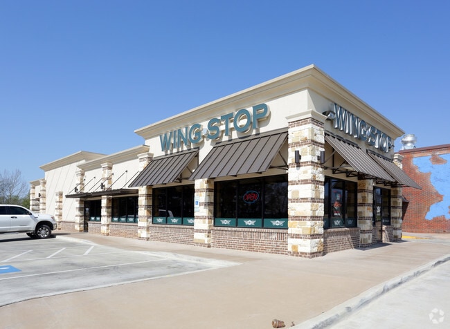
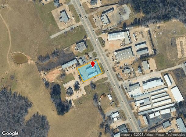
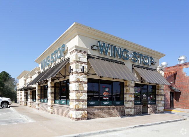
Property Record
2561 S Main St, Lindale, TX 75771
NEARBY LISTINGS FOR SALE OR LEASE
Property Detail
2561 S Main St
1-00000-0120-00-020000
A0120 J Bond
Restaurantbuilding
ABST A0120 J BONDTRACT 20
X
Smith
48423C0225D
Texas
2024
0.82 AC
2025
Tyler & Longview
001408
Other Market Areas
4,033 SF
Tyler, TX
DEMOGRAPHICS near 2561 S Main St
1 Mile
3 Mile
5 Mile
2024 Total Population
1,319
11,735
22,396
2029 Population
1,455
12,868
24,536
Pop Growth 2024-2029
+ 10.31%
+ 9.65%
+ 9.56%
Average Age
38
38
41
2024 Total Households
462
4,223
8,274
HH Growth 2024-2029
+ 9.74%
+ 9.07%
+ 8.97%
Median Household Inc
$73,208
$74,433
$77,049
Avg Household Size
2.80
2.70
2.60
2024 Avg HH Vehicles
2.00
2.00
2.00
Median Home Value
$228,571
$208,648
$224,974
Median Year Built
2000
1995
1991
Nearby Places
Map Layers
Map Styles
 Street
 Aerial
- Restaurants
- Banks
- Shops
- Fitness
- Groceries
PUBLIC TRANSPORTATION
AIRPORT
Tyler Pounds Regional
DRIVE
WALK
Distance
Tyler Pounds Regional
20 min
13.6 mi
Freight Ports
Port of Shreveport
DRIVE
WALK
Distance
Port of Shreveport
122 min
109.9 mi
Nearby Properties
Address
Land Use
TOTAL SIZE
Lot Size
Zoning
Address
Land Use
TOTAL SIZE
Lot Size
Zoning
1,680,000 SF
145.53 AC
Address
Land Use
TOTAL SIZE
Lot Size
Zoning
74,983 SF
5.44 AC
Address
Land Use
TOTAL SIZE
Lot Size
Zoning
72,185 SF
17.53 AC
Address
Land Use
TOTAL SIZE
Lot Size
Zoning
13,776 SF
3.64 AC
Address
Land Use
TOTAL SIZE
Lot Size
Zoning
28,988 SF
7.66 AC
Address
Land Use
TOTAL SIZE
Lot Size
Zoning
32,238 SF
10.61 AC
Address
Land Use
TOTAL SIZE
Lot Size
Zoning
163,900 SF
27.35 AC
Address
Land Use
TOTAL SIZE
Lot Size
Zoning
156,758 SF
21.96 AC
Address
Land Use
TOTAL SIZE
Lot Size
Zoning
44,616 SF
3.30 AC
Address
Land Use
TOTAL SIZE
Lot Size
Zoning
44,299 SF
9.36 AC
Address
Land Use
TOTAL SIZE
Lot Size
Zoning
26.50 AC
Address
Land Use
TOTAL SIZE
Lot Size
Zoning
66,065 SF
2.56 AC
Address
Land Use
TOTAL SIZE
Lot Size
Zoning
104,953 SF
6.37 AC
Address
Land Use
TOTAL SIZE
Lot Size
Zoning
19.02 AC
Address
Land Use
TOTAL SIZE
Lot Size
Zoning
3,063 SF
0.27 AC
Address
Land Use
TOTAL SIZE
Lot Size
Zoning
4,200 SF
7.93 AC
Address
Land Use
TOTAL SIZE
Lot Size
Zoning
136,846 SF
15.10 AC
Address
Land Use
TOTAL SIZE
Lot Size
Zoning
29,024 SF
1.27 AC
Address
Land Use
TOTAL SIZE
Lot Size
Zoning
5.75 AC
Address
Land Use
TOTAL SIZE
Lot Size
Zoning
95,278 SF
4.60 AC
Address
Land Use
TOTAL SIZE
Lot Size
Zoning
3,200 SF
3.47 AC
Address
Land Use
TOTAL SIZE
Lot Size
Zoning
16,625 SF
5.82 AC
Address
Land Use
TOTAL SIZE
Lot Size
Zoning
59,382 SF
3.21 AC
Address
Land Use
TOTAL SIZE
Lot Size
Zoning
48,777 SF
3.18 AC
Address
Land Use
TOTAL SIZE
Lot Size
Zoning
7,822 SF
7.59 AC
Address
Land Use
TOTAL SIZE
Lot Size
Zoning
34,596 SF
2.24 AC
Address
Land Use
TOTAL SIZE
Lot Size
Zoning
16,950 SF
10.48 AC
Address
Land Use
TOTAL SIZE
Lot Size
Zoning
32,107 SF
5.53 AC
Address
Land Use
TOTAL SIZE
Lot Size
Zoning
35,870 SF
3.19 AC
Address
Land Use
TOTAL SIZE
Lot Size
Zoning
48,016 SF
2 AC
The World's #1 Commercial Real Estate Marketplace
Connect with us
© 2025 CoStar Group
The information above has been obtained from sources believed reliable. While we do not doubt its accuracy we have not verified it and make no guarantee, warranty or representation about it. It is your responsibility to independently confirm its accuracy and completeness. Any projections, opinions, assumptions, or estimates used are for example only and do not represent the current or future performance of the property. The value of this transaction to you depends on tax and other factors which should be evaluated by your tax, financial, and legal advisors. You and your advisors should conduct a careful, independent investigation of the property to determine to your satisfaction the suitability of the property for your needs.