Property Record
2561 S Highway 27, Somerset, KY 42501


NEARBY LISTINGS FOR SALE OR LEASE
Property Detail
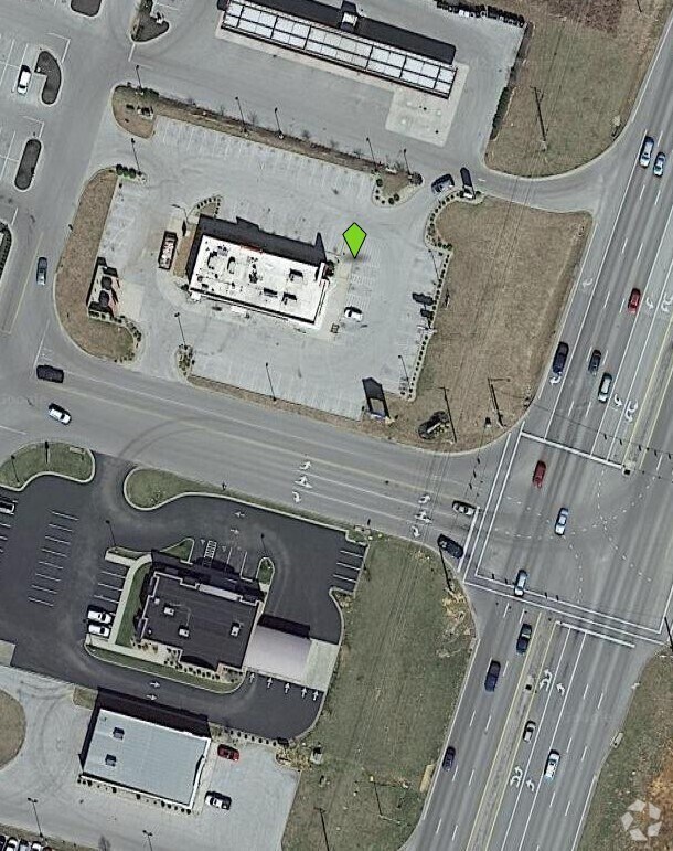
2561 S Highway 27
Somerset, KY
Stonebrook Development Grand C
062-1-0-70.3
TR 2 STONEBROOK DEV GRAND CENTRAL 1.08 AC STEAK & SHAKE
Restaurantdrivein
Pulaski
X
Kentucky
21199C0311C
2
2024
1.08 AC
2025
Corbin/London Area
930506
Other Market Areas
DEMOGRAPHICS near 2561 S Highway 27
1 Mile
3 Mile
5 Mile
2024 Total Population
2,745
19,382
34,125
2029 Population
2,838
19,935
35,042
Pop Growth 2024-2029
+ 3.39%
+ 2.85%
+ 2.69%
Average Age
42
42
42
2024 Total Households
1,160
7,890
13,868
HH Growth 2024-2029
+ 3.36%
+ 2.79%
+ 2.62%
Median Household Inc
$37,583
$39,989
$43,853
Avg Household Size
2.20
2.30
2.40
2024 Avg HH Vehicles
2.00
2.00
2.00
Median Home Value
$136,513
$155,319
$160,516
Median Year Built
1984
1980
1983
Nearby Places
Map Layers
Map Styles
 Street
 Aerial
- Restaurants
- Banks
- Shops
- Fitness
- Groceries
Nearby Properties
Address
Land Use
TOTAL SIZE
Lot Size
Zoning
Address
Land Use
TOTAL SIZE
Lot Size
Zoning
235,000 SF
15 AC
Address
Land Use
TOTAL SIZE
Lot Size
Zoning
Address
Land Use
TOTAL SIZE
Lot Size
Zoning
Address
Land Use
TOTAL SIZE
Lot Size
Zoning
Address
Land Use
TOTAL SIZE
Lot Size
Zoning
15.19 AC
Address
Land Use
TOTAL SIZE
Lot Size
Zoning
5.80 AC
Address
Land Use
TOTAL SIZE
Lot Size
Zoning
5,000 SF
115 AC
Address
Land Use
TOTAL SIZE
Lot Size
Zoning
10.20 AC
Address
Land Use
TOTAL SIZE
Lot Size
Zoning
15,000 SF
71 AC
Address
Land Use
TOTAL SIZE
Lot Size
Zoning
Address
Land Use
TOTAL SIZE
Lot Size
Zoning
16.44 AC
Address
Land Use
TOTAL SIZE
Lot Size
Zoning
206,820 SF
22 AC
Address
Land Use
TOTAL SIZE
Lot Size
Zoning
47,985 SF
1.78 AC
Address
Land Use
TOTAL SIZE
Lot Size
Zoning
39,161 SF
3.10 AC
Address
Land Use
TOTAL SIZE
Lot Size
Zoning
Address
Land Use
TOTAL SIZE
Lot Size
Zoning
7.34 AC
Address
Land Use
TOTAL SIZE
Lot Size
Zoning
512 SF
30 AC
Address
Land Use
TOTAL SIZE
Lot Size
Zoning
29,162 SF
2.78 AC
Address
Land Use
TOTAL SIZE
Lot Size
Zoning
2,400 SF
34.50 AC
Address
Land Use
TOTAL SIZE
Lot Size
Zoning
2,490 SF
21.94 AC
Address
Land Use
TOTAL SIZE
Lot Size
Zoning
47,387 SF
5.80 AC
Address
Land Use
TOTAL SIZE
Lot Size
Zoning
114,392 SF
14 AC
Address
Land Use
TOTAL SIZE
Lot Size
Zoning
2,135 SF
11.58 AC
Address
Land Use
TOTAL SIZE
Lot Size
Zoning
3.67 AC
Address
Land Use
TOTAL SIZE
Lot Size
Zoning
103,600 SF
28 AC
Address
Land Use
TOTAL SIZE
Lot Size
Zoning
17,560 SF
3.41 AC
Address
Land Use
TOTAL SIZE
Lot Size
Zoning
91,214 SF
23.49 AC
Address
Land Use
TOTAL SIZE
Lot Size
Zoning
72,778 SF
44.27 AC
Address
Land Use
TOTAL SIZE
Lot Size
Zoning
1,620 SF
2.01 AC
Address
Land Use
TOTAL SIZE
Lot Size
Zoning
1,769 SF
1.33 AC
The World's #1 Commercial Real Estate Marketplace
Connect with us
© 2025 CoStar Group
The information above has been obtained from sources believed reliable. While we do not doubt its accuracy we have not verified it and make no guarantee, warranty or representation about it. It is your responsibility to independently confirm its accuracy and completeness. Any projections, opinions, assumptions, or estimates used are for example only and do not represent the current or future performance of the property. The value of this transaction to you depends on tax and other factors which should be evaluated by your tax, financial, and legal advisors. You and your advisors should conduct a careful, independent investigation of the property to determine to your satisfaction the suitability of the property for your needs.