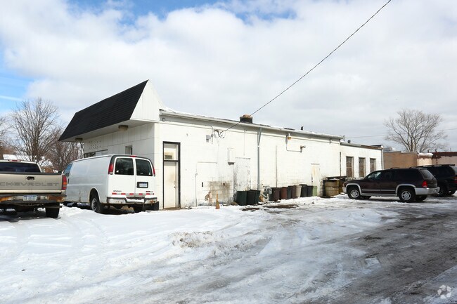
Property Record
25639 W 7 Mile Rd, Redford, MI 48240


NEARBY LISTINGS FOR SALE OR LEASE
Property Detail
25639 W 7 Mile Rd
Detroit-Warren-Dearborn, MI
Eden Park
79-011-03-0118-000
08C118 TO 124 LOTS 118 TO 124 INCL HITCHMANS EDEN PARK SUB T1S R10E L52 P34 WCR
Servicestation
Wayne
X
Michigan
26163C0066E
118-124
2024
0.33 AC
2025
Southern I-275 Corridor
554300
Detroit
2,313 SF
DEMOGRAPHICS near 25639 W 7 Mile Rd
1 Mile
3 Mile
5 Mile
2024 Total Population
16,746
96,427
259,890
2029 Population
16,127
93,819
253,131
Pop Growth 2024-2029
(3.70%)
(2.70%)
(2.60%)
Average Age
39
40
41
2024 Total Households
6,696
40,193
108,095
HH Growth 2024-2029
(3.79%)
(2.79%)
(2.62%)
Median Household Inc
$48,536
$52,475
$57,400
Avg Household Size
2.40
2.30
2.30
2024 Avg HH Vehicles
2.00
2.00
2.00
Median Home Value
$104,669
$135,884
$159,046
Median Year Built
1954
1956
1957
Nearby Places
Map Layers
Map Styles
 Street
 Aerial
- Restaurants
- Banks
- Shops
- Fitness
- Groceries
PUBLIC TRANSPORTATION
AIRPORT
Windsor International
DRIVE
WALK
Distance
Windsor International
46 min
28.2 mi
Detroit Metro Wayne County
DRIVE
WALK
Distance
Detroit Metro Wayne County
37 min
28.7 mi
Freight Ports
Port of Toledo
DRIVE
WALK
Distance
Port of Toledo
87 min
70.3 mi
Nearby Properties
Address
Land Use
TOTAL SIZE
Lot Size
Zoning
Address
Land Use
TOTAL SIZE
Lot Size
Zoning
383,602 SF
36.60 AC
I-1
Address
Land Use
TOTAL SIZE
Lot Size
Zoning
311,298 SF
31.66 AC
BI
Address
Land Use
TOTAL SIZE
Lot Size
Zoning
174 SF
14.17 AC
RM
Address
Land Use
TOTAL SIZE
Lot Size
Zoning
202,736 SF
20 AC
PD
Address
Land Use
TOTAL SIZE
Lot Size
Zoning
397,200 SF
14.07 AC
RMU
Address
Land Use
TOTAL SIZE
Lot Size
Zoning
129 SF
15.16 AC
RM
Address
Land Use
TOTAL SIZE
Lot Size
Zoning
164,964 SF
14.96 AC
R-7
Address
Land Use
TOTAL SIZE
Lot Size
Zoning
158,092 SF
11.75 AC
B-3
Address
Land Use
TOTAL SIZE
Lot Size
Zoning
204 SF
11.31 AC
RM
Address
Land Use
TOTAL SIZE
Lot Size
Zoning
138,104 SF
8.66 AC
AI
Address
Land Use
TOTAL SIZE
Lot Size
Zoning
143,941 SF
11.66 AC
PD
Address
Land Use
TOTAL SIZE
Lot Size
Zoning
192,038 SF
16.26 AC
C-2
Address
Land Use
TOTAL SIZE
Lot Size
Zoning
167,562 SF
9.25 AC
R5
Address
Land Use
TOTAL SIZE
Lot Size
Zoning
129,975 SF
6.89 AC
R5
Address
Land Use
TOTAL SIZE
Lot Size
Zoning
115,270 SF
7.07 AC
AI
Address
Land Use
TOTAL SIZE
Lot Size
Zoning
104,567 SF
2.14 AC
PD
Address
Land Use
TOTAL SIZE
Lot Size
Zoning
142,058 SF
10.02 AC
R-7
Address
Land Use
TOTAL SIZE
Lot Size
Zoning
152 SF
7.32 AC
RM
Address
Land Use
TOTAL SIZE
Lot Size
Zoning
9.07 AC
R-7
Address
Land Use
TOTAL SIZE
Lot Size
Zoning
Address
Land Use
TOTAL SIZE
Lot Size
Zoning
137,658 SF
18.37 AC
I-L
Address
Land Use
TOTAL SIZE
Lot Size
Zoning
129,711 SF
10.28 AC
R-7
Address
Land Use
TOTAL SIZE
Lot Size
Zoning
112,344 SF
2.51 AC
II
Address
Land Use
TOTAL SIZE
Lot Size
Zoning
37,030 SF
4.47 AC
C-2
Address
Land Use
TOTAL SIZE
Lot Size
Zoning
53,157 SF
2.86 AC
C-1
Address
Land Use
TOTAL SIZE
Lot Size
Zoning
43,140 SF
10.41 AC
C-2
Address
Land Use
TOTAL SIZE
Lot Size
Zoning
99,154 SF
7.04 AC
AI
Address
Land Use
TOTAL SIZE
Lot Size
Zoning
79,340 SF
3.20 AC
PD
Address
Land Use
TOTAL SIZE
Lot Size
Zoning
381,559 SF
21.08 AC
C-2
Address
Land Use
TOTAL SIZE
Lot Size
Zoning
76,117 SF
5.57 AC
R-9
The World's #1 Commercial Real Estate Marketplace
Connect with us
© 2025 CoStar Group
The information above has been obtained from sources believed reliable. While we do not doubt its accuracy we have not verified it and make no guarantee, warranty or representation about it. It is your responsibility to independently confirm its accuracy and completeness. Any projections, opinions, assumptions, or estimates used are for example only and do not represent the current or future performance of the property. The value of this transaction to you depends on tax and other factors which should be evaluated by your tax, financial, and legal advisors. You and your advisors should conduct a careful, independent investigation of the property to determine to your satisfaction the suitability of the property for your needs.