Property Record
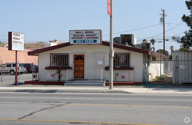
257 E 4Th St, Perris, CA 92570


Property Detail
257 E 4Th St
Riverside-San Bernardino-Ontario, CA
.16 ACRES M/L IN POR LOT 9 BLK 5 MB 004/244 SD CARPENTERS ADD
310-042-037
Riverside
Medicalbuilding
California
B and X Area of moderate flood hazard, usually the area between the limits of the 100-year and 500-year floods.
9
2024
0.16 AC
2025
Moreno Valley/Perris
042802
Inland Empire (California)
1,736 SF
NEARBY LISTINGS FOR SALE OR LEASE
-
-
View all Perris listings for lease on LoopNet.com
DEMOGRAPHICS near 257 E 4Th St
1 mile
3 mile
5 mile
2025 Total Population
17,210
62,603
115,851
2030 Population
17,984
64,494
119,066
Pop Growth 2025-2030
+ 4.50%
+ 3.02%
+ 2.78%
Average Age
32
33
35
2025 Total Households
4,467
15,067
30,105
HH Growth 2025-2030
+ 4.45%
+ 2.91%
+ 2.62%
Median Household Inc
$70,610
$77,888
$79,517
Avg Household Size
3.80
4.00
3.70
2025 Avg HH Vehicles
2.00
2.00
2.00
Median Home Value
$428,930
$446,199
$456,839
Median Year Built
1992
1992
1993
Nearby Places
Map Layers
Map Styles
 Street
 Aerial
Transit
 Traffic
 Biking
Places
Listings with unknown addresses are not visible on the map
- Restaurants
- Banks
- Shops
- Fitness
- Groceries
PUBLIC TRANSPORTATION
COMMUTER RAIL
Drive
Walk
Distance
1 min
10 min
0.5 mi
Drive
Walk
Distance
3 min
2.0 mi
AIRPORT
Ontario International
Drive
Walk
Distance
Ontario International
41 min
32.9 mi
SALE & LEASE HISTORY
LISTING DATE
SALE/LEASE

Oct 20, 2017
For Lease
Nearby Properties
Address
Land Use
TOTAL SIZE
Lot Size
Zoning
Address
Land Use
TOTAL SIZE
Lot Size
Zoning
325,560 SF
16.65 AC
Address
Land Use
TOTAL SIZE
Lot Size
Zoning
429,823 SF
20.07 AC
Address
Land Use
TOTAL SIZE
Lot Size
Zoning
18,121 SF
15.15 AC
Address
Land Use
TOTAL SIZE
Lot Size
Zoning
28.13 AC
RR
Address
Land Use
TOTAL SIZE
Lot Size
Zoning
197,865 SF
10.74 AC
Address
Land Use
TOTAL SIZE
Lot Size
Zoning
57,600 SF
51.69 AC
Address
Land Use
TOTAL SIZE
Lot Size
Zoning
6.99 AC
MIX
Address
Land Use
TOTAL SIZE
Lot Size
Zoning
187,889 SF
20.64 AC
Address
Land Use
TOTAL SIZE
Lot Size
Zoning
32,709 SF
4.61 AC
C2
Address
Land Use
TOTAL SIZE
Lot Size
Zoning
89,409 SF
6.18 AC
Address
Land Use
TOTAL SIZE
Lot Size
Zoning
207,130 SF
16.15 AC
Address
Land Use
TOTAL SIZE
Lot Size
Zoning
22,119 SF
4.59 AC
R3
Address
Land Use
TOTAL SIZE
Lot Size
Zoning
75,109 SF
9.39 AC
Address
Land Use
TOTAL SIZE
Lot Size
Zoning
1,080 SF
9.53 AC
A02
Address
Land Use
TOTAL SIZE
Lot Size
Zoning
122,824 SF
5.18 AC
CC
Address
Land Use
TOTAL SIZE
Lot Size
Zoning
247,929 SF
12.35 AC
Address
Land Use
TOTAL SIZE
Lot Size
Zoning
50,000 SF
5.36 AC
CC
Address
Land Use
TOTAL SIZE
Lot Size
Zoning
10.85 AC
MH
Address
Land Use
TOTAL SIZE
Lot Size
Zoning
47,440 SF
5.32 AC
C2
Address
Land Use
TOTAL SIZE
Lot Size
Zoning
1,018,178 SF
57.91 AC
Address
Land Use
TOTAL SIZE
Lot Size
Zoning
3,750 SF
37.79 AC
GI
Address
Land Use
TOTAL SIZE
Lot Size
Zoning
201,496 SF
13.35 AC
LI
The World's #1 Commercial Real Estate Marketplace
Connect with us
© 2026 CoStar Group
The information above has been obtained from sources believed reliable. While we do not doubt its accuracy we have not verified it and make no guarantee, warranty or representation about it. It is your responsibility to independently confirm its accuracy and completeness. Any projections, opinions, assumptions, or estimates used are for example only and do not represent the current or future performance of the property. The value of this transaction to you depends on tax and other factors which should be evaluated by your tax, financial, and legal advisors. You and your advisors should conduct a careful, independent investigation of the property to determine to your satisfaction the suitability of the property for your needs.