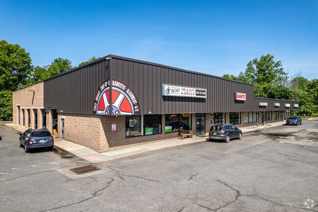
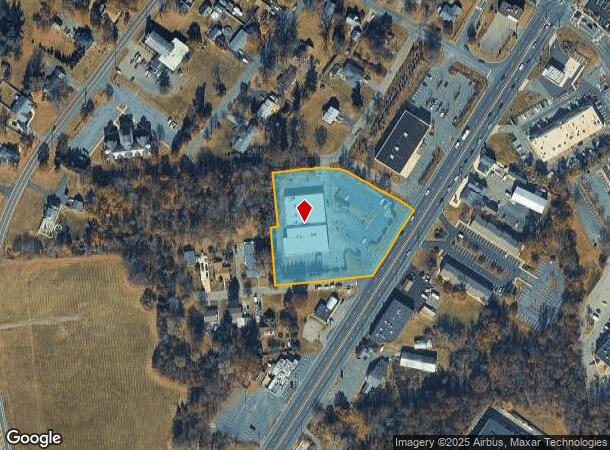
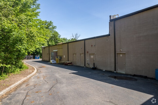
Property Record
257 Us Highway 202/31 S, Flemington, NJ 08822
NEARBY LISTINGS FOR SALE OR LEASE
Property Detail
257 Us Highway 202/31 S
21-00070-0000-00006
Hunterdon
Storebuilding
New Jersey
X
6
34019C0351F
2.57 AC
2024
Hunterdon
2025
Northern New Jersey
011306
Newark, NJ-PA
DEMOGRAPHICS near 257 Us Highway 202/31 S
1 Mile
3 Mile
5 Mile
2024 Total Population
6,688
25,318
37,451
2029 Population
6,766
25,917
38,146
Pop Growth 2024-2029
+ 1.17%
+ 2.37%
+ 1.86%
Average Age
43
42
43
2024 Total Households
2,850
9,555
14,070
HH Growth 2024-2029
+ 1.19%
+ 2.35%
+ 1.86%
Median Household Inc
$89,114
$114,054
$125,469
Avg Household Size
2.30
2.60
2.60
2024 Avg HH Vehicles
2.00
2.00
2.00
Median Home Value
$371,864
$438,879
$467,150
Median Year Built
1982
1983
1983
Nearby Places
Map Layers
Map Styles
 Street
 Aerial
- Restaurants
- Banks
- Shops
- Fitness
- Groceries
PUBLIC TRANSPORTATION
AIRPORT
Trenton Mercer
DRIVE
WALK
Distance
Trenton Mercer
33 min
19.0 mi
Lehigh Valley International
DRIVE
WALK
Distance
Lehigh Valley International
63 min
43.9 mi
Freight Ports
Port of Philadelphia
DRIVE
WALK
Distance
Port of Philadelphia
70 min
41.5 mi
SALE & LEASE HISTORY
LISTING DATE
SALE/LEASE

Sep 25, 2016
For Lease
Sep 24, 2016
For Sale
May 19, 2022
For Sale
Mar 29, 2021
For Lease
Mar 23, 2021
For Sale
Apr 09, 2017
For Lease
Nearby Properties
Address
Land Use
TOTAL SIZE
Lot Size
Zoning
Address
Land Use
TOTAL SIZE
Lot Size
Zoning
34.80 AC
H
Address
Land Use
TOTAL SIZE
Lot Size
Zoning
68.38 AC
P
Address
Land Use
TOTAL SIZE
Lot Size
Zoning
7.88 AC
CR
Address
Land Use
TOTAL SIZE
Lot Size
Zoning
39.32 AC
P
Address
Land Use
TOTAL SIZE
Lot Size
Zoning
65.10 AC
I-1
Address
Land Use
TOTAL SIZE
Lot Size
Zoning
19.85 AC
B-2
Address
Land Use
TOTAL SIZE
Lot Size
Zoning
10,546 SF
12.75 AC
GA
Address
Land Use
TOTAL SIZE
Lot Size
Zoning
12,208 SF
11 AC
GA
Address
Land Use
TOTAL SIZE
Lot Size
Zoning
11.59 AC
B-2
Address
Land Use
TOTAL SIZE
Lot Size
Zoning
40 AC
AR-2
Address
Land Use
TOTAL SIZE
Lot Size
Zoning
23.84 AC
I-2
Address
Land Use
TOTAL SIZE
Lot Size
Zoning
20.89 AC
O/SS
Address
Land Use
TOTAL SIZE
Lot Size
Zoning
26.03 AC
I-2
Address
Land Use
TOTAL SIZE
Lot Size
Zoning
108.22 AC
I-2
Address
Land Use
TOTAL SIZE
Lot Size
Zoning
54.74 AC
P
Address
Land Use
TOTAL SIZE
Lot Size
Zoning
4.34 AC
PO
Address
Land Use
TOTAL SIZE
Lot Size
Zoning
12.75 AC
B-2
Address
Land Use
TOTAL SIZE
Lot Size
Zoning
11.58 AC
P
Address
Land Use
TOTAL SIZE
Lot Size
Zoning
0.75 AC
H
Address
Land Use
TOTAL SIZE
Lot Size
Zoning
4.51 AC
R-3
Address
Land Use
TOTAL SIZE
Lot Size
Zoning
16.01 AC
I-2
Address
Land Use
TOTAL SIZE
Lot Size
Zoning
8.07 AC
I-2
Address
Land Use
TOTAL SIZE
Lot Size
Zoning
5.47 AC
B-2
Address
Land Use
TOTAL SIZE
Lot Size
Zoning
13.56 AC
CR
Address
Land Use
TOTAL SIZE
Lot Size
Zoning
2,826 SF
6.28 AC
B-2
Address
Land Use
TOTAL SIZE
Lot Size
Zoning
7.75 AC
HR
Address
Land Use
TOTAL SIZE
Lot Size
Zoning
38.30 AC
O-2
Address
Land Use
TOTAL SIZE
Lot Size
Zoning
7.09 AC
I-2
Address
Land Use
TOTAL SIZE
Lot Size
Zoning
6.16 AC
B-2
Address
Land Use
TOTAL SIZE
Lot Size
Zoning
15,048 SF
5.61 AC
C-3
The World's #1 Commercial Real Estate Marketplace
Connect with us
© 2025 CoStar Group
The information above has been obtained from sources believed reliable. While we do not doubt its accuracy we have not verified it and make no guarantee, warranty or representation about it. It is your responsibility to independently confirm its accuracy and completeness. Any projections, opinions, assumptions, or estimates used are for example only and do not represent the current or future performance of the property. The value of this transaction to you depends on tax and other factors which should be evaluated by your tax, financial, and legal advisors. You and your advisors should conduct a careful, independent investigation of the property to determine to your satisfaction the suitability of the property for your needs.