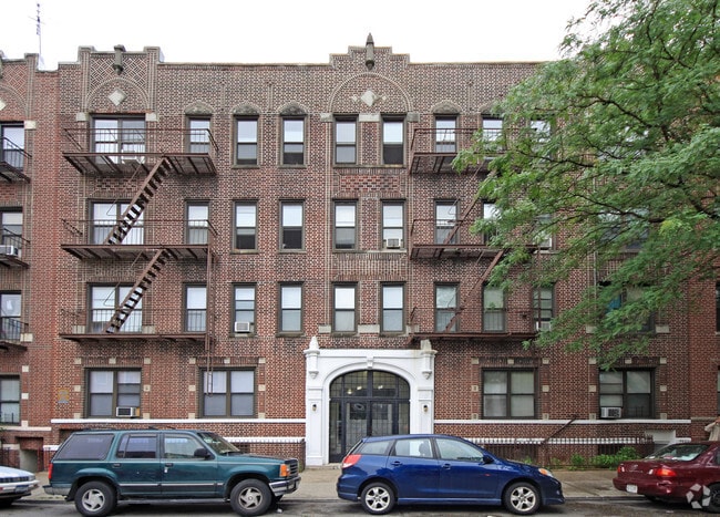
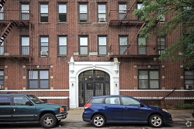
Property Record
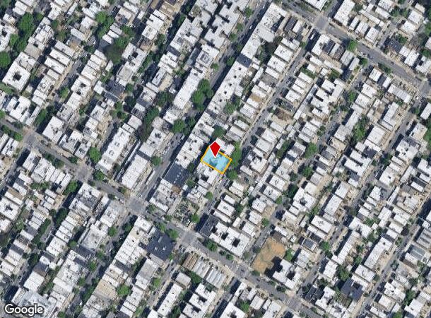
2570 41St St, Astoria, NY 11103

NEARBY LISTINGS FOR SALE OR LEASE
Property Detail
2570 41St St
00684-0072
Queens
Multifamilydwelling
New York
X
72
3604970093F
0.17 AC
2024
Downtown Astoria
2025
Long Island (New York)
014300
New York-Jersey City-White Plains, NY-NJ
19,748 SF
DEMOGRAPHICS near 2570 41St St
1 Mile
3 Mile
5 Mile
2024 Total Population
132,229
967,727
2,946,207
2029 Population
124,840
902,673
2,749,743
Pop Growth 2024-2029
(5.59%)
(6.72%)
(6.67%)
Average Age
40
41
40
2024 Total Households
59,004
403,749
1,238,143
HH Growth 2024-2029
(5.93%)
(6.87%)
(6.97%)
Median Household Inc
$86,615
$81,080
$73,661
Avg Household Size
2.20
2.30
2.30
2024 Avg HH Vehicles
1.00
.00
.00
Median Home Value
$863,838
$840,522
$812,134
Median Year Built
1948
1956
1955
Nearby Places
- Restaurants
- Banks
- Shops
- Fitness
- Groceries
PUBLIC TRANSPORTATION
TRANSIT/SUBWAY
30 Av (Broadway Local - N - MTA New York City Transit, Broadway Local - W - MTA New York City Transit)
DRIVE
WALK
Distance
30 Av (Broadway Local - N - MTA New York City Transit, Broadway Local - W - MTA New York City Transit)
3 min
12 min
0.6 mi
Astoria Blvd (Broadway Local - N - MTA New York City Transit, Broadway Local - W - MTA New York City Transit)
DRIVE
WALK
Distance
Astoria Blvd (Broadway Local - N - MTA New York City Transit, Broadway Local - W - MTA New York City Transit)
2 min
12 min
0.6 mi
Astoria-Ditmars Blvd (Broadway Local - N - MTA New York City Transit, Broadway Local - W - MTA New York City Transit)
DRIVE
WALK
Distance
Astoria-Ditmars Blvd (Broadway Local - N - MTA New York City Transit, Broadway Local - W - MTA New York City Transit)
3 min
16 min
0.9 mi
Broadway (Broadway Local - N - MTA New York City Transit, Broadway Local - W - MTA New York City Transit)
DRIVE
WALK
Distance
Broadway (Broadway Local - N - MTA New York City Transit, Broadway Local - W - MTA New York City Transit)
4 min
20 min
1.0 mi
COMMUTER RAIL
Woodside Station (Babylon Branch - Long Island Rail Road, Far Rockaway Branch - Long Island Rail Road, Hempstead Branch - Long Island Rail Road, Long Beach Branch - Long Island Rail Road, Montauk Branch - Long Island Rail Road, Port Jefferson Branch - Long Island Rail Road, Port Washington Branch - Long Island Rail Road, Ronkonkoma Branch - Long Island Rail Road)
DRIVE
WALK
Distance
Woodside Station (Babylon Branch - Long Island Rail Road, Far Rockaway Branch - Long Island Rail Road, Hempstead Branch - Long Island Rail Road, Long Beach Branch - Long Island Rail Road, Montauk Branch - Long Island Rail Road, Port Jefferson Branch - Long Island Rail Road, Port Washington Branch - Long Island Rail Road, Ronkonkoma Branch - Long Island Rail Road)
5 min
2.4 mi
Hunterspoint Avenue Station (Hempstead Branch - Long Island Rail Road, Oyster Bay Branch - Long Island Rail Road)
DRIVE
WALK
Distance
Hunterspoint Avenue Station (Hempstead Branch - Long Island Rail Road, Oyster Bay Branch - Long Island Rail Road)
9 min
3.8 mi
AIRPORT
LaGuardia
DRIVE
WALK
Distance
LaGuardia
6 min
2.5 mi
John F Kennedy International
DRIVE
WALK
Distance
John F Kennedy International
19 min
13.7 mi
Newark Liberty International
DRIVE
WALK
Distance
Newark Liberty International
33 min
20.2 mi
Freight Ports
NY - Red Hook Container Terminal
DRIVE
WALK
Distance
NY - Red Hook Container Terminal
19 min
10.6 mi
Nearby Properties
Address
Land Use
TOTAL SIZE
Lot Size
Zoning
Address
Land Use
TOTAL SIZE
Lot Size
Zoning
5,519,372 SF
409.21 AC
C8-2
Address
Land Use
TOTAL SIZE
Lot Size
Zoning
2,215,000 SF
6.43 AC
R9
Address
Land Use
TOTAL SIZE
Lot Size
Zoning
2,230,742 SF
6.33 AC
R9
Address
Land Use
TOTAL SIZE
Lot Size
Zoning
539,643 SF
C5-2
Address
Land Use
TOTAL SIZE
Lot Size
Zoning
1,242,587 SF
1.49 AC
C6-6
Address
Land Use
TOTAL SIZE
Lot Size
Zoning
1,200,000 SF
10.24 AC
R9
Address
Land Use
TOTAL SIZE
Lot Size
Zoning
755,000 SF
1.85 AC
R7-2
Address
Land Use
TOTAL SIZE
Lot Size
Zoning
1,065,915 SF
2.13 AC
M16R10
Address
Land Use
TOTAL SIZE
Lot Size
Zoning
757,439 SF
0.91 AC
C1-9
Address
Land Use
TOTAL SIZE
Lot Size
Zoning
733,747 SF
0.98 AC
R10
Address
Land Use
TOTAL SIZE
Lot Size
Zoning
1,502,532 SF
6.35 AC
R7B
Address
Land Use
TOTAL SIZE
Lot Size
Zoning
714,224 SF
0.70 AC
R8
Address
Land Use
TOTAL SIZE
Lot Size
Zoning
805,287 SF
1 AC
R10
Address
Land Use
TOTAL SIZE
Lot Size
Zoning
1,075,000 SF
6.74 AC
R7-2
Address
Land Use
TOTAL SIZE
Lot Size
Zoning
1,321,050 SF
1.89 AC
C1-9
Address
Land Use
TOTAL SIZE
Lot Size
Zoning
984,760 SF
2.04 AC
M3-1
Address
Land Use
TOTAL SIZE
Lot Size
Zoning
775,241 SF
1.87 AC
R8B
Address
Land Use
TOTAL SIZE
Lot Size
Zoning
407,259 SF
0.93 AC
C5-2
Address
Land Use
TOTAL SIZE
Lot Size
Zoning
661,538 SF
11.26 AC
R7-2
Address
Land Use
TOTAL SIZE
Lot Size
Zoning
540,779 SF
0.79 AC
R8B
Address
Land Use
TOTAL SIZE
Lot Size
Zoning
1,359,110 SF
1.89 AC
C5-3
Address
Land Use
TOTAL SIZE
Lot Size
Zoning
527,900 SF
0.57 AC
R10
Address
Land Use
TOTAL SIZE
Lot Size
Zoning
723,300 SF
1.87 AC
R8B
Address
Land Use
TOTAL SIZE
Lot Size
Zoning
334,675 SF
10.24 AC
R9
Address
Land Use
TOTAL SIZE
Lot Size
Zoning
150,328 SF
1.94 AC
C5-2
Address
Land Use
TOTAL SIZE
Lot Size
Zoning
908,799 SF
2.13 AC
R10
Address
Land Use
TOTAL SIZE
Lot Size
Zoning
838,890 SF
1.94 AC
C5-2
Address
Land Use
TOTAL SIZE
Lot Size
Zoning
538,454 SF
2.37 AC
R9
Address
Land Use
TOTAL SIZE
Lot Size
Zoning
804,200 SF
5.28 AC
R7-2
Address
Land Use
TOTAL SIZE
Lot Size
Zoning
207.09 AC
PARK
The World's #1 Commercial Real Estate Marketplace
Connect with us
© 2025 CoStar Group
The information above has been obtained from sources believed reliable. While we do not doubt its accuracy we have not verified it and make no guarantee, warranty or representation about it. It is your responsibility to independently confirm its accuracy and completeness. Any projections, opinions, assumptions, or estimates used are for example only and do not represent the current or future performance of the property. The value of this transaction to you depends on tax and other factors which should be evaluated by your tax, financial, and legal advisors. You and your advisors should conduct a careful, independent investigation of the property to determine to your satisfaction the suitability of the property for your needs.