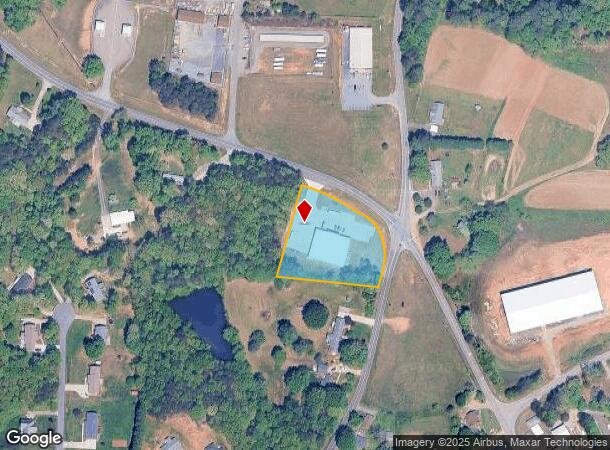
Property Record
2570 Nc 8 And 89 Hwy S, Walnut Cove, NC 27052
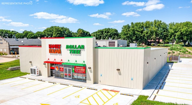
This Property Is For Sale
NEARBY LISTINGS FOR SALE OR LEASE
Property Detail
2570 Nc 8 And 89 Hwy S
Winston-Salem, NC
LOA PL19-115
695501157329
Stokes
Commercialnec
North Carolina
2025
1.72 AC
2025
Stokes County
070701
Greensboro/Winston-Salem
10,374 SF
DEMOGRAPHICS near 2570 Nc 8 And 89 Hwy S
1 Mile
3 Mile
5 Mile
2024 Total Population
424
2,560
6,293
2029 Population
441
2,665
6,507
Pop Growth 2024-2029
+ 4.01%
+ 4.10%
+ 3.40%
Average Age
45
45
45
2024 Total Households
187
1,133
2,727
HH Growth 2024-2029
+ 4.28%
+ 4.15%
+ 3.37%
Median Household Inc
$67,500
$64,198
$53,136
Avg Household Size
2.20
2.20
2.20
2024 Avg HH Vehicles
2.00
2.00
2.00
Median Home Value
$162,999
$152,325
$169,987
Median Year Built
1984
1983
1982
Nearby Places
- Restaurants
- Banks
- Shops
- Fitness
- Groceries
PUBLIC TRANSPORTATION
AIRPORT
Piedmont Triad International
DRIVE
WALK
Distance
Piedmont Triad International
54 min
31.7 mi
Freight Ports
Virginia Port Authority - Richmond
DRIVE
WALK
Distance
Virginia Port Authority - Richmond
270 min
201.3 mi
Nearby Properties
Address
Land Use
TOTAL SIZE
Lot Size
Zoning
Address
Land Use
TOTAL SIZE
Lot Size
Zoning
20,340 SF
45.86 AC
R-A
Address
Land Use
TOTAL SIZE
Lot Size
Zoning
13,000 SF
1.24 AC
H-B
Address
Land Use
TOTAL SIZE
Lot Size
Zoning
11.09 AC
M-1
Address
Land Use
TOTAL SIZE
Lot Size
Zoning
7,083 SF
4.06 AC
R-A
Address
Land Use
TOTAL SIZE
Lot Size
Zoning
3,262 SF
7.54 AC
R-A,R-MF
Address
Land Use
TOTAL SIZE
Lot Size
Zoning
2,040 SF
81.09 AC
R-A
Address
Land Use
TOTAL SIZE
Lot Size
Zoning
232.73 AC
R-A
Address
Land Use
TOTAL SIZE
Lot Size
Zoning
7,581 SF
0.64 AC
I-1
Address
Land Use
TOTAL SIZE
Lot Size
Zoning
612 SF
204.33 AC
R-A
Address
Land Use
TOTAL SIZE
Lot Size
Zoning
45.28 AC
R-A
Address
Land Use
TOTAL SIZE
Lot Size
Zoning
9,016 SF
1.36 AC
H-B
Address
Land Use
TOTAL SIZE
Lot Size
Zoning
6,429 SF
3.50 AC
R-A
Address
Land Use
TOTAL SIZE
Lot Size
Zoning
8,061 SF
0.80 AC
I-1
Address
Land Use
TOTAL SIZE
Lot Size
Zoning
36,296 SF
12.98 AC
M-1
Address
Land Use
TOTAL SIZE
Lot Size
Zoning
21.73 AC
I-1
Address
Land Use
TOTAL SIZE
Lot Size
Zoning
4,695 SF
31.28 AC
R-A
Address
Land Use
TOTAL SIZE
Lot Size
Zoning
3,772 SF
9.60 AC
UNKNOWN
Address
Land Use
TOTAL SIZE
Lot Size
Zoning
63.35 AC
R-A
Address
Land Use
TOTAL SIZE
Lot Size
Zoning
4,200 SF
0.58 AC
H-B
Address
Land Use
TOTAL SIZE
Lot Size
Zoning
3,797 SF
3.51 AC
R-A
Address
Land Use
TOTAL SIZE
Lot Size
Zoning
103.48 AC
R-A
Address
Land Use
TOTAL SIZE
Lot Size
Zoning
99.36 AC
R-A
Address
Land Use
TOTAL SIZE
Lot Size
Zoning
90.97 AC
R-A
Address
Land Use
TOTAL SIZE
Lot Size
Zoning
111.94 AC
R-A
Address
Land Use
TOTAL SIZE
Lot Size
Zoning
86.37 AC
R-A
Address
Land Use
TOTAL SIZE
Lot Size
Zoning
79.89 AC
R-A
Address
Land Use
TOTAL SIZE
Lot Size
Zoning
80.29 AC
R-A
Address
Land Use
TOTAL SIZE
Lot Size
Zoning
133.84 AC
R-A
Address
Land Use
TOTAL SIZE
Lot Size
Zoning
7,500 SF
3.26 AC
B-2
The World's #1 Commercial Real Estate Marketplace
Connect with us
© 2025 CoStar Group
The information above has been obtained from sources believed reliable. While we do not doubt its accuracy we have not verified it and make no guarantee, warranty or representation about it. It is your responsibility to independently confirm its accuracy and completeness. Any projections, opinions, assumptions, or estimates used are for example only and do not represent the current or future performance of the property. The value of this transaction to you depends on tax and other factors which should be evaluated by your tax, financial, and legal advisors. You and your advisors should conduct a careful, independent investigation of the property to determine to your satisfaction the suitability of the property for your needs.