Property Record
2575 Florida St, Mandeville, LA 70448
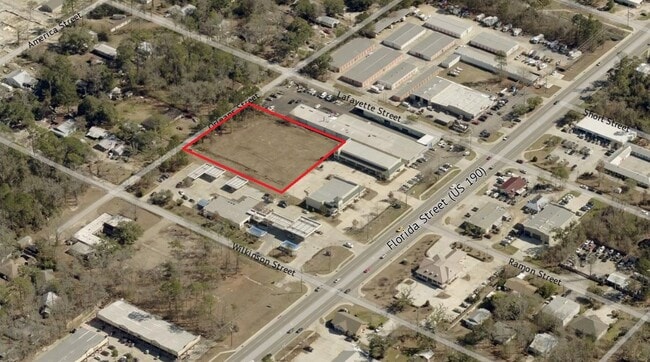


Property Detail
2575 Florida St
Slidell-Mandeville-Covington, LA
LOT 1B2 SQ 108 MEAS 147 X 510 MANDEVILLE CB 1190 849 CB 1504 939 INST NO 984002 INST NO 990383 INST NO 990389 INST NO 1070393
60363
ST TAMMANY
Commercialnec
Louisiana
B and X Area of moderate flood hazard, usually the area between the limits of the 100-year and 500-year floods.
1b2
2025
1 AC
2025
Mandeville/Covington
041209
New Orleans/Metairie/Kenner
6,064 SF
NEARBY LISTINGS FOR SALE OR LEASE
DEMOGRAPHICS near 2575 Florida St
1 mile
3 mile
5 mile
2025 Total Population
7,904
35,811
56,849
2030 Population
8,081
36,565
58,129
Pop Growth 2025-2030
+ 2.24%
+ 2.11%
+ 2.25%
Average Age
42
42
41
2025 Total Households
3,222
13,835
21,936
HH Growth 2025-2030
+ 2.36%
+ 2.23%
+ 2.34%
Median Household Inc
$76,895
$92,989
$92,440
Avg Household Size
2.40
2.50
2.50
2025 Avg HH Vehicles
2.00
2.00
2.00
Median Home Value
$361,398
$370,694
$373,141
Median Year Built
1990
1993
1994
Nearby Places
Map Layers
Map Styles
 Street
 Aerial
Transit
 Traffic
 Biking
Places
Listings with unknown addresses are not visible on the map
- Restaurants
- Banks
- Shops
- Fitness
- Groceries
PUBLIC TRANSPORTATION
AIRPORT
Louis Armstrong New Orleans International
Drive
Walk
Distance
Louis Armstrong New Orleans International
49 min
35.6 mi
Freight Ports
Port of New Orleans
Drive
Walk
Distance
Port of New Orleans
53 min
36.6 mi
SALE & LEASE HISTORY
LISTING DATE
SALE/LEASE

Jul 07, 2021
For Sale
Nearby Properties
Address
Land Use
TOTAL SIZE
Lot Size
Zoning
Address
Land Use
TOTAL SIZE
Lot Size
Zoning
Address
Land Use
TOTAL SIZE
Lot Size
Zoning
229,994 SF
30 AC
Address
Land Use
TOTAL SIZE
Lot Size
Zoning
220,860 SF
25.07 AC
Address
Land Use
TOTAL SIZE
Lot Size
Zoning
154,751 SF
14.96 AC
Address
Land Use
TOTAL SIZE
Lot Size
Zoning
165,168 SF
18.16 AC
Address
Land Use
TOTAL SIZE
Lot Size
Zoning
43,301 SF
3.26 AC
Address
Land Use
TOTAL SIZE
Lot Size
Zoning
147,457 SF
8.90 AC
Address
Land Use
TOTAL SIZE
Lot Size
Zoning
119,452 SF
10.34 AC
Address
Land Use
TOTAL SIZE
Lot Size
Zoning
54,226 SF
5.10 AC
Address
Land Use
TOTAL SIZE
Lot Size
Zoning
93,800 SF
10.35 AC
Address
Land Use
TOTAL SIZE
Lot Size
Zoning
206,403 SF
9.06 AC
Address
Land Use
TOTAL SIZE
Lot Size
Zoning
50,560 SF
6.32 AC
Address
Land Use
TOTAL SIZE
Lot Size
Zoning
56,162 SF
5.30 AC
Address
Land Use
TOTAL SIZE
Lot Size
Zoning
100,734 SF
23.66 AC
Address
Land Use
TOTAL SIZE
Lot Size
Zoning
77,388 SF
7.57 AC
Address
Land Use
TOTAL SIZE
Lot Size
Zoning
40,064 SF
3.66 AC
Address
Land Use
TOTAL SIZE
Lot Size
Zoning
90,603 SF
6.50 AC
Address
Land Use
TOTAL SIZE
Lot Size
Zoning
41,311 SF
Address
Land Use
TOTAL SIZE
Lot Size
Zoning
88,002 SF
10 AC
Address
Land Use
TOTAL SIZE
Lot Size
Zoning
86,799 SF
28.55 AC
Address
Land Use
TOTAL SIZE
Lot Size
Zoning
76,264 SF
8.26 AC
Address
Land Use
TOTAL SIZE
Lot Size
Zoning
82,479 SF
5.95 AC
Address
Land Use
TOTAL SIZE
Lot Size
Zoning
61,000 SF
5.76 AC
Address
Land Use
TOTAL SIZE
Lot Size
Zoning
59,702 SF
5.97 AC
Address
Land Use
TOTAL SIZE
Lot Size
Zoning
48,307 SF
4.60 AC
Address
Land Use
TOTAL SIZE
Lot Size
Zoning
48,307 SF
4.79 AC
Address
Land Use
TOTAL SIZE
Lot Size
Zoning
50,608 SF
2.82 AC
Address
Land Use
TOTAL SIZE
Lot Size
Zoning
67,550 SF
3.66 AC
Address
Land Use
TOTAL SIZE
Lot Size
Zoning
60,971 SF
4.80 AC
Address
Land Use
TOTAL SIZE
Lot Size
Zoning
80,160 SF
1 AC
The World's #1 Commercial Real Estate Marketplace
Connect with us
© 2026 CoStar Group
The information above has been obtained from sources believed reliable. While we do not doubt its accuracy we have not verified it and make no guarantee, warranty or representation about it. It is your responsibility to independently confirm its accuracy and completeness. Any projections, opinions, assumptions, or estimates used are for example only and do not represent the current or future performance of the property. The value of this transaction to you depends on tax and other factors which should be evaluated by your tax, financial, and legal advisors. You and your advisors should conduct a careful, independent investigation of the property to determine to your satisfaction the suitability of the property for your needs.