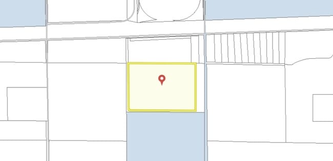
Property Record
2575 Petterson Rd, , CO

Property Detail
2575 Petterson Rd
Denver
ROCKY MOUNTAIN RAIL PARK FLG 1 LOT 11 THAT PORT OF LOT 11 DESC AS SOUTH PARCEL (LOT 11) ACCORDING TO THE ROCKY MOUNTAIN RAIL PARK PUD AMND 1 MORE PARTICULARLY DESC AS FOLLOWS COM AT SD CEN4 COR SEC 35 TH ALG THE W LN OF THE NE4 OF SD SEC 35 N 00D 25M
Denver-Aurora-Centennial, CO
ADAMS
1817-35-1-02-003
Colorado
Warehouse
11
2024
82.58 AC
2025
Outlying Adams Cnty
132,800 SF
NEARBY LISTINGS FOR SALE OR LEASE
-
-
View all listings for sale on LoopNet.com
DEMOGRAPHICS near 2575 Petterson Rd
1 mile
3 mile
5 mile
2025 Total Population
45
290
5,726
2030 Population
47
290
6,163
Pop Growth 2025-2030
+ 4.44%
0.00%
+ 7.63%
Average Age
43
43
38
2025 Total Households
16
99
1,937
HH Growth 2025-2030
0.00%
0.00%
+ 7.80%
Median Household Inc
$106,250
$128,906
$112,949
Avg Household Size
3.00
2.90
2.90
2025 Avg HH Vehicles
3.00
3.00
3.00
Median Home Value
$725,000
$765,384
$473,408
Median Year Built
1992
1995
1996
Nearby Places
Map Layers
Map Styles
 Street
 Aerial
Transit
 Traffic
 Biking
Places
Listings with unknown addresses are not visible on the map
- Restaurants
- Banks
- Shops
- Fitness
- Groceries
PUBLIC TRANSPORTATION
AIRPORT
Denver International
Drive
Walk
Distance
Denver International
29 min
18.5 mi
Freight Ports
Tulsa Port Of Catoosa
Drive
Walk
Distance
Tulsa Port Of Catoosa
701 min
683.0 mi
Nearby Properties
Address
Land Use
TOTAL SIZE
Lot Size
Zoning
Address
Land Use
TOTAL SIZE
Lot Size
Zoning
Address
Land Use
TOTAL SIZE
Lot Size
Zoning
Address
Land Use
TOTAL SIZE
Lot Size
Zoning
39.98 AC
Address
Land Use
TOTAL SIZE
Lot Size
Zoning
10,200 SF
143.74 AC
A3
Address
Land Use
TOTAL SIZE
Lot Size
Zoning
6.99 AC
AB5
Address
Land Use
TOTAL SIZE
Lot Size
Zoning
10,508 SF
44.75 AC
AV
Address
Land Use
TOTAL SIZE
Lot Size
Zoning
1 SF
39.07 AC
Address
Land Use
TOTAL SIZE
Lot Size
Zoning
36.31 AC
Address
Land Use
TOTAL SIZE
Lot Size
Zoning
4,500 SF
0.10 AC
AV
Address
Land Use
TOTAL SIZE
Lot Size
Zoning
4,500 SF
0.10 AC
AV
Address
Land Use
TOTAL SIZE
Lot Size
Zoning
4,500 SF
0.10 AC
AV
Address
Land Use
TOTAL SIZE
Lot Size
Zoning
4,500 SF
0.10 AC
AV
Address
Land Use
TOTAL SIZE
Lot Size
Zoning
4,200 SF
80 AC
AV
Address
Land Use
TOTAL SIZE
Lot Size
Zoning
10,069 SF
38.93 AC
AA1
Address
Land Use
TOTAL SIZE
Lot Size
Zoning
3,662 SF
88.41 AC
AA1
Address
Land Use
TOTAL SIZE
Lot Size
Zoning
1,056 SF
255.86 AC
AAE
Address
Land Use
TOTAL SIZE
Lot Size
Zoning
5,003 SF
18.63 AC
AA1
Address
Land Use
TOTAL SIZE
Lot Size
Zoning
8,995 SF
35.01 AC
AA1
Address
Land Use
TOTAL SIZE
Lot Size
Zoning
4,861 SF
70 AC
Address
Land Use
TOTAL SIZE
Lot Size
Zoning
3,606 SF
34.49 AC
AA1
Address
Land Use
TOTAL SIZE
Lot Size
Zoning
3,612 SF
19.50 AC
AA1
Address
Land Use
TOTAL SIZE
Lot Size
Zoning
37.22 AC
AA1
Address
Land Use
TOTAL SIZE
Lot Size
Zoning
37 AC
AA1
Address
Land Use
TOTAL SIZE
Lot Size
Zoning
1,958 SF
19.44 AC
AA1
Address
Land Use
TOTAL SIZE
Lot Size
Zoning
5,505 SF
38.02 AC
AA1
Address
Land Use
TOTAL SIZE
Lot Size
Zoning
5,008 SF
39 AC
AA1
Address
Land Use
TOTAL SIZE
Lot Size
Zoning
5,470 SF
40.16 AC
AA1
Address
Land Use
TOTAL SIZE
Lot Size
Zoning
5,283 SF
35.01 AC
AA1
Address
Land Use
TOTAL SIZE
Lot Size
Zoning
6,140 SF
20 AC
The World's #1 Commercial Real Estate Marketplace
Connect with us
© 2026 CoStar Group
The information above has been obtained from sources believed reliable. While we do not doubt its accuracy we have not verified it and make no guarantee, warranty or representation about it. It is your responsibility to independently confirm its accuracy and completeness. Any projections, opinions, assumptions, or estimates used are for example only and do not represent the current or future performance of the property. The value of this transaction to you depends on tax and other factors which should be evaluated by your tax, financial, and legal advisors. You and your advisors should conduct a careful, independent investigation of the property to determine to your satisfaction the suitability of the property for your needs.