Property Record
258-262 Spring St, Paterson, NJ 07503

Save to a Folder
{{folder.Name}}
{{folder.ListingIds.length}} Properties
{{folder.ListingIds.length}} Property
Create a New Folder
Property Detail
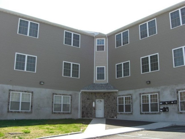
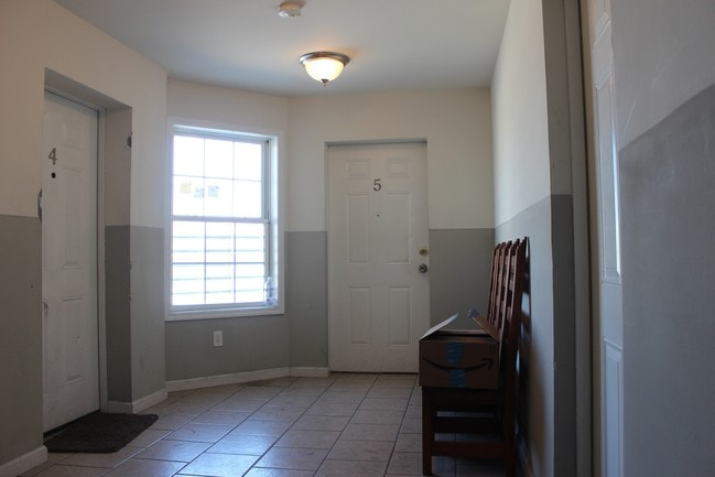
258-262 Spring St
08-05805-0000-00012
FACILITY NAME: 201-343-5001
Apartment
Passaic
I-2
New Jersey
B and X Area of moderate flood hazard, usually the area between the limits of the 100-year and 500-year floods.
12
2025
0.17 AC
2026
South Paterson
182900
Northern New Jersey
2,967 SF
New York-Jersey City-White Plains, NY-NJ
NEARBY LISTINGS FOR SALE OR LEASE
DEMOGRAPHICS near 258-262 Spring St
1 mile
3 mile
5 mile
2025 Total Population
46,809
292,454
588,917
2030 Population
46,999
294,772
597,453
Pop Growth 2025-2030
+ 0.41%
+ 0.79%
+ 1.45%
Average Age
37
39
39
2025 Total Households
15,071
95,967
198,891
HH Growth 2025-2030
+ 0.49%
+ 0.86%
+ 1.51%
Median Household Inc
$49,269
$70,376
$85,990
Avg Household Size
2.90
2.90
2.80
2025 Avg HH Vehicles
1.00
1.00
2.00
Median Home Value
$372,938
$445,636
$498,419
Median Year Built
1956
1953
1954
Nearby Places
Map Layers
Map Styles
 Street
 Aerial
Layers
 Traffic
 Biking
Places
Listings with unknown addresses are not visible on the map
- Restaurants
- Banks
- Shops
- Fitness
- Groceries
PUBLIC TRANSPORTATION
TRANSIT/SUBWAY
Paterson (Main/Port Jervis Line - NJ Transit Commuter Rail (NJ Transit))
Drive
Walk
Distance
Paterson (Main/Port Jervis Line - NJ Transit Commuter Rail (NJ Transit))
2 min
16 min
0.8 mi
COMMUTER RAIL
Paterson (Main/Port Jervis Line - NJ Transit Commuter Rail (NJ Transit))
Drive
Walk
Distance
Paterson (Main/Port Jervis Line - NJ Transit Commuter Rail (NJ Transit))
2 min
18 min
0.9 mi
Clifton (Main/Port Jervis Line - NJ Transit Commuter Rail (NJ Transit))
Drive
Walk
Distance
Clifton (Main/Port Jervis Line - NJ Transit Commuter Rail (NJ Transit))
7 min
3.2 mi
AIRPORT
Newark Liberty International
Drive
Walk
Distance
Newark Liberty International
25 min
20.2 mi
LaGuardia
Drive
Walk
Distance
LaGuardia
37 min
25.1 mi
Westchester County
Drive
Walk
Distance
Westchester County
57 min
40.8 mi
Freight Ports
Maher Terminal
Drive
Walk
Distance
Maher Terminal
31 min
19.1 mi
SALE & LEASE HISTORY
LISTING DATE
SALE/LEASE

Oct 04, 2016
For Sale
Oct 04, 2016
For Sale
Apr 05, 2017
For Sale
Nearby Properties
Address
Land Use
TOTAL SIZE
Lot Size
Zoning
Address
Land Use
TOTAL SIZE
Lot Size
Zoning
8.75 AC
Address
Land Use
TOTAL SIZE
Lot Size
Zoning
12,506 SF
130 AC
B-2
Address
Land Use
TOTAL SIZE
Lot Size
Zoning
79,310 SF
2 AC
B-2
Address
Land Use
TOTAL SIZE
Lot Size
Zoning
152,050 SF
1.96 AC
B-1
Address
Land Use
TOTAL SIZE
Lot Size
Zoning
26,816 SF
25.50 AC
POP
Address
Land Use
TOTAL SIZE
Lot Size
Zoning
7.83 AC
Address
Land Use
TOTAL SIZE
Lot Size
Zoning
1.80 AC
Address
Land Use
TOTAL SIZE
Lot Size
Zoning
0.69 AC
I-1
Address
Land Use
TOTAL SIZE
Lot Size
Zoning
764,364 SF
16.60 AC
I-2
Address
Land Use
TOTAL SIZE
Lot Size
Zoning
0.12 AC
Address
Land Use
TOTAL SIZE
Lot Size
Zoning
20.43 AC
Address
Land Use
TOTAL SIZE
Lot Size
Zoning
11.87 AC
Address
Land Use
TOTAL SIZE
Lot Size
Zoning
183,072 SF
5.50 AC
Address
Land Use
TOTAL SIZE
Lot Size
Zoning
192,252 SF
5 AC
Address
Land Use
TOTAL SIZE
Lot Size
Zoning
140,626 SF
3.28 AC
B-2
Address
Land Use
TOTAL SIZE
Lot Size
Zoning
269,236 SF
10 AC
Address
Land Use
TOTAL SIZE
Lot Size
Zoning
Address
Land Use
TOTAL SIZE
Lot Size
Zoning
7.03 AC
MU
Address
Land Use
TOTAL SIZE
Lot Size
Zoning
1.07 AC
Address
Land Use
TOTAL SIZE
Lot Size
Zoning
3.73 AC
B-2
Address
Land Use
TOTAL SIZE
Lot Size
Zoning
1.20 AC
B-2
Address
Land Use
TOTAL SIZE
Lot Size
Zoning
82,976 SF
0.89 AC
Address
Land Use
TOTAL SIZE
Lot Size
Zoning
48,265 SF
3 AC
R-4
Address
Land Use
TOTAL SIZE
Lot Size
Zoning
4,576 SF
11.75 AC
IR10
Address
Land Use
TOTAL SIZE
Lot Size
Zoning
1.30 AC
B-2
Address
Land Use
TOTAL SIZE
Lot Size
Zoning
84,845 SF
2.30 AC
B-2
Address
Land Use
TOTAL SIZE
Lot Size
Zoning
63,600 SF
2.46 AC
Address
Land Use
TOTAL SIZE
Lot Size
Zoning
19.46 AC
Address
Land Use
TOTAL SIZE
Lot Size
Zoning
73,052 SF
1.27 AC
B-2
Address
Land Use
TOTAL SIZE
Lot Size
Zoning
7.20 AC
The World's #1 Commercial Real Estate Marketplace
Connect with us
© 2026 CoStar Group
The information above has been obtained from sources believed reliable. While we do not doubt its accuracy we have not verified it and make no guarantee, warranty or representation about it. It is your responsibility to independently confirm its accuracy and completeness. Any projections, opinions, assumptions, or estimates used are for example only and do not represent the current or future performance of the property. The value of this transaction to you depends on tax and other factors which should be evaluated by your tax, financial, and legal advisors. You and your advisors should conduct a careful, independent investigation of the property to determine to your satisfaction the suitability of the property for your needs.