Property Record
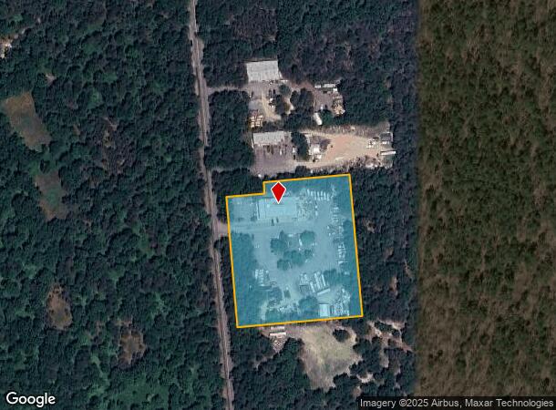
258 Line Rd, Manorville, NY 11949
NEARBY LISTINGS FOR SALE OR LEASE
Property Detail
258 Line Rd
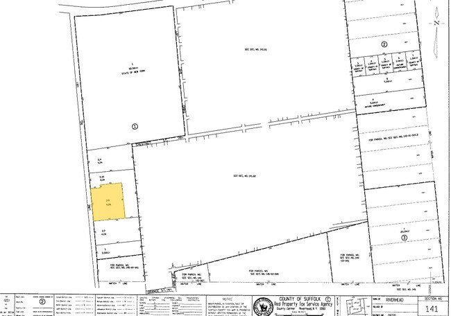
0600-141-00-01-00-002-009
N X FICHTER E X LINE RD BOUNDARY LINE ALT
Warehouse
Suffolk
X
New York
36103C0439H
2
2024
4.20 AC
2024
Eastern Suffolk
169706
Long Island (New York)
7,200 SF
Nassau County-Suffolk County, NY
DEMOGRAPHICS near 258 Line Rd
1 Mile
3 Mile
5 Mile
2024 Total Population
95
7,302
39,936
2029 Population
94
7,232
39,751
Pop Growth 2024-2029
(1.05%)
(0.96%)
(0.46%)
Average Age
50
42
45
2024 Total Households
44
2,582
15,464
HH Growth 2024-2029
0.00%
(1.05%)
(0.45%)
Median Household Inc
$62,308
$122,916
$100,181
Avg Household Size
2.10
2.70
2.50
2024 Avg HH Vehicles
2.00
2.00
2.00
Median Home Value
$99,999
$491,918
$439,107
Median Year Built
1977
1988
1982
Nearby Places
- Restaurants
- Banks
- Shops
- Fitness
- Groceries
PUBLIC TRANSPORTATION
COMMUTER RAIL
Riverhead Station (Greenport Branch - Long Island Rail Road)
DRIVE
WALK
Distance
Riverhead Station (Greenport Branch - Long Island Rail Road)
18 min
9.1 mi
Yaphank Station (Greenport Branch - Long Island Rail Road)
DRIVE
WALK
Distance
Yaphank Station (Greenport Branch - Long Island Rail Road)
17 min
9.5 mi
AIRPORT
Long Island MacArthur
DRIVE
WALK
Distance
Long Island MacArthur
37 min
21.6 mi
Nearby Properties
Address
Land Use
TOTAL SIZE
Lot Size
Zoning
Address
Land Use
TOTAL SIZE
Lot Size
Zoning
1,980.10 AC
10
Address
Land Use
TOTAL SIZE
Lot Size
Zoning
7.31 AC
LI200
Address
Land Use
TOTAL SIZE
Lot Size
Zoning
6.82 AC
LI200
Address
Land Use
TOTAL SIZE
Lot Size
Zoning
109.90 AC
Address
Land Use
TOTAL SIZE
Lot Size
Zoning
95.60 AC
PIP
Address
Land Use
TOTAL SIZE
Lot Size
Zoning
42 AC
PRP
Address
Land Use
TOTAL SIZE
Lot Size
Zoning
32.33 AC
Address
Land Use
TOTAL SIZE
Lot Size
Zoning
286.40 AC
4
Address
Land Use
TOTAL SIZE
Lot Size
Zoning
385.40 AC
9
Address
Land Use
TOTAL SIZE
Lot Size
Zoning
32.44 AC
Address
Land Use
TOTAL SIZE
Lot Size
Zoning
15,840 SF
50 AC
LI
Address
Land Use
TOTAL SIZE
Lot Size
Zoning
191.70 AC
04
Address
Land Use
TOTAL SIZE
Lot Size
Zoning
388.50 AC
10
Address
Land Use
TOTAL SIZE
Lot Size
Zoning
26.11 AC
Address
Land Use
TOTAL SIZE
Lot Size
Zoning
20.60 AC
PIP
Address
Land Use
TOTAL SIZE
Lot Size
Zoning
14.78 AC
Address
Land Use
TOTAL SIZE
Lot Size
Zoning
128.50 AC
04
Address
Land Use
TOTAL SIZE
Lot Size
Zoning
173.60 AC
09
Address
Land Use
TOTAL SIZE
Lot Size
Zoning
160 SF
191.17 AC
04
Address
Land Use
TOTAL SIZE
Lot Size
Zoning
265 AC
NRP
Address
Land Use
TOTAL SIZE
Lot Size
Zoning
20 AC
09
Address
Land Use
TOTAL SIZE
Lot Size
Zoning
Address
Land Use
TOTAL SIZE
Lot Size
Zoning
3,936 SF
181.60 AC
OSC
Address
Land Use
TOTAL SIZE
Lot Size
Zoning
128.50 AC
OSC
Address
Land Use
TOTAL SIZE
Lot Size
Zoning
95.60 AC
09
Address
Land Use
TOTAL SIZE
Lot Size
Zoning
9.40 AC
PIP
Address
Land Use
TOTAL SIZE
Lot Size
Zoning
7,219 SF
4.70 AC
OSC
Address
Land Use
TOTAL SIZE
Lot Size
Zoning
10.79 AC
PIP
Address
Land Use
TOTAL SIZE
Lot Size
Zoning
1,632 SF
102.50 AC
09
Address
Land Use
TOTAL SIZE
Lot Size
Zoning
56.60 AC
RB80
The World's #1 Commercial Real Estate Marketplace
Connect with us
© 2025 CoStar Group
The information above has been obtained from sources believed reliable. While we do not doubt its accuracy we have not verified it and make no guarantee, warranty or representation about it. It is your responsibility to independently confirm its accuracy and completeness. Any projections, opinions, assumptions, or estimates used are for example only and do not represent the current or future performance of the property. The value of this transaction to you depends on tax and other factors which should be evaluated by your tax, financial, and legal advisors. You and your advisors should conduct a careful, independent investigation of the property to determine to your satisfaction the suitability of the property for your needs.