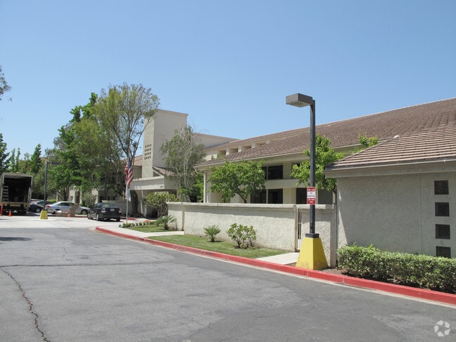
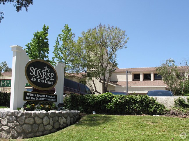
Property Record
25815 Mcbean Pky, Valencia, CA 91355

Save to a Folder
{{folder.Name}}
{{folder.ListingIds.length}} Properties
{{folder.ListingIds.length}} Property
Create a New Folder
Property Detail
25815 Mcbean Pky
2861-036-004
PARCEL MAP AS PER BK 190 P 21-23 OF P M LOT 3
Retirementnursinghomecombined
Los Angeles
SCUR4
California
B and X Area of moderate flood hazard, usually the area between the limits of the 100-year and 500-year floods.
3
2025
3.68 AC
2025
Santa Clarita Valley
920330
Los Angeles
86,201 SF
Los Angeles-Long Beach-Glendale, CA
NEARBY LISTINGS FOR SALE OR LEASE
-
-
View all Valencia listings for sale on LoopNet.com
DEMOGRAPHICS near 25815 Mcbean Pky
1 mile
3 mile
5 mile
2025 Total Population
19,370
89,862
176,533
2030 Population
19,237
89,200
174,971
Pop Growth 2025-2030
(0.69%)
(0.74%)
(0.88%)
Average Age
44
41
41
2025 Total Households
7,580
31,409
59,825
HH Growth 2025-2030
(0.82%)
(0.98%)
(1.06%)
Median Household Inc
$111,968
$118,889
$123,954
Avg Household Size
2.50
2.80
2.90
2025 Avg HH Vehicles
2.00
2.00
2.00
Median Home Value
$751,854
$817,838
$776,465
Median Year Built
1983
1988
1989
Nearby Places
Map Layers
Map Styles
 Street
 Aerial
Layers
 Traffic
 Biking
Places
Listings with unknown addresses are not visible on the map
- Restaurants
- Banks
- Shops
- Fitness
- Groceries
PUBLIC TRANSPORTATION
COMMUTER RAIL
Newhall (Antelope Valley Line - Southern California Regional Rail Authority (Metrolink))
Drive
Walk
Distance
Newhall (Antelope Valley Line - Southern California Regional Rail Authority (Metrolink))
7 min
2.9 mi
Santa Clarita (Antelope Valley Line - Southern California Regional Rail Authority (Metrolink))
Drive
Walk
Distance
Santa Clarita (Antelope Valley Line - Southern California Regional Rail Authority (Metrolink))
8 min
4.0 mi
AIRPORT
Bob Hope
Drive
Walk
Distance
Bob Hope
28 min
21.0 mi
Freight Ports
The Port of Hueneme
Drive
Walk
Distance
The Port of Hueneme
75 min
53.3 mi
Nearby Properties
Address
Land Use
TOTAL SIZE
Lot Size
Zoning
Address
Land Use
TOTAL SIZE
Lot Size
Zoning
491,654 SF
17.56 AC
SCPI
Address
Land Use
TOTAL SIZE
Lot Size
Zoning
479,178 SF
14.17 AC
SCCR
Address
Land Use
TOTAL SIZE
Lot Size
Zoning
173,298 SF
12.42 AC
LCA25*
Address
Land Use
TOTAL SIZE
Lot Size
Zoning
200,717 SF
7.62 AC
SCCR
Address
Land Use
TOTAL SIZE
Lot Size
Zoning
197,558 SF
3.08 AC
SCBP
Address
Land Use
TOTAL SIZE
Lot Size
Zoning
495,604 SF
38.40 AC
SCI
Address
Land Use
TOTAL SIZE
Lot Size
Zoning
291,344 SF
15.32 AC
LCA2
Address
Land Use
TOTAL SIZE
Lot Size
Zoning
1,014,267 SF
59.95 AC
SCPI
Address
Land Use
TOTAL SIZE
Lot Size
Zoning
225,723 SF
11.37 AC
Address
Land Use
TOTAL SIZE
Lot Size
Zoning
245,053 SF
19.81 AC
LCA25*
Address
Land Use
TOTAL SIZE
Lot Size
Zoning
258,260 SF
12.67 AC
SCSP
Address
Land Use
TOTAL SIZE
Lot Size
Zoning
194,907 SF
7.83 AC
SCSP
Address
Land Use
TOTAL SIZE
Lot Size
Zoning
139,196 SF
8.79 AC
SCUR5
Address
Land Use
TOTAL SIZE
Lot Size
Zoning
266,614 SF
7.47 AC
SCSP
Address
Land Use
TOTAL SIZE
Lot Size
Zoning
203,590 SF
10.09 AC
SCBP
Address
Land Use
TOTAL SIZE
Lot Size
Zoning
325,406 SF
4.11 AC
SCBP
Address
Land Use
TOTAL SIZE
Lot Size
Zoning
161,103 SF
4.68 AC
SCUR4
Address
Land Use
TOTAL SIZE
Lot Size
Zoning
180,450 SF
5.08 AC
SCCR
Address
Land Use
TOTAL SIZE
Lot Size
Zoning
402,480 SF
13.58 AC
SCCN
Address
Land Use
TOTAL SIZE
Lot Size
Zoning
315,346 SF
15.99 AC
SCBP
Address
Land Use
TOTAL SIZE
Lot Size
Zoning
103,828 SF
6.23 AC
SCUR4
Address
Land Use
TOTAL SIZE
Lot Size
Zoning
118,380 SF
4.52 AC
LCA2
Address
Land Use
TOTAL SIZE
Lot Size
Zoning
83,698 SF
8.94 AC
SCPI
Address
Land Use
TOTAL SIZE
Lot Size
Zoning
174,562 SF
4.01 AC
SCCR
Address
Land Use
TOTAL SIZE
Lot Size
Zoning
212,783 SF
11.44 AC
SCBP
Address
Land Use
TOTAL SIZE
Lot Size
Zoning
132,668 SF
0.90 AC
SCCR
Address
Land Use
TOTAL SIZE
Lot Size
Zoning
271,399 SF
7.49 AC
LCA25*
Address
Land Use
TOTAL SIZE
Lot Size
Zoning
2,355 SF
497.82 AC
SCSP
Address
Land Use
TOTAL SIZE
Lot Size
Zoning
131,425 SF
0.82 AC
SCCR
Address
Land Use
TOTAL SIZE
Lot Size
Zoning
93,450 SF
4.83 AC
LCA2
The World's #1 Commercial Real Estate Marketplace
Connect with us
© 2026 CoStar Group
The information above has been obtained from sources believed reliable. While we do not doubt its accuracy we have not verified it and make no guarantee, warranty or representation about it. It is your responsibility to independently confirm its accuracy and completeness. Any projections, opinions, assumptions, or estimates used are for example only and do not represent the current or future performance of the property. The value of this transaction to you depends on tax and other factors which should be evaluated by your tax, financial, and legal advisors. You and your advisors should conduct a careful, independent investigation of the property to determine to your satisfaction the suitability of the property for your needs.